Property Record
8702 E Fm 1518 N, Schertz, TX 78154


Save to a Folder
{{folder.Name}}
{{folder.ListingIds.length}} Properties
{{folder.ListingIds.length}} Property
Create a New Folder
Property Detail
8702 E Fm 1518 N
San Antonio-New Braunfels, TX
CB 5059 P-12E ABS 187 MERGE FOR 2008 (CR-16138)//2015-SPLIT PER DEED 16530/1429 EX 1/28/2014
05059-000-0340
BEXAR
Vacantlandnec
Texas
B and X Area of moderate flood hazard, usually the area between the limits of the 100-year and 500-year floods.
34
2025
5.07 AC
2025
Northeast
131601
San Antonio
2,818 SF
NEARBY LISTINGS FOR SALE OR LEASE
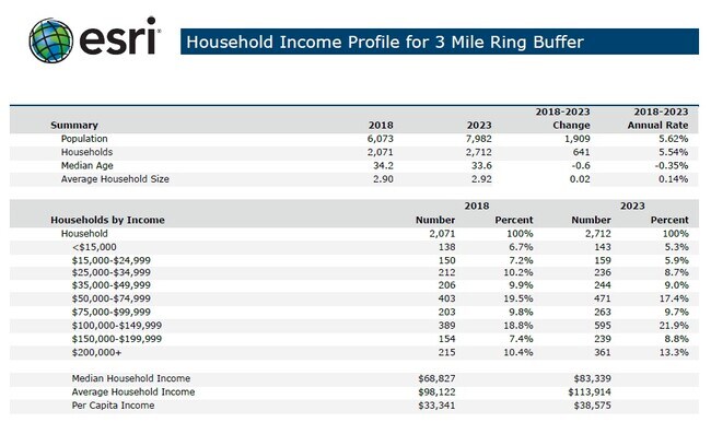
DEMOGRAPHICS near 8702 E Fm 1518 N
1 mile
3 mile
5 mile
2025 Total Population
2,434
12,396
89,870
2030 Population
2,611
13,613
98,415
Pop Growth 2025-2030
+ 7.27%
+ 9.82%
+ 9.51%
Average Age
37
38
38
2025 Total Households
797
4,253
31,358
HH Growth 2025-2030
+ 7.40%
+ 10.42%
+ 9.86%
Median Household Inc
$102,064
$90,372
$97,741
Avg Household Size
3.00
2.90
2.80
2025 Avg HH Vehicles
2.00
2.00
2.00
Median Home Value
$440,517
$390,830
$307,215
Median Year Built
2010
2010
2004
Nearby Places
Map Layers
Map Styles
 Street
 Aerial
Layers
 Traffic
 Biking
Places
Listings with unknown addresses are not visible on the map
- Restaurants
- Banks
- Shops
- Fitness
- Groceries
PUBLIC TRANSPORTATION
AIRPORT
San Antonio International
Drive
Walk
Distance
San Antonio International
31 min
18.3 mi
Freight Ports
Calhoun Port
Drive
Walk
Distance
Calhoun Port
172 min
139.1 mi
SALE & LEASE HISTORY
LISTING DATE
SALE/LEASE

May 06, 2019
For Sale
Nearby Properties
Address
Land Use
TOTAL SIZE
Lot Size
Zoning
Address
Land Use
TOTAL SIZE
Lot Size
Zoning
398,442 SF
14.62 AC
Address
Land Use
TOTAL SIZE
Lot Size
Zoning
33,243 SF
80.72 AC
Address
Land Use
TOTAL SIZE
Lot Size
Zoning
1,332 SF
70.85 AC
Address
Land Use
TOTAL SIZE
Lot Size
Zoning
2,574 SF
127.70 AC
Address
Land Use
TOTAL SIZE
Lot Size
Zoning
74,210 SF
34.98 AC
Address
Land Use
TOTAL SIZE
Lot Size
Zoning
46,500 SF
3.01 AC
Address
Land Use
TOTAL SIZE
Lot Size
Zoning
1,036 SF
165.64 AC
Address
Land Use
TOTAL SIZE
Lot Size
Zoning
167.75 AC
Address
Land Use
TOTAL SIZE
Lot Size
Zoning
74.97 AC
Address
Land Use
TOTAL SIZE
Lot Size
Zoning
65,138 SF
13.69 AC
Address
Land Use
TOTAL SIZE
Lot Size
Zoning
36.29 AC
Address
Land Use
TOTAL SIZE
Lot Size
Zoning
47,601 SF
5.76 AC
Address
Land Use
TOTAL SIZE
Lot Size
Zoning
21,657 SF
3.12 AC
Address
Land Use
TOTAL SIZE
Lot Size
Zoning
1,352 SF
92.30 AC
Address
Land Use
TOTAL SIZE
Lot Size
Zoning
65,556 SF
4.78 AC
Address
Land Use
TOTAL SIZE
Lot Size
Zoning
1,246 SF
218.03 AC
Address
Land Use
TOTAL SIZE
Lot Size
Zoning
1,292 SF
112.47 AC
Address
Land Use
TOTAL SIZE
Lot Size
Zoning
4,120 SF
83.68 AC
Address
Land Use
TOTAL SIZE
Lot Size
Zoning
142,016 SF
16.35 AC
Address
Land Use
TOTAL SIZE
Lot Size
Zoning
25.84 AC
Address
Land Use
TOTAL SIZE
Lot Size
Zoning
Address
Land Use
TOTAL SIZE
Lot Size
Zoning
189.56 AC
Address
Land Use
TOTAL SIZE
Lot Size
Zoning
95,900 SF
3.23 AC
Address
Land Use
TOTAL SIZE
Lot Size
Zoning
59,989 SF
5.07 AC
Address
Land Use
TOTAL SIZE
Lot Size
Zoning
78.15 AC
Address
Land Use
TOTAL SIZE
Lot Size
Zoning
76.77 AC
Address
Land Use
TOTAL SIZE
Lot Size
Zoning
4,778 SF
101.35 AC
Address
Land Use
TOTAL SIZE
Lot Size
Zoning
183.60 AC
Address
Land Use
TOTAL SIZE
Lot Size
Zoning
17,960 SF
3.70 AC
Address
Land Use
TOTAL SIZE
Lot Size
Zoning
16,800 SF
2.34 AC
The World's #1 Commercial Real Estate Marketplace
Connect with us
© 2026 CoStar Group
The information above has been obtained from sources believed reliable. While we do not doubt its accuracy we have not verified it and make no guarantee, warranty or representation about it. It is your responsibility to independently confirm its accuracy and completeness. Any projections, opinions, assumptions, or estimates used are for example only and do not represent the current or future performance of the property. The value of this transaction to you depends on tax and other factors which should be evaluated by your tax, financial, and legal advisors. You and your advisors should conduct a careful, independent investigation of the property to determine to your satisfaction the suitability of the property for your needs.