Property Record
8709 Xograph Ave, Saint Louis, MO 63136

NEARBY LISTINGS FOR SALE OR LEASE
Property Detail
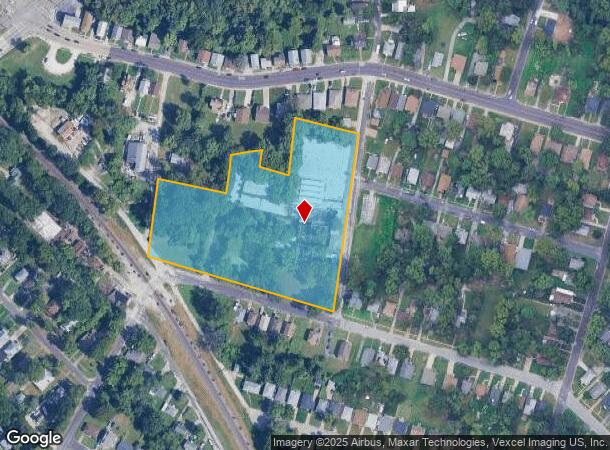
8709 Xograph Ave
St. Louis, MO-IL
Ann B Jennings Estate 2Nd
13G-52-1296
ANN B JENNINGS ESTATE 2ND BLK 11 LOTS 1 & 2 & LOT PTS 3 THRU 8
Industrialgeneral
St. Louis
X
Missouri
29189C0207K
1-2
0
5.46 AC
2025
North County
212003
St. Louis
103,891 SF
DEMOGRAPHICS near 8709 Xograph Ave
1 mile
3 mile
5 mile
2024 Total Population
14,817
105,443
251,211
2029 Population
15,063
105,546
250,776
Pop Growth 2024-2029
+ 1.66%
+ 0.10%
(0.17%)
Average Age
37
39
39
2024 Total Households
6,209
43,454
103,114
HH Growth 2024-2029
+ 1.63%
+ 0.03%
(0.22%)
Median Household Inc
$25,876
$36,365
$39,609
Avg Household Size
2.30
2.30
2.30
2024 Avg HH Vehicles
1.00
1.00
1.00
Median Home Value
$60,121
$70,586
$83,444
Median Year Built
1958
1955
1955
Nearby Places
Map Layers
Map Styles
 Street
 Aerial
Transit
 Traffic
 Biking
Places
Listings with unknown addresses are not visible on the map
- Restaurants
- Banks
- Shops
- Fitness
- Groceries
PUBLIC TRANSPORTATION
COMMUTER RAIL
Um St. Louis South (Lambert Airport Shiloh-Scott - St. Louis MetroLink (MetroLink))
Drive
Walk
Distance
Um St. Louis South (Lambert Airport Shiloh-Scott - St. Louis MetroLink (MetroLink))
9 min
3.7 mi
Um St. Louis North (Lambert Airport Shiloh-Scott - St. Louis MetroLink (MetroLink))
Drive
Walk
Distance
Um St. Louis North (Lambert Airport Shiloh-Scott - St. Louis MetroLink (MetroLink))
9 min
4.1 mi
AIRPORT
St Louis Lambert International
Drive
Walk
Distance
St Louis Lambert International
13 min
6.7 mi
Scott AFB/Midamerica St Louis
Drive
Walk
Distance
Scott AFB/Midamerica St Louis
52 min
33.0 mi
Freight Ports
Port Milwaukee
Drive
Walk
Distance
Port Milwaukee
424 min
371.8 mi
Nearby Properties
Address
Land Use
TOTAL SIZE
Lot Size
Zoning
Address
Land Use
TOTAL SIZE
Lot Size
Zoning
124.96 AC
J
Address
Land Use
TOTAL SIZE
Lot Size
Zoning
72,612 SF
118.34 AC
3INSTU
Address
Land Use
TOTAL SIZE
Lot Size
Zoning
348,233 SF
23.68 AC
Address
Land Use
TOTAL SIZE
Lot Size
Zoning
42.40 AC
M2
Address
Land Use
TOTAL SIZE
Lot Size
Zoning
231,336 SF
18.88 AC
7M-2
Address
Land Use
TOTAL SIZE
Lot Size
Zoning
46.18 AC
A
Address
Land Use
TOTAL SIZE
Lot Size
Zoning
151,640 SF
5.38 AC
D
Address
Land Use
TOTAL SIZE
Lot Size
Zoning
0.73 AC
B
Address
Land Use
TOTAL SIZE
Lot Size
Zoning
460,170 SF
152.70 AC
22M-1
Address
Land Use
TOTAL SIZE
Lot Size
Zoning
5,640 SF
10.42 AC
A
Address
Land Use
TOTAL SIZE
Lot Size
Zoning
303,535 SF
16.44 AC
B
Address
Land Use
TOTAL SIZE
Lot Size
Zoning
226,000 SF
34.48 AC
7M-2
Address
Land Use
TOTAL SIZE
Lot Size
Zoning
19.94 AC
39SFR
Address
Land Use
TOTAL SIZE
Lot Size
Zoning
51,460 SF
101.96 AC
K
Address
Land Use
TOTAL SIZE
Lot Size
Zoning
675 SF
20.38 AC
R5
Address
Land Use
TOTAL SIZE
Lot Size
Zoning
58,818 SF
8.02 AC
22C-1
Address
Land Use
TOTAL SIZE
Lot Size
Zoning
504,189 SF
40.28 AC
R7
Address
Land Use
TOTAL SIZE
Lot Size
Zoning
83,705 SF
4.82 AC
7M-2
Address
Land Use
TOTAL SIZE
Lot Size
Zoning
15.59 AC
R4
Address
Land Use
TOTAL SIZE
Lot Size
Zoning
448,714 SF
34.05 AC
22M-1
Address
Land Use
TOTAL SIZE
Lot Size
Zoning
30.99 AC
39MULTI
Address
Land Use
TOTAL SIZE
Lot Size
Zoning
5.74 AC
C1
Address
Land Use
TOTAL SIZE
Lot Size
Zoning
108,753 SF
18.44 AC
31C-3
Address
Land Use
TOTAL SIZE
Lot Size
Zoning
218,234 SF
14.53 AC
7M-2
Address
Land Use
TOTAL SIZE
Lot Size
Zoning
14,150 SF
20 AC
39SFR
Address
Land Use
TOTAL SIZE
Lot Size
Zoning
12.98 AC
22R-1D
Address
Land Use
TOTAL SIZE
Lot Size
Zoning
4.07 AC
31R-1
Address
Land Use
TOTAL SIZE
Lot Size
Zoning
38.62 AC
AF
Address
Land Use
TOTAL SIZE
Lot Size
Zoning
20.34 AC
NU
Address
Land Use
TOTAL SIZE
Lot Size
Zoning
1.80 AC
31R-1
The World's #1 Commercial Real Estate Marketplace
Connect with us
© 2026 CoStar Group
The information above has been obtained from sources believed reliable. While we do not doubt its accuracy we have not verified it and make no guarantee, warranty or representation about it. It is your responsibility to independently confirm its accuracy and completeness. Any projections, opinions, assumptions, or estimates used are for example only and do not represent the current or future performance of the property. The value of this transaction to you depends on tax and other factors which should be evaluated by your tax, financial, and legal advisors. You and your advisors should conduct a careful, independent investigation of the property to determine to your satisfaction the suitability of the property for your needs.