Property Record
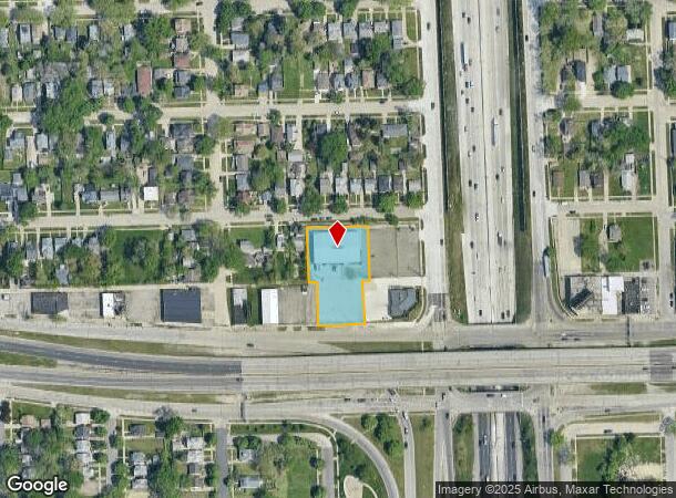
871 E 8 Mile Rd, Hazel Park, MI 48030

NEARBY LISTINGS FOR SALE OR LEASE
Property Detail
871 E 8 Mile Rd
Detroit-Warren-Dearborn, MI
Herman W Meinke Sub
25-36-380-022
T1N, R11E, SEC 36 HERMAN W MEINKE SUB LOTS 16 TO 21 INCL, ALSO LOTS 32 TO 35 INCL, ALSO 1/2 OF VAC ALLEY ADJ TO SAME EXC THAT PART ADJ TO E 20 FT OF LOT 32 & W 20 FT OF LOT 35 8-21-03 FR 020
Warehouse
Oakland
X
Michigan
26163C0125E
32
2024
0.83 AC
2024
Royal Oak
175300
Detroit
9,749 SF
DEMOGRAPHICS near 871 E 8 Mile Rd
1 Mile
3 Mile
5 Mile
2024 Total Population
16,865
131,123
391,080
2029 Population
16,976
130,960
387,830
Pop Growth 2024-2029
+ 0.66%
(0.12%)
(0.83%)
Average Age
38
39
39
2024 Total Households
7,068
56,044
159,588
HH Growth 2024-2029
+ 0.55%
(0.14%)
(0.70%)
Median Household Inc
$38,698
$50,924
$48,884
Avg Household Size
2.30
2.30
2.40
2024 Avg HH Vehicles
1.00
2.00
1.00
Median Home Value
$90,339
$129,080
$139,107
Median Year Built
1953
1952
1951
Nearby Places
Map Layers
Map Styles
 Street
 Aerial
- Restaurants
- Banks
- Shops
- Fitness
- Groceries
PUBLIC TRANSPORTATION
COMMUTER RAIL
DRIVE
WALK
Distance
10 min
5.2 mi
DRIVE
WALK
Distance
10 min
6.5 mi
AIRPORT
Windsor International
DRIVE
WALK
Distance
Windsor International
35 min
18.4 mi
Detroit Metro Wayne County
DRIVE
WALK
Distance
Detroit Metro Wayne County
39 min
27.9 mi
Nearby Properties
Address
Land Use
TOTAL SIZE
Lot Size
Zoning
Address
Land Use
TOTAL SIZE
Lot Size
Zoning
3,529,575 SF
84.46 AC
B4
Address
Land Use
TOTAL SIZE
Lot Size
Zoning
910,140 SF
47.78 AC
Address
Land Use
TOTAL SIZE
Lot Size
Zoning
3,327,621 SF
130.89 AC
M-4
Address
Land Use
TOTAL SIZE
Lot Size
Zoning
649,140 SF
43.98 AC
Address
Land Use
TOTAL SIZE
Lot Size
Zoning
576,924 SF
31.35 AC
Address
Land Use
TOTAL SIZE
Lot Size
Zoning
1,784,888 SF
58.32 AC
M-4
Address
Land Use
TOTAL SIZE
Lot Size
Zoning
306,345 SF
Address
Land Use
TOTAL SIZE
Lot Size
Zoning
455,425 SF
Address
Land Use
TOTAL SIZE
Lot Size
Zoning
576,924 SF
36.24 AC
Address
Land Use
TOTAL SIZE
Lot Size
Zoning
150,703 SF
Address
Land Use
TOTAL SIZE
Lot Size
Zoning
233,900 SF
15.56 AC
M-2
Address
Land Use
TOTAL SIZE
Lot Size
Zoning
259,959 SF
27.39 AC
MZ
Address
Land Use
TOTAL SIZE
Lot Size
Zoning
199,592 SF
17.02 AC
B3
Address
Land Use
TOTAL SIZE
Lot Size
Zoning
220,561 SF
10.62 AC
M-2
Address
Land Use
TOTAL SIZE
Lot Size
Zoning
303,615 SF
22.07 AC
MZ
Address
Land Use
TOTAL SIZE
Lot Size
Zoning
128,309 SF
1.74 AC
Address
Land Use
TOTAL SIZE
Lot Size
Zoning
123,844 SF
1.81 AC
R2
Address
Land Use
TOTAL SIZE
Lot Size
Zoning
156,250 SF
8.79 AC
B4
Address
Land Use
TOTAL SIZE
Lot Size
Zoning
137,583 SF
2.96 AC
BI
Address
Land Use
TOTAL SIZE
Lot Size
Zoning
168,200 SF
12.08 AC
R-3
Address
Land Use
TOTAL SIZE
Lot Size
Zoning
119,418 SF
13.81 AC
B4
Address
Land Use
TOTAL SIZE
Lot Size
Zoning
292,032 SF
20.25 AC
B4
Address
Land Use
TOTAL SIZE
Lot Size
Zoning
180,056 SF
1.45 AC
II
Address
Land Use
TOTAL SIZE
Lot Size
Zoning
353,800 SF
15.70 AC
Address
Land Use
TOTAL SIZE
Lot Size
Zoning
162,400 SF
M1LT
Address
Land Use
TOTAL SIZE
Lot Size
Zoning
125,055 SF
7.74 AC
MZ
Address
Land Use
TOTAL SIZE
Lot Size
Zoning
87,890 SF
Address
Land Use
TOTAL SIZE
Lot Size
Zoning
641,836 SF
20.69 AC
M4
Address
Land Use
TOTAL SIZE
Lot Size
Zoning
181,798 SF
10.48 AC
B4
Address
Land Use
TOTAL SIZE
Lot Size
Zoning
90,595 SF
8.20 AC
BI
The World's #1 Commercial Real Estate Marketplace
Connect with us
© 2025 CoStar Group
The information above has been obtained from sources believed reliable. While we do not doubt its accuracy we have not verified it and make no guarantee, warranty or representation about it. It is your responsibility to independently confirm its accuracy and completeness. Any projections, opinions, assumptions, or estimates used are for example only and do not represent the current or future performance of the property. The value of this transaction to you depends on tax and other factors which should be evaluated by your tax, financial, and legal advisors. You and your advisors should conduct a careful, independent investigation of the property to determine to your satisfaction the suitability of the property for your needs.