Property Record
8715 Plantation Ln, Manassas, VA 20110
Property Detail
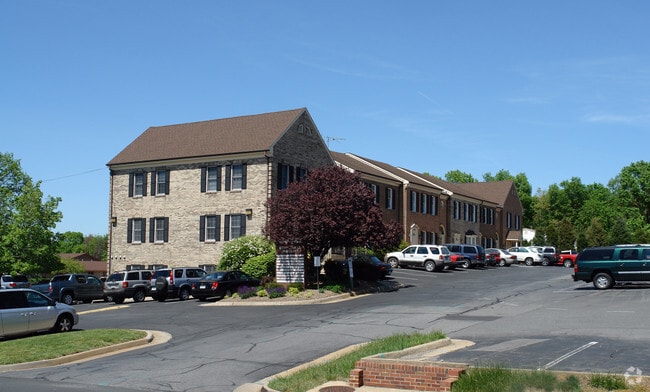
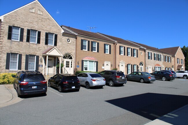
8715 Plantation Ln
Officecondo
UNIT 4A STONEWALL SQUARE
BUSINESS O
MANASSAS CITY
B and X Area of moderate flood hazard, usually the area between the limits of the 100-year and 500-year floods.
Virginia
2026
Manassas
2025
Washington, DC
910202
Washington-Arlington-Alexandria, DC-VA-MD-WV
1,081 SF
112-03-00-32F-4C
NEARBY LISTINGS FOR SALE OR LEASE
DEMOGRAPHICS near 8715 Plantation Ln
1 mile
3 mile
5 mile
2025 Total Population
19,104
120,535
183,761
2030 Population
19,498
122,828
187,392
Pop Growth 2025-2030
+ 2.06%
+ 1.90%
+ 1.98%
Average Age
37
36
36
2025 Total Households
5,827
38,149
57,977
HH Growth 2025-2030
+ 2.03%
+ 1.91%
+ 1.98%
Median Household Inc
$121,945
$106,472
$119,695
Avg Household Size
3.20
3.10
3.10
2025 Avg HH Vehicles
2.00
2.00
2.00
Median Home Value
$464,291
$443,357
$495,196
Median Year Built
1978
1985
1989
Nearby Places
Map Layers
Map Styles
 Street
 Aerial
Layers
 Traffic
 Biking
Places
Listings with unknown addresses are not visible on the map
- Restaurants
- Banks
- Shops
- Fitness
- Groceries
PUBLIC TRANSPORTATION
COMMUTER RAIL
Manassas Amtrak Station (Cardinal - Amtrak, Crescent - Amtrak, Manassas Line - Amtrak, Northeast Regional - Amtrak)
Drive
Walk
Distance
Manassas Amtrak Station (Cardinal - Amtrak, Crescent - Amtrak, Manassas Line - Amtrak, Northeast Regional - Amtrak)
4 min
1.4 mi
Lead (Manassas Line - Virginia Railway Express)
Drive
Walk
Distance
Lead (Manassas Line - Virginia Railway Express)
10 min
4.8 mi
AIRPORT
Washington Dulles International
Drive
Walk
Distance
Washington Dulles International
35 min
20.6 mi
Ronald Reagan Washington Ntl
Drive
Walk
Distance
Ronald Reagan Washington Ntl
48 min
35.1 mi
Freight Ports
Port of Baltimore
Drive
Walk
Distance
Port of Baltimore
94 min
71.0 mi
SALE & LEASE HISTORY
LISTING DATE
SALE/LEASE

Oct 21, 2024
For Sale
Oct 19, 2024
For Sale
Nov 18, 2021
For Sale
Nov 18, 2021
For Sale
Jan 03, 2025
For Sale
Feb 21, 2018
For Lease
Feb 07, 2023
For Sale
Aug 11, 2017
For Lease
Nearby Properties
Address
Land Use
TOTAL SIZE
Lot Size
Zoning
Address
Land Use
TOTAL SIZE
Lot Size
Zoning
795,191 SF
82.58 AC
M1
Address
Land Use
TOTAL SIZE
Lot Size
Zoning
233,757 SF
15.54 AC
PBD
Address
Land Use
TOTAL SIZE
Lot Size
Zoning
223,757 SF
15.92 AC
PBD
Address
Land Use
TOTAL SIZE
Lot Size
Zoning
216,067 SF
15.85 AC
PBD
Address
Land Use
TOTAL SIZE
Lot Size
Zoning
213,320 SF
31.06 AC
PBD
Address
Land Use
TOTAL SIZE
Lot Size
Zoning
305,510 SF
22.72 AC
M2
Address
Land Use
TOTAL SIZE
Lot Size
Zoning
269,091 SF
32.31 AC
M2
Address
Land Use
TOTAL SIZE
Lot Size
Zoning
656,797 SF
Address
Land Use
TOTAL SIZE
Lot Size
Zoning
824,085 SF
120.07 AC
MIXED
Address
Land Use
TOTAL SIZE
Lot Size
Zoning
247,608 SF
19.50 AC
PBD
Address
Land Use
TOTAL SIZE
Lot Size
Zoning
127,000 SF
12.40 AC
M2
Address
Land Use
TOTAL SIZE
Lot Size
Zoning
440,331 SF
61.47 AC
M1
Address
Land Use
TOTAL SIZE
Lot Size
Zoning
409,252 SF
18.75 AC
M2
Address
Land Use
TOTAL SIZE
Lot Size
Zoning
136,228 SF
9.19 AC
M2
Address
Land Use
TOTAL SIZE
Lot Size
Zoning
270,540 SF
13.65 AC
PBD
Address
Land Use
TOTAL SIZE
Lot Size
Zoning
352,401 SF
91.60 AC
M2
Address
Land Use
TOTAL SIZE
Lot Size
Zoning
187,752 SF
20.77 AC
HEAVY INDU
Address
Land Use
TOTAL SIZE
Lot Size
Zoning
51.84 AC
MIXED
Address
Land Use
TOTAL SIZE
Lot Size
Zoning
75,816 SF
29.15 AC
R16
Address
Land Use
TOTAL SIZE
Lot Size
Zoning
382,368 SF
18.40 AC
PMR
Address
Land Use
TOTAL SIZE
Lot Size
Zoning
402,295 SF
8.50 AC
A1
Address
Land Use
TOTAL SIZE
Lot Size
Zoning
23.93 AC
PUD
Address
Land Use
TOTAL SIZE
Lot Size
Zoning
203,544 SF
20.90 AC
GENERAL CO
Address
Land Use
TOTAL SIZE
Lot Size
Zoning
327,574 SF
34.13 AC
R16
Address
Land Use
TOTAL SIZE
Lot Size
Zoning
30.22 AC
M2
Address
Land Use
TOTAL SIZE
Lot Size
Zoning
243,217 SF
LIGHT INDU
Address
Land Use
TOTAL SIZE
Lot Size
Zoning
10.62 AC
PUD
Address
Land Use
TOTAL SIZE
Lot Size
Zoning
240,103 SF
19.93 AC
R16
Address
Land Use
TOTAL SIZE
Lot Size
Zoning
18,128 SF
MULTI-FAMI
Address
Land Use
TOTAL SIZE
Lot Size
Zoning
69,276 SF
18.15 AC
R16
The World's #1 Commercial Real Estate Marketplace
Connect with us
© 2026 CoStar Group
The information above has been obtained from sources believed reliable. While we do not doubt its accuracy we have not verified it and make no guarantee, warranty or representation about it. It is your responsibility to independently confirm its accuracy and completeness. Any projections, opinions, assumptions, or estimates used are for example only and do not represent the current or future performance of the property. The value of this transaction to you depends on tax and other factors which should be evaluated by your tax, financial, and legal advisors. You and your advisors should conduct a careful, independent investigation of the property to determine to your satisfaction the suitability of the property for your needs.