Property Record
872 Dearborn Ave, Toledo, OH 43605
NEARBY LISTINGS FOR SALE OR LEASE
Property Detail
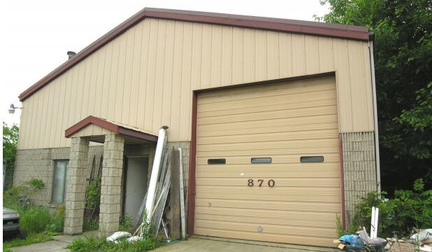
872 Dearborn Ave
Toledo, OH
Booses Addition
02-22251
BOOSES ADDITION LOT 15 SE 30 FT
Warehouse
Lucas
X
Ohio
39095C0113F
15
2024
0.08 AC
2024
East Toledo/Oregon
004900
Toledo
1,600 SF
DEMOGRAPHICS near 872 Dearborn Ave
1 Mile
3 Mile
5 Mile
2024 Total Population
11,989
64,344
140,027
2029 Population
11,887
64,576
140,929
Pop Growth 2024-2029
(0.85%)
+ 0.36%
+ 0.64%
Average Age
38
38
39
2024 Total Households
4,876
26,468
58,299
HH Growth 2024-2029
(0.94%)
+ 0.20%
+ 0.58%
Median Household Inc
$40,600
$35,182
$38,861
Avg Household Size
2.30
2.30
2.30
2024 Avg HH Vehicles
1.00
1.00
1.00
Median Home Value
$85,596
$91,627
$91,834
Median Year Built
1948
1951
1949
Nearby Places
Map Layers
Map Styles
 Street
 Aerial
- Restaurants
- Banks
- Shops
- Fitness
- Groceries
PUBLIC TRANSPORTATION
COMMUTER RAIL
DRIVE
WALK
Distance
7 min
3.1 mi
AIRPORT
Eugene F Kranz Toledo Express
DRIVE
WALK
Distance
Eugene F Kranz Toledo Express
40 min
22.2 mi
Freight Ports
DRIVE
WALK
Distance
13 min
4.6 mi
SALE & LEASE HISTORY
LISTING DATE
SALE/LEASE

Jul 11, 2019
For Sale
Nearby Properties
Address
Land Use
TOTAL SIZE
Lot Size
Zoning
Address
Land Use
TOTAL SIZE
Lot Size
Zoning
1,243,593 SF
42.25 AC
10-MX
Address
Land Use
TOTAL SIZE
Lot Size
Zoning
1,046,727 SF
0.41 AC
10-IC
Address
Land Use
TOTAL SIZE
Lot Size
Zoning
569,999 SF
45.25 AC
10-MX
Address
Land Use
TOTAL SIZE
Lot Size
Zoning
605,609 SF
9.66 AC
40-C4
Address
Land Use
TOTAL SIZE
Lot Size
Zoning
277,862 SF
3 AC
10-CD
Address
Land Use
TOTAL SIZE
Lot Size
Zoning
314,826 SF
10.28 AC
10-CM
Address
Land Use
TOTAL SIZE
Lot Size
Zoning
313,004 SF
44.54 AC
40-C2
Address
Land Use
TOTAL SIZE
Lot Size
Zoning
625,485 SF
2 AC
10-MX
Address
Land Use
TOTAL SIZE
Lot Size
Zoning
111,471 SF
6.17 AC
10-CD
Address
Land Use
TOTAL SIZE
Lot Size
Zoning
1.74 AC
10-CD
Address
Land Use
TOTAL SIZE
Lot Size
Zoning
225,407 SF
128.05 AC
10-MX
Address
Land Use
TOTAL SIZE
Lot Size
Zoning
243,165 SF
3.63 AC
10-CD
Address
Land Use
TOTAL SIZE
Lot Size
Zoning
375,323 SF
10-IC
Address
Land Use
TOTAL SIZE
Lot Size
Zoning
940,263 SF
0.52 AC
10-MX
Address
Land Use
TOTAL SIZE
Lot Size
Zoning
182,983 SF
2 AC
10-CD
Address
Land Use
TOTAL SIZE
Lot Size
Zoning
14,824 SF
54.18 AC
10-MX
Address
Land Use
TOTAL SIZE
Lot Size
Zoning
136,090 SF
4 AC
Address
Land Use
TOTAL SIZE
Lot Size
Zoning
68,517 SF
1.56 AC
10-RM36
Address
Land Use
TOTAL SIZE
Lot Size
Zoning
390,272 SF
5 AC
10-CD
Address
Land Use
TOTAL SIZE
Lot Size
Zoning
127,658 SF
9.01 AC
40-C4
Address
Land Use
TOTAL SIZE
Lot Size
Zoning
202,118 SF
1.50 AC
10-CD
Address
Land Use
TOTAL SIZE
Lot Size
Zoning
232,758 SF
2 AC
10-CO
Address
Land Use
TOTAL SIZE
Lot Size
Zoning
132,690 SF
5 AC
10-CO
Address
Land Use
TOTAL SIZE
Lot Size
Zoning
158,288 SF
1.22 AC
10-CO
Address
Land Use
TOTAL SIZE
Lot Size
Zoning
73,802 SF
22.50 AC
40-MX
Address
Land Use
TOTAL SIZE
Lot Size
Zoning
370,650 SF
13.65 AC
10-MX
Address
Land Use
TOTAL SIZE
Lot Size
Zoning
158,473 SF
1 AC
10-CD
Address
Land Use
TOTAL SIZE
Lot Size
Zoning
273,871 SF
0.66 AC
10-CD
Address
Land Use
TOTAL SIZE
Lot Size
Zoning
3.22 AC
10-CD
Address
Land Use
TOTAL SIZE
Lot Size
Zoning
The World's #1 Commercial Real Estate Marketplace
Connect with us
© 2025 CoStar Group
The information above has been obtained from sources believed reliable. While we do not doubt its accuracy we have not verified it and make no guarantee, warranty or representation about it. It is your responsibility to independently confirm its accuracy and completeness. Any projections, opinions, assumptions, or estimates used are for example only and do not represent the current or future performance of the property. The value of this transaction to you depends on tax and other factors which should be evaluated by your tax, financial, and legal advisors. You and your advisors should conduct a careful, independent investigation of the property to determine to your satisfaction the suitability of the property for your needs.