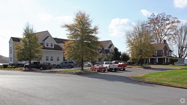
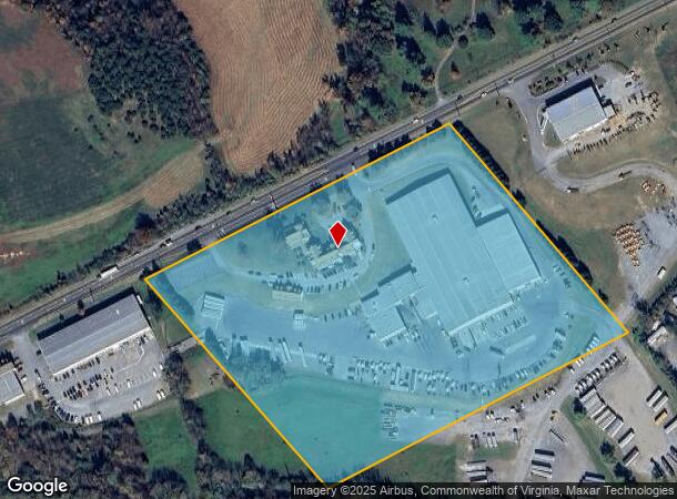
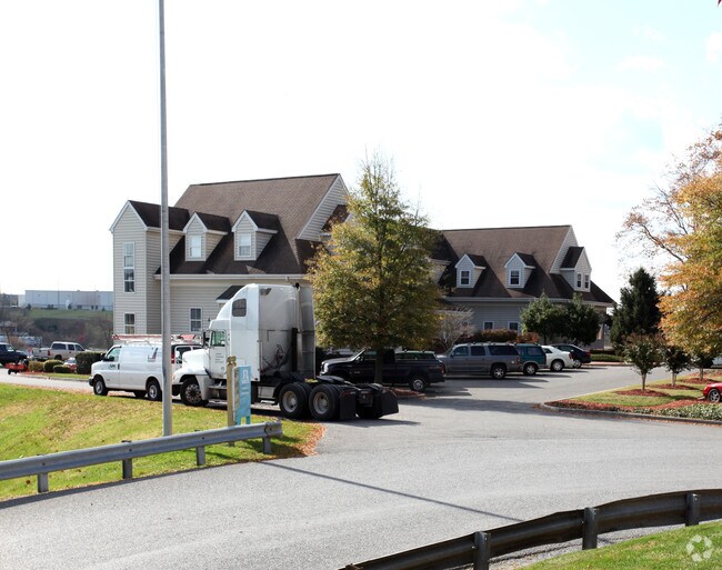
Property Record
872 Lee Hwy, Roanoke, VA 24019
NEARBY LISTINGS FOR SALE OR LEASE
Property Detail
872 Lee Hwy
106B(1)2A
HOLLINS PARCEL 1
Commercialnec
Botetourt
AE
Virginia
51023C0460C
16.94 AC
2024
Botetourt County
2025
Roanoke
040402
Roanoke, VA
DEMOGRAPHICS near 872 Lee Hwy
1 Mile
3 Mile
5 Mile
2024 Total Population
2,469
19,730
56,534
2029 Population
2,538
19,971
56,704
Pop Growth 2024-2029
+ 2.79%
+ 1.22%
+ 0.30%
Average Age
42
43
43
2024 Total Households
982
7,897
23,484
HH Growth 2024-2029
+ 2.75%
+ 1.18%
+ 0.23%
Median Household Inc
$64,636
$72,106
$65,851
Avg Household Size
2.40
2.40
2.30
2024 Avg HH Vehicles
2.00
2.00
2.00
Median Home Value
$304,582
$256,725
$213,345
Median Year Built
1982
1979
1976
Nearby Places
Map Layers
Map Styles
 Street
 Aerial
- Restaurants
- Banks
- Shops
- Fitness
- Groceries
PUBLIC TRANSPORTATION
COMMUTER RAIL
Roanoke (Northeast Regional - Amtrak)
DRIVE
WALK
Distance
Roanoke (Northeast Regional - Amtrak)
14 min
8.6 mi
AIRPORT
Roanoke/Blacksburg Regional (Woodrum Field)
DRIVE
WALK
Distance
Roanoke/Blacksburg Regional (Woodrum Field)
11 min
5.6 mi
Freight Ports
Virginia Port Authority - Richmond
DRIVE
WALK
Distance
Virginia Port Authority - Richmond
207 min
184.1 mi
Nearby Properties
Address
Land Use
TOTAL SIZE
Lot Size
Zoning
Address
Land Use
TOTAL SIZE
Lot Size
Zoning
5,957.14 AC
FC
Address
Land Use
TOTAL SIZE
Lot Size
Zoning
4,284 SF
17.86 AC
R3
Address
Land Use
TOTAL SIZE
Lot Size
Zoning
26 AC
R-1
Address
Land Use
TOTAL SIZE
Lot Size
Zoning
9.31 AC
B-1
Address
Land Use
TOTAL SIZE
Lot Size
Zoning
40.12 AC
M-1
Address
Land Use
TOTAL SIZE
Lot Size
Zoning
609,211 SF
41.01 AC
I1C
Address
Land Use
TOTAL SIZE
Lot Size
Zoning
40.04 AC
M-2
Address
Land Use
TOTAL SIZE
Lot Size
Zoning
15,312 SF
182.27 AC
AG3
Address
Land Use
TOTAL SIZE
Lot Size
Zoning
22.52 AC
R-1
Address
Land Use
TOTAL SIZE
Lot Size
Zoning
124,725 SF
6.53 AC
I1
Address
Land Use
TOTAL SIZE
Lot Size
Zoning
36.98 AC
M-1
Address
Land Use
TOTAL SIZE
Lot Size
Zoning
69,212 SF
19.65 AC
R3S
Address
Land Use
TOTAL SIZE
Lot Size
Zoning
70,091 SF
11.82 AC
R1
Address
Land Use
TOTAL SIZE
Lot Size
Zoning
35,582 SF
16.36 AC
I2S
Address
Land Use
TOTAL SIZE
Lot Size
Zoning
70,770 SF
6 AC
R3
Address
Land Use
TOTAL SIZE
Lot Size
Zoning
24,512 SF
9.10 AC
C2S
Address
Land Use
TOTAL SIZE
Lot Size
Zoning
35,004 SF
5.07 AC
SCD
Address
Land Use
TOTAL SIZE
Lot Size
Zoning
9.98 AC
A1
Address
Land Use
TOTAL SIZE
Lot Size
Zoning
20,086 SF
9.79 AC
R1S
Address
Land Use
TOTAL SIZE
Lot Size
Zoning
68,179 SF
10.18 AC
C2
Address
Land Use
TOTAL SIZE
Lot Size
Zoning
9.14 AC
M-2
Address
Land Use
TOTAL SIZE
Lot Size
Zoning
58,366 SF
3.02 AC
C2CS
Address
Land Use
TOTAL SIZE
Lot Size
Zoning
14.27 AC
SCD
Address
Land Use
TOTAL SIZE
Lot Size
Zoning
12,252 SF
9.38 AC
R4
Address
Land Use
TOTAL SIZE
Lot Size
Zoning
66,386 SF
8.23 AC
C2CS
Address
Land Use
TOTAL SIZE
Lot Size
Zoning
55,295 SF
4.18 AC
C2
Address
Land Use
TOTAL SIZE
Lot Size
Zoning
113,496 SF
6.51 AC
I1
Address
Land Use
TOTAL SIZE
Lot Size
Zoning
12,152 SF
12.20 AC
R3C
Address
Land Use
TOTAL SIZE
Lot Size
Zoning
28,116 SF
13.48 AC
C2CS
Address
Land Use
TOTAL SIZE
Lot Size
Zoning
9,152 SF
7.75 AC
R3
The World's #1 Commercial Real Estate Marketplace
Connect with us
© 2025 CoStar Group
The information above has been obtained from sources believed reliable. While we do not doubt its accuracy we have not verified it and make no guarantee, warranty or representation about it. It is your responsibility to independently confirm its accuracy and completeness. Any projections, opinions, assumptions, or estimates used are for example only and do not represent the current or future performance of the property. The value of this transaction to you depends on tax and other factors which should be evaluated by your tax, financial, and legal advisors. You and your advisors should conduct a careful, independent investigation of the property to determine to your satisfaction the suitability of the property for your needs.