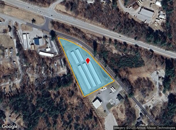
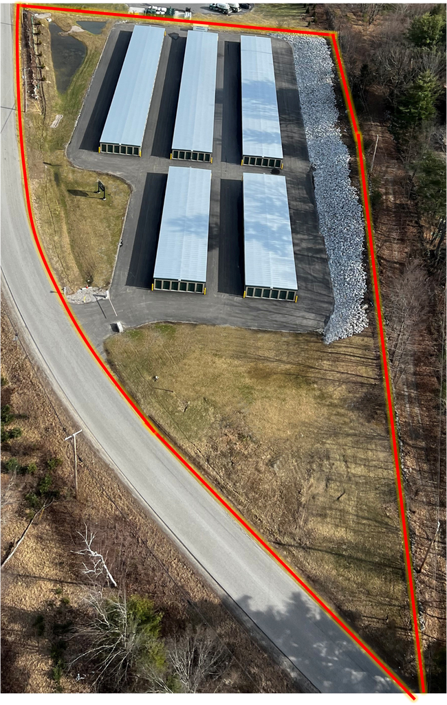
Property Record
872 Old Concord Rd, Henniker, NH 03242
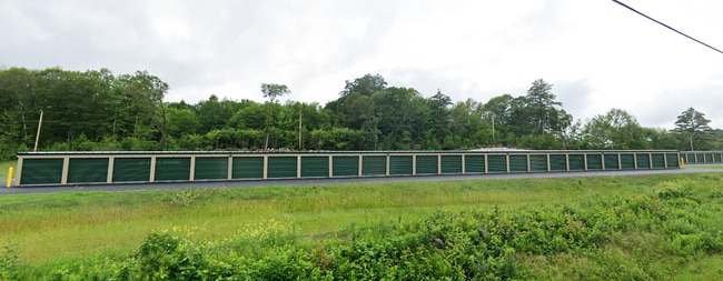
This Property Is For Sale
NEARBY LISTINGS FOR SALE OR LEASE
-
-
View all Henniker listings for sale on LoopNet.com
Property Detail
872 Old Concord Rd
HENN-000001-000000-000549-E000000
Merrimack
Commercialnec
New Hampshire
X
549
33013C0491E
3.30 AC
2024
Concord/New Hampshire North Area
2024
Other Market Areas
040000
Concord, NH
1,397 SF
DEMOGRAPHICS near 872 Old Concord Rd
1 Mile
3 Mile
5 Mile
2024 Total Population
457
6,030
10,059
2029 Population
466
6,061
10,184
Pop Growth 2024-2029
+ 1.97%
+ 0.51%
+ 1.24%
Average Age
42
36
39
2024 Total Households
174
1,641
3,231
HH Growth 2024-2029
+ 1.72%
+ 0.79%
+ 1.55%
Median Household Inc
$116,666
$98,421
$108,680
Avg Household Size
2.50
2.50
2.50
2024 Avg HH Vehicles
2.00
2.00
2.00
Median Home Value
$366,666
$380,624
$397,866
Median Year Built
1976
1973
1974
Nearby Places
Map Layers
Map Styles
 Street
 Aerial
- Restaurants
- Banks
- Shops
- Fitness
- Groceries
PUBLIC TRANSPORTATION
AIRPORT
Manchester Boston Regional
DRIVE
WALK
Distance
Manchester Boston Regional
49 min
34.6 mi
Nearby Properties
Address
Land Use
TOTAL SIZE
Lot Size
Zoning
Address
Land Use
TOTAL SIZE
Lot Size
Zoning
654 SF
145 AC
R-2 CL
Address
Land Use
TOTAL SIZE
Lot Size
Zoning
15.03 AC
EOD -
Address
Land Use
TOTAL SIZE
Lot Size
Zoning
224.18 AC
COMM R
Address
Land Use
TOTAL SIZE
Lot Size
Zoning
76,139 SF
4.03 AC
EOD -
Address
Land Use
TOTAL SIZE
Lot Size
Zoning
3.85 AC
EOD -
Address
Land Use
TOTAL SIZE
Lot Size
Zoning
44.76 AC
HEAVY
Address
Land Use
TOTAL SIZE
Lot Size
Zoning
3,245 SF
39.10 AC
R-2
Address
Land Use
TOTAL SIZE
Lot Size
Zoning
4.30 AC
VILLAG
Address
Land Use
TOTAL SIZE
Lot Size
Zoning
35,052 SF
2.89 AC
EOD -
Address
Land Use
TOTAL SIZE
Lot Size
Zoning
11.70 AC
RES NE
Address
Land Use
TOTAL SIZE
Lot Size
Zoning
28,009 SF
EOD -
Address
Land Use
TOTAL SIZE
Lot Size
Zoning
34,244 SF
EOD -
Address
Land Use
TOTAL SIZE
Lot Size
Zoning
3.93 AC
MEDIUM
Address
Land Use
TOTAL SIZE
Lot Size
Zoning
3.60 AC
VILLAG
Address
Land Use
TOTAL SIZE
Lot Size
Zoning
1,654 SF
1,307 AC
R-4
Address
Land Use
TOTAL SIZE
Lot Size
Zoning
21 AC
RES NE
Address
Land Use
TOTAL SIZE
Lot Size
Zoning
21,415 SF
EOD -
Address
Land Use
TOTAL SIZE
Lot Size
Zoning
20,794 SF
EOD -
Address
Land Use
TOTAL SIZE
Lot Size
Zoning
117.64 AC
MEDIUM
Address
Land Use
TOTAL SIZE
Lot Size
Zoning
20,488 SF
EOD -
Address
Land Use
TOTAL SIZE
Lot Size
Zoning
770.91 AC
FD - F
Address
Land Use
TOTAL SIZE
Lot Size
Zoning
38.40 AC
RES NE
Address
Land Use
TOTAL SIZE
Lot Size
Zoning
18,950 SF
2.11 AC
VILLAG
Address
Land Use
TOTAL SIZE
Lot Size
Zoning
13.36 AC
COMM R
Address
Land Use
TOTAL SIZE
Lot Size
Zoning
825.40 AC
FD - F
Address
Land Use
TOTAL SIZE
Lot Size
Zoning
2.49 AC
HEAVY
Address
Land Use
TOTAL SIZE
Lot Size
Zoning
7,600 SF
39.49 AC
COMM R
Address
Land Use
TOTAL SIZE
Lot Size
Zoning
19,362 SF
0.36 AC
VILLAG
Address
Land Use
TOTAL SIZE
Lot Size
Zoning
20.60 AC
RURAL
The World's #1 Commercial Real Estate Marketplace
Connect with us
© 2026 CoStar Group
The information above has been obtained from sources believed reliable. While we do not doubt its accuracy we have not verified it and make no guarantee, warranty or representation about it. It is your responsibility to independently confirm its accuracy and completeness. Any projections, opinions, assumptions, or estimates used are for example only and do not represent the current or future performance of the property. The value of this transaction to you depends on tax and other factors which should be evaluated by your tax, financial, and legal advisors. You and your advisors should conduct a careful, independent investigation of the property to determine to your satisfaction the suitability of the property for your needs.