Property Record
8720 N County Rd W, Odessa, TX 79764


NEARBY LISTINGS FOR SALE OR LEASE
Property Detail
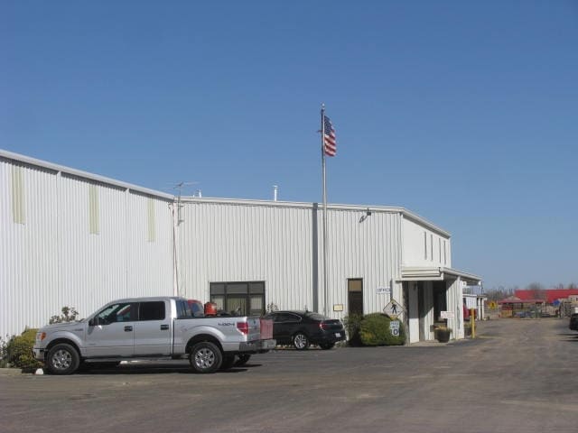
8720 N County Rd W
Odessa, TX
Miether Addition
192250010000000
MIETHER ADDITION BLOCK 1 LOT 1
Commercialnec
Ector
X
Texas
48135C0220E
1
2025
3.97 AC
2025
Midland & Odessa
000100
Other Market Areas
21,000 SF
DEMOGRAPHICS near 8720 N County Rd W
1 Mile
3 Mile
5 Mile
2024 Total Population
2,021
16,641
52,963
2029 Population
1,999
16,167
51,973
Pop Growth 2024-2029
(1.09%)
(2.85%)
(1.87%)
Average Age
36
32
33
2024 Total Households
703
5,622
18,946
HH Growth 2024-2029
(1.42%)
(3.24%)
(2.14%)
Median Household Inc
$71,697
$68,790
$61,001
Avg Household Size
2.80
2.90
2.70
2024 Avg HH Vehicles
2.00
2.00
2.00
Median Home Value
$307,143
$232,456
$180,258
Median Year Built
1979
2001
1979
Nearby Places
Map Layers
Map Styles
 Street
 Aerial
- Restaurants
- Banks
- Shops
- Fitness
- Groceries
PUBLIC TRANSPORTATION
AIRPORT
Midland International Air And Space Port
DRIVE
WALK
Distance
Midland International Air And Space Port
27 min
17.4 mi
Freight Ports
Port of Corpus Christi
DRIVE
WALK
Distance
Port of Corpus Christi
511 min
492.1 mi
SALE & LEASE HISTORY
LISTING DATE
SALE/LEASE

Sep 24, 2016
For Sale
May 21, 2018
For Sale
Mar 15, 2018
For Sale
Feb 11, 2019
For Sale
Nearby Properties
Address
Land Use
TOTAL SIZE
Lot Size
Zoning
Address
Land Use
TOTAL SIZE
Lot Size
Zoning
295,840 SF
12.04 AC
EC1
Address
Land Use
TOTAL SIZE
Lot Size
Zoning
136,794 SF
631.22 AC
EC3
Address
Land Use
TOTAL SIZE
Lot Size
Zoning
106,812 SF
28 AC
EC2
Address
Land Use
TOTAL SIZE
Lot Size
Zoning
5,682 SF
9.17 AC
EC1
Address
Land Use
TOTAL SIZE
Lot Size
Zoning
64,691 SF
9.90 AC
EC1
Address
Land Use
TOTAL SIZE
Lot Size
Zoning
36,543 SF
11.50 AC
EC1
Address
Land Use
TOTAL SIZE
Lot Size
Zoning
160 AC
EC4
Address
Land Use
TOTAL SIZE
Lot Size
Zoning
52,800 SF
9.16 AC
EA2
Address
Land Use
TOTAL SIZE
Lot Size
Zoning
28,800 SF
5.08 AC
EA2
Address
Land Use
TOTAL SIZE
Lot Size
Zoning
11,250 SF
10.15 AC
EA2
Address
Land Use
TOTAL SIZE
Lot Size
Zoning
7,560 SF
6.20 AC
EC1
Address
Land Use
TOTAL SIZE
Lot Size
Zoning
33,145 SF
14.99 AC
EA2
Address
Land Use
TOTAL SIZE
Lot Size
Zoning
42,835 SF
3.26 AC
EC1
Address
Land Use
TOTAL SIZE
Lot Size
Zoning
3,500 SF
5.04 AC
EA2
Address
Land Use
TOTAL SIZE
Lot Size
Zoning
16,000 SF
4.12 AC
EA1
Address
Land Use
TOTAL SIZE
Lot Size
Zoning
12,100 SF
2.02 AC
EA3
Address
Land Use
TOTAL SIZE
Lot Size
Zoning
6,600 SF
5.40 AC
EC2
Address
Land Use
TOTAL SIZE
Lot Size
Zoning
11,160 SF
3.85 AC
EC1
Address
Land Use
TOTAL SIZE
Lot Size
Zoning
51,002 SF
5.99 AC
EA2
Address
Land Use
TOTAL SIZE
Lot Size
Zoning
2,700 SF
14.44 AC
EA3
Address
Land Use
TOTAL SIZE
Lot Size
Zoning
47.14 AC
4
Address
Land Use
TOTAL SIZE
Lot Size
Zoning
46,670 SF
2.01 AC
EA2
Address
Land Use
TOTAL SIZE
Lot Size
Zoning
1,051 SF
13.86 AC
EC1
Address
Land Use
TOTAL SIZE
Lot Size
Zoning
39,918 SF
8.08 AC
EC3
Address
Land Use
TOTAL SIZE
Lot Size
Zoning
7,042 SF
21.56 AC
EA3
Address
Land Use
TOTAL SIZE
Lot Size
Zoning
26,200 SF
20 AC
EA2
Address
Land Use
TOTAL SIZE
Lot Size
Zoning
8,659 SF
3 AC
EC2
Address
Land Use
TOTAL SIZE
Lot Size
Zoning
4,800 SF
1.41 AC
EA5
Address
Land Use
TOTAL SIZE
Lot Size
Zoning
5,281 SF
1.70 AC
EC1
Address
Land Use
TOTAL SIZE
Lot Size
Zoning
43,452 SF
2.33 AC
EA2
The World's #1 Commercial Real Estate Marketplace
Connect with us
© 2025 CoStar Group
The information above has been obtained from sources believed reliable. While we do not doubt its accuracy we have not verified it and make no guarantee, warranty or representation about it. It is your responsibility to independently confirm its accuracy and completeness. Any projections, opinions, assumptions, or estimates used are for example only and do not represent the current or future performance of the property. The value of this transaction to you depends on tax and other factors which should be evaluated by your tax, financial, and legal advisors. You and your advisors should conduct a careful, independent investigation of the property to determine to your satisfaction the suitability of the property for your needs.