Property Record
8725 S Highland Dr, Sandy, UT 84093


NEARBY LISTINGS FOR SALE OR LEASE
Property Detail
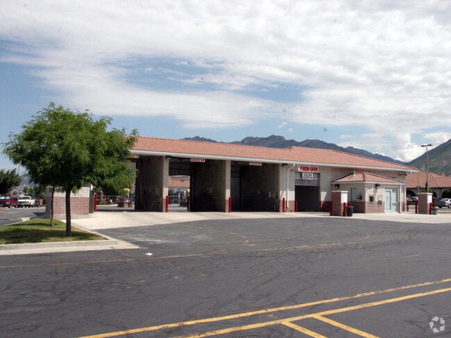
8725 S Highland Dr
28-03-102-056-0000
Ream Fiesta Village Sub
Regionalshoppingcenterormallwithanchorstore
PARCEL 2, REAM FIESTA VILLAGE SUB. LESS ST. ALSO DESCRIBED AS FOLLOWS: BEG S 89^4033 E 855.74 FT ALG SEC LINE & S 0^1927 W 60 FT & S 11^4612 W 9.33 FT FR NW COR SEC 3, T 3S, R 1E, SLM; S 11^4612 W 108.94 FT; S 77^52 E 150.76 FT; N 12^0022 E 127.98 FT
X
Salt Lake
49035C0454G
Utah
2024
11.19 AC
2025
Southeast Valley
112615
Salt Lake City
134,208 SF
Salt Lake City-Murray, UT
DEMOGRAPHICS near 8725 S Highland Dr
1 Mile
3 Mile
5 Mile
2024 Total Population
13,913
110,672
229,521
2029 Population
13,933
111,208
231,645
Pop Growth 2024-2029
+ 0.14%
+ 0.48%
+ 0.93%
Average Age
41
40
39
2024 Total Households
4,503
39,741
84,262
HH Growth 2024-2029
+ 0.04%
+ 0.38%
+ 0.88%
Median Household Inc
$120,465
$97,119
$88,831
Avg Household Size
3.10
2.70
2.70
2024 Avg HH Vehicles
3.00
2.00
2.00
Median Home Value
$591,937
$512,476
$499,480
Median Year Built
1977
1978
1982
Nearby Places
Map Layers
Map Styles
 Street
 Aerial
- Restaurants
- Banks
- Shops
- Fitness
- Groceries
PUBLIC TRANSPORTATION
COMMUTER RAIL
South Jordan Station (FrontRunner - Utah Transit Authority (UTA))
DRIVE
WALK
Distance
South Jordan Station (FrontRunner - Utah Transit Authority (UTA))
14 min
6.3 mi
AIRPORT
Salt Lake City International
DRIVE
WALK
Distance
Salt Lake City International
29 min
20.8 mi
Provo Municipal
DRIVE
WALK
Distance
Provo Municipal
53 min
37.3 mi
Freight Ports
Port of Stockton
DRIVE
WALK
Distance
Port of Stockton
729 min
707.8 mi
Nearby Properties
Address
Land Use
TOTAL SIZE
Lot Size
Zoning
Address
Land Use
TOTAL SIZE
Lot Size
Zoning
257,906 SF
36.42 AC
1110
Address
Land Use
TOTAL SIZE
Lot Size
Zoning
235,963 SF
35.56 AC
SF1-DO
Address
Land Use
TOTAL SIZE
Lot Size
Zoning
512,301 SF
25.39 AC
SD(H)
Address
Land Use
TOTAL SIZE
Lot Size
Zoning
552,994 SF
13.64 AC
SD-X
Address
Land Use
TOTAL SIZE
Lot Size
Zoning
186,717 SF
21.58 AC
RM
Address
Land Use
TOTAL SIZE
Lot Size
Zoning
133,669 SF
19.81 AC
R-M
Address
Land Use
TOTAL SIZE
Lot Size
Zoning
191,718 SF
6.74 AC
RM-25
Address
Land Use
TOTAL SIZE
Lot Size
Zoning
191,718 SF
0.83 AC
RM-25
Address
Land Use
TOTAL SIZE
Lot Size
Zoning
124,434 SF
13.64 AC
PUD-15
Address
Land Use
TOTAL SIZE
Lot Size
Zoning
225,849 SF
16.36 AC
RM-ZC
Address
Land Use
TOTAL SIZE
Lot Size
Zoning
143,600 SF
7.56 AC
2000
Address
Land Use
TOTAL SIZE
Lot Size
Zoning
327,940 SF
3.95 AC
SD
Address
Land Use
TOTAL SIZE
Lot Size
Zoning
103,114 SF
14.82 AC
RM 25
Address
Land Use
TOTAL SIZE
Lot Size
Zoning
327,940 SF
3.37 AC
SD
Address
Land Use
TOTAL SIZE
Lot Size
Zoning
241,418 SF
8.84 AC
ORD
Address
Land Use
TOTAL SIZE
Lot Size
Zoning
176,826 SF
6.13 AC
SD(H)
Address
Land Use
TOTAL SIZE
Lot Size
Zoning
422,482 SF
3.42 AC
RC
Address
Land Use
TOTAL SIZE
Lot Size
Zoning
185,116 SF
14.49 AC
PUD-10
Address
Land Use
TOTAL SIZE
Lot Size
Zoning
106,016 SF
32.73 AC
1108
Address
Land Use
TOTAL SIZE
Lot Size
Zoning
131,979 SF
12.38 AC
PUD15
Address
Land Use
TOTAL SIZE
Lot Size
Zoning
382,939 SF
5.70 AC
PDD-1
Address
Land Use
TOTAL SIZE
Lot Size
Zoning
3,867 SF
2.20 AC
1144
Address
Land Use
TOTAL SIZE
Lot Size
Zoning
95,950 SF
9.40 AC
RM-25
Address
Land Use
TOTAL SIZE
Lot Size
Zoning
77,051 SF
8.34 AC
RM/ZC
Address
Land Use
TOTAL SIZE
Lot Size
Zoning
151,789 SF
9.45 AC
RC
Address
Land Use
TOTAL SIZE
Lot Size
Zoning
150,570 SF
12.76 AC
ORD
Address
Land Use
TOTAL SIZE
Lot Size
Zoning
110,101 SF
33.98 AC
Address
Land Use
TOTAL SIZE
Lot Size
Zoning
176,107 SF
19.30 AC
1108
Address
Land Use
TOTAL SIZE
Lot Size
Zoning
45,941 SF
3.31 AC
MU
Address
Land Use
TOTAL SIZE
Lot Size
Zoning
49,722 SF
7.59 AC
RM-ZC
The World's #1 Commercial Real Estate Marketplace
Connect with us
© 2026 CoStar Group
The information above has been obtained from sources believed reliable. While we do not doubt its accuracy we have not verified it and make no guarantee, warranty or representation about it. It is your responsibility to independently confirm its accuracy and completeness. Any projections, opinions, assumptions, or estimates used are for example only and do not represent the current or future performance of the property. The value of this transaction to you depends on tax and other factors which should be evaluated by your tax, financial, and legal advisors. You and your advisors should conduct a careful, independent investigation of the property to determine to your satisfaction the suitability of the property for your needs.