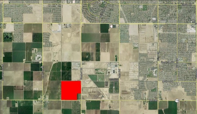
Property Record
8728 Taft Hwy, Bakersfield, CA 93311


NEARBY LISTINGS FOR SALE OR LEASE
Property Detail
8728 Taft Hwy
543-010-12-00-6
SECTION 32 , TOWNSHIP 30 , RANGE 27 , QUARTER
Agriculturalland
Kern
X
California
06029C2300E
65.82 AC
2024
SW Outlying Kern County
2025
Bakersfield
003220
Bakersfield, CA
1,000 SF
DEMOGRAPHICS near 8728 Taft Hwy
1 Mile
3 Mile
5 Mile
2024 Total Population
175
51,597
147,955
2029 Population
186
51,807
148,051
Pop Growth 2024-2029
+ 6.29%
+ 0.41%
+ 0.06%
Average Age
35
33
35
2024 Total Households
53
13,922
44,592
HH Growth 2024-2029
+ 5.66%
+ 0.36%
(0.02%)
Median Household Inc
$135,526
$96,878
$83,562
Avg Household Size
3.30
3.60
3.20
2024 Avg HH Vehicles
3.00
2.00
2.00
Median Home Value
$568,182
$335,283
$306,940
Median Year Built
2010
2004
1991
Nearby Places
Map Layers
Map Styles
 Street
 Aerial
- Restaurants
- Banks
- Shops
- Fitness
- Groceries
PUBLIC TRANSPORTATION
AIRPORT
Meadows Field
DRIVE
WALK
Distance
Meadows Field
29 min
17.5 mi
Freight Ports
The Port of Hueneme
DRIVE
WALK
Distance
The Port of Hueneme
149 min
118.6 mi
SALE & LEASE HISTORY
LISTING DATE
SALE/LEASE

Mar 24, 2017
For Sale
Mar 11, 2020
For Sale
Nearby Properties
Address
Land Use
TOTAL SIZE
Lot Size
Zoning
Address
Land Use
TOTAL SIZE
Lot Size
Zoning
269,429 SF
12.71 AC
R-2
Address
Land Use
TOTAL SIZE
Lot Size
Zoning
138,559 SF
11.92 AC
C-2 PCD
Address
Land Use
TOTAL SIZE
Lot Size
Zoning
37,760 SF
12.16 AC
R3
Address
Land Use
TOTAL SIZE
Lot Size
Zoning
223,557 SF
21.31 AC
PCD
Address
Land Use
TOTAL SIZE
Lot Size
Zoning
88,988 SF
9.82 AC
C-2
Address
Land Use
TOTAL SIZE
Lot Size
Zoning
135,549 SF
12 AC
M1
Address
Land Use
TOTAL SIZE
Lot Size
Zoning
58,496 SF
7.32 AC
Address
Land Use
TOTAL SIZE
Lot Size
Zoning
7.55 AC
Address
Land Use
TOTAL SIZE
Lot Size
Zoning
1,014 SF
3.78 AC
PUD
Address
Land Use
TOTAL SIZE
Lot Size
Zoning
80,172 SF
14.14 AC
C-2
Address
Land Use
TOTAL SIZE
Lot Size
Zoning
4,415 SF
5.94 AC
R-1-CH
Address
Land Use
TOTAL SIZE
Lot Size
Zoning
13,011 SF
44.96 AC
A
Address
Land Use
TOTAL SIZE
Lot Size
Zoning
135,860 SF
16.98 AC
Address
Land Use
TOTAL SIZE
Lot Size
Zoning
18,248 SF
3.35 AC
M-2
Address
Land Use
TOTAL SIZE
Lot Size
Zoning
43.86 AC
Address
Land Use
TOTAL SIZE
Lot Size
Zoning
17,316 SF
1.67 AC
C-2
Address
Land Use
TOTAL SIZE
Lot Size
Zoning
137 AC
R1PUD
Address
Land Use
TOTAL SIZE
Lot Size
Zoning
2,695 SF
313.74 AC
A
Address
Land Use
TOTAL SIZE
Lot Size
Zoning
39.66 AC
Address
Land Use
TOTAL SIZE
Lot Size
Zoning
36.80 AC
A
Address
Land Use
TOTAL SIZE
Lot Size
Zoning
4.09 AC
Address
Land Use
TOTAL SIZE
Lot Size
Zoning
1.47 AC
Address
Land Use
TOTAL SIZE
Lot Size
Zoning
9,936 SF
2.44 AC
C2 PCD
Address
Land Use
TOTAL SIZE
Lot Size
Zoning
14,709 SF
1.57 AC
C2
Address
Land Use
TOTAL SIZE
Lot Size
Zoning
2,472 SF
7.51 AC
C-2
Address
Land Use
TOTAL SIZE
Lot Size
Zoning
2,957 SF
315.45 AC
A
Address
Land Use
TOTAL SIZE
Lot Size
Zoning
17.54 AC
C-2
The World's #1 Commercial Real Estate Marketplace
Connect with us
© 2025 CoStar Group
The information above has been obtained from sources believed reliable. While we do not doubt its accuracy we have not verified it and make no guarantee, warranty or representation about it. It is your responsibility to independently confirm its accuracy and completeness. Any projections, opinions, assumptions, or estimates used are for example only and do not represent the current or future performance of the property. The value of this transaction to you depends on tax and other factors which should be evaluated by your tax, financial, and legal advisors. You and your advisors should conduct a careful, independent investigation of the property to determine to your satisfaction the suitability of the property for your needs.