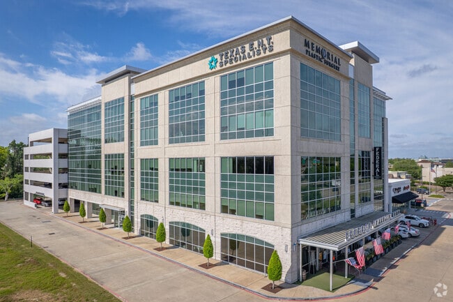
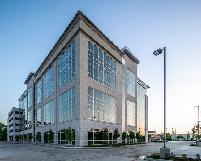
Property Record
8731 Katy Fwy, Houston, TX 77024

Current Lease Availabilities
NEARBY LISTINGS FOR SALE OR LEASE
Property Detail
8731 Katy Fwy
0440340010250
Fulcrum
Medicalbuilding
RES A BLK 1 FULCRUM
X
Harris
48201C0645L
Texas
2024
2 AC
2025
Katy Freeway East
430500
Houston
247,490 SF
Houston-Pasadena-The Woodlands, TX
DEMOGRAPHICS near 8731 Katy Fwy
1 Mile
3 Mile
5 Mile
2024 Total Population
9,034
144,222
459,148
2029 Population
9,192
148,678
474,694
Pop Growth 2024-2029
+ 1.75%
+ 3.09%
+ 3.39%
Average Age
40
39
37
2024 Total Households
3,050
58,757
195,810
HH Growth 2024-2029
+ 1.74%
+ 3.24%
+ 3.45%
Median Household Inc
$223,584
$75,448
$63,020
Avg Household Size
2.90
2.40
2.30
2024 Avg HH Vehicles
2.00
2.00
2.00
Median Home Value
$1,051,778
$628,045
$423,581
Median Year Built
1982
1978
1980
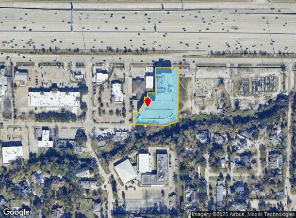
Nearby Places
Map Layers
Map Styles
 Street
 Aerial
- Restaurants
- Banks
- Shops
- Fitness
- Groceries
PUBLIC TRANSPORTATION
COMMUTER RAIL
Houston (Sunset Limited - Amtrak)
DRIVE
WALK
Distance
Houston (Sunset Limited - Amtrak)
14 min
10.0 mi
AIRPORT
William P Hobby
DRIVE
WALK
Distance
William P Hobby
35 min
22.3 mi
George Bush Intcntl/Houston
DRIVE
WALK
Distance
George Bush Intcntl/Houston
34 min
26.3 mi
Freight Ports
Port of Houston
DRIVE
WALK
Distance
Port of Houston
28 min
19.1 mi
Nearby Properties
Address
Land Use
TOTAL SIZE
Lot Size
Zoning
Address
Land Use
TOTAL SIZE
Lot Size
Zoning
935,613 SF
27.93 AC
Address
Land Use
TOTAL SIZE
Lot Size
Zoning
797,516 SF
2.91 AC
Address
Land Use
TOTAL SIZE
Lot Size
Zoning
797,509 SF
3.11 AC
Address
Land Use
TOTAL SIZE
Lot Size
Zoning
730,107 SF
2.92 AC
Address
Land Use
TOTAL SIZE
Lot Size
Zoning
730,107 SF
2.57 AC
Address
Land Use
TOTAL SIZE
Lot Size
Zoning
542,880 SF
1.22 AC
Address
Land Use
TOTAL SIZE
Lot Size
Zoning
527,312 SF
2.58 AC
Address
Land Use
TOTAL SIZE
Lot Size
Zoning
743,954 SF
2.97 AC
Address
Land Use
TOTAL SIZE
Lot Size
Zoning
487,073 SF
44.12 AC
Address
Land Use
TOTAL SIZE
Lot Size
Zoning
1,819,963 SF
5.30 AC
Address
Land Use
TOTAL SIZE
Lot Size
Zoning
402,886 SF
17.95 AC
Address
Land Use
TOTAL SIZE
Lot Size
Zoning
507,014 SF
2.93 AC
Address
Land Use
TOTAL SIZE
Lot Size
Zoning
357,280 SF
1.72 AC
Address
Land Use
TOTAL SIZE
Lot Size
Zoning
497,932 SF
3.97 AC
Address
Land Use
TOTAL SIZE
Lot Size
Zoning
656,741 SF
1.88 AC
Address
Land Use
TOTAL SIZE
Lot Size
Zoning
224,114 SF
4.24 AC
Address
Land Use
TOTAL SIZE
Lot Size
Zoning
702,286 SF
15.67 AC
Address
Land Use
TOTAL SIZE
Lot Size
Zoning
561,732 SF
6.10 AC
Address
Land Use
TOTAL SIZE
Lot Size
Zoning
714,049 SF
25.73 AC
Address
Land Use
TOTAL SIZE
Lot Size
Zoning
385,587 SF
3.08 AC
Address
Land Use
TOTAL SIZE
Lot Size
Zoning
504,256 SF
6.09 AC
Address
Land Use
TOTAL SIZE
Lot Size
Zoning
544,102 SF
2.99 AC
Address
Land Use
TOTAL SIZE
Lot Size
Zoning
597,397 SF
2.93 AC
Address
Land Use
TOTAL SIZE
Lot Size
Zoning
589,957 SF
5.30 AC
Address
Land Use
TOTAL SIZE
Lot Size
Zoning
199,423 SF
Address
Land Use
TOTAL SIZE
Lot Size
Zoning
726,444 SF
7.29 AC
Address
Land Use
TOTAL SIZE
Lot Size
Zoning
324,600 SF
2.06 AC
Address
Land Use
TOTAL SIZE
Lot Size
Zoning
729,149 SF
2.32 AC
Address
Land Use
TOTAL SIZE
Lot Size
Zoning
605,420 SF
7.51 AC
Address
Land Use
TOTAL SIZE
Lot Size
Zoning
475,272 SF
4.73 AC
The World's #1 Commercial Real Estate Marketplace
Connect with us
© 2026 CoStar Group
The information above has been obtained from sources believed reliable. While we do not doubt its accuracy we have not verified it and make no guarantee, warranty or representation about it. It is your responsibility to independently confirm its accuracy and completeness. Any projections, opinions, assumptions, or estimates used are for example only and do not represent the current or future performance of the property. The value of this transaction to you depends on tax and other factors which should be evaluated by your tax, financial, and legal advisors. You and your advisors should conduct a careful, independent investigation of the property to determine to your satisfaction the suitability of the property for your needs.