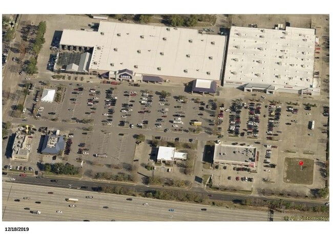
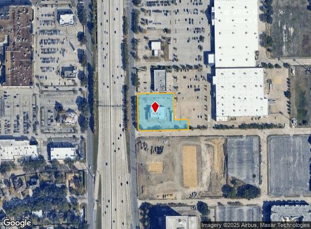
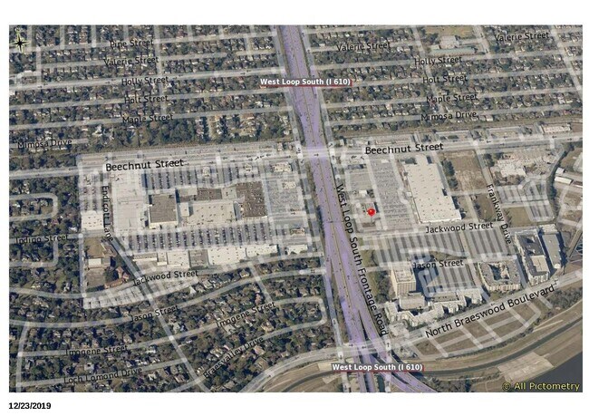
Property Record
8715 West Loop S, Houston, TX 77096

NEARBY LISTINGS FOR SALE OR LEASE
Property Detail
8715 West Loop S
1157220030005
Meyer Park Sec 3 Par R/P
Restaurantbuilding
RES A2 BLK 3 (PR YR IMPS 2017*1157220030003) MEYER PARK SEC 3 PAR R/P
AE
Harris
48201C0865M
Texas
2024
1.51 AC
2025
Bellaire
412901
Houston
8,360 SF
Houston-Pasadena-The Woodlands, TX
DEMOGRAPHICS near 8715 West Loop S
1 Mile
3 Mile
5 Mile
2024 Total Population
16,438
188,413
516,658
2029 Population
17,053
193,918
532,375
Pop Growth 2024-2029
+ 3.74%
+ 2.92%
+ 3.04%
Average Age
40
37
37
2024 Total Households
6,359
75,786
218,632
HH Growth 2024-2029
+ 3.82%
+ 2.90%
+ 3.15%
Median Household Inc
$126,855
$63,492
$61,748
Avg Household Size
2.50
2.40
2.30
2024 Avg HH Vehicles
2.00
2.00
2.00
Median Home Value
$750,320
$465,751
$370,793
Median Year Built
1992
1979
1982
Nearby Places
Map Layers
Map Styles
 Street
 Aerial
- Restaurants
- Banks
- Shops
- Fitness
- Groceries
PUBLIC TRANSPORTATION
AIRPORT
William P Hobby
DRIVE
WALK
Distance
William P Hobby
29 min
16.4 mi
George Bush Intcntl/Houston
DRIVE
WALK
Distance
George Bush Intcntl/Houston
37 min
29.5 mi
Freight Ports
Port of Houston
DRIVE
WALK
Distance
Port of Houston
26 min
16.2 mi
SALE & LEASE HISTORY
LISTING DATE
SALE/LEASE

Oct 07, 2020
For Lease
Nearby Properties
Address
Land Use
TOTAL SIZE
Lot Size
Zoning
Address
Land Use
TOTAL SIZE
Lot Size
Zoning
1,009,859 SF
28.73 AC
Address
Land Use
TOTAL SIZE
Lot Size
Zoning
777,791 SF
47.90 AC
Address
Land Use
TOTAL SIZE
Lot Size
Zoning
507,499 SF
7.66 AC
Address
Land Use
TOTAL SIZE
Lot Size
Zoning
444,589 SF
11 AC
Address
Land Use
TOTAL SIZE
Lot Size
Zoning
828,746 SF
7.76 AC
Address
Land Use
TOTAL SIZE
Lot Size
Zoning
1,202,191 SF
39.08 AC
Address
Land Use
TOTAL SIZE
Lot Size
Zoning
15.46 AC
Address
Land Use
TOTAL SIZE
Lot Size
Zoning
760,932 SF
14.37 AC
Address
Land Use
TOTAL SIZE
Lot Size
Zoning
499,411 SF
5.73 AC
Address
Land Use
TOTAL SIZE
Lot Size
Zoning
1,000,928 SF
18.79 AC
Address
Land Use
TOTAL SIZE
Lot Size
Zoning
550,115 SF
6.38 AC
Address
Land Use
TOTAL SIZE
Lot Size
Zoning
1,612,349 SF
54.03 AC
Address
Land Use
TOTAL SIZE
Lot Size
Zoning
417,988 SF
15.70 AC
Address
Land Use
TOTAL SIZE
Lot Size
Zoning
461,938 SF
10.14 AC
Address
Land Use
TOTAL SIZE
Lot Size
Zoning
807,423 SF
30.01 AC
Address
Land Use
TOTAL SIZE
Lot Size
Zoning
812,087 SF
28.58 AC
Address
Land Use
TOTAL SIZE
Lot Size
Zoning
599,112 SF
11.93 AC
Address
Land Use
TOTAL SIZE
Lot Size
Zoning
284,836 SF
4.22 AC
Address
Land Use
TOTAL SIZE
Lot Size
Zoning
335,626 SF
4.22 AC
Address
Land Use
TOTAL SIZE
Lot Size
Zoning
507,395 SF
9.22 AC
Address
Land Use
TOTAL SIZE
Lot Size
Zoning
499,978 SF
5.57 AC
Address
Land Use
TOTAL SIZE
Lot Size
Zoning
769,005 SF
20.46 AC
Address
Land Use
TOTAL SIZE
Lot Size
Zoning
544,698 SF
15.66 AC
Address
Land Use
TOTAL SIZE
Lot Size
Zoning
640,860 SF
5.31 AC
Address
Land Use
TOTAL SIZE
Lot Size
Zoning
398,772 SF
2.97 AC
Address
Land Use
TOTAL SIZE
Lot Size
Zoning
207,494 SF
1.23 AC
Address
Land Use
TOTAL SIZE
Lot Size
Zoning
494,942 SF
5.19 AC
Address
Land Use
TOTAL SIZE
Lot Size
Zoning
297,620 SF
11.01 AC
Address
Land Use
TOTAL SIZE
Lot Size
Zoning
422,115 SF
6.18 AC
Address
Land Use
TOTAL SIZE
Lot Size
Zoning
292,644 SF
15.47 AC
The World's #1 Commercial Real Estate Marketplace
Connect with us
© 2026 CoStar Group
The information above has been obtained from sources believed reliable. While we do not doubt its accuracy we have not verified it and make no guarantee, warranty or representation about it. It is your responsibility to independently confirm its accuracy and completeness. Any projections, opinions, assumptions, or estimates used are for example only and do not represent the current or future performance of the property. The value of this transaction to you depends on tax and other factors which should be evaluated by your tax, financial, and legal advisors. You and your advisors should conduct a careful, independent investigation of the property to determine to your satisfaction the suitability of the property for your needs.