Property Record
8745 Palm Breeze Rd, Jacksonville, FL 32256


NEARBY LISTINGS FOR SALE OR LEASE
-
-
View all Jacksonville listings for sale on LoopNet.com
Property Detail
8745 Palm Breeze Rd
149208-0085
Section Land
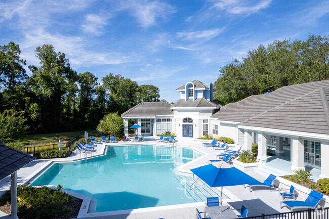
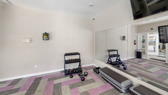
Multifamilydwelling
36-3S-27E 28.31 PT N 1/2 SEC 36 RECD O/R 20276-322
X
Duval
12031C0558H
Florida
2024
28.33 AC
2025
Southside
014425
Jacksonville (Florida)
313,211 SF
Jacksonville, FL
DEMOGRAPHICS near 8745 Palm Breeze Rd
1 Mile
3 Mile
5 Mile
2024 Total Population
9,860
62,683
165,136
2029 Population
10,235
66,739
173,881
Pop Growth 2024-2029
+ 3.80%
+ 6.47%
+ 5.30%
Average Age
37
39
39
2024 Total Households
4,878
27,859
71,834
HH Growth 2024-2029
+ 3.90%
+ 6.67%
+ 5.45%
Median Household Inc
$62,555
$69,649
$71,575
Avg Household Size
2.00
2.20
2.20
2024 Avg HH Vehicles
2.00
2.00
2.00
Median Home Value
$311,037
$325,189
$280,482
Median Year Built
1991
1996
1995
Nearby Places
Map Layers
Map Styles
 Street
 Aerial
- Restaurants
- Banks
- Shops
- Fitness
- Groceries
PUBLIC TRANSPORTATION
AIRPORT
Jacksonville International
DRIVE
WALK
Distance
Jacksonville International
42 min
26.5 mi
Freight Ports
Jacksonville Port
DRIVE
WALK
Distance
Jacksonville Port
27 min
15.8 mi
Nearby Properties
Address
Land Use
TOTAL SIZE
Lot Size
Zoning
Address
Land Use
TOTAL SIZE
Lot Size
Zoning
1,159,855 SF
89.44 AC
RMD-D
Address
Land Use
TOTAL SIZE
Lot Size
Zoning
1,013,318 SF
131.30 AC
PUD
Address
Land Use
TOTAL SIZE
Lot Size
Zoning
371,068 SF
19.22 AC
PUD
Address
Land Use
TOTAL SIZE
Lot Size
Zoning
810,921 SF
58.85 AC
PUD
Address
Land Use
TOTAL SIZE
Lot Size
Zoning
723,629 SF
18.30 AC
PUD
Address
Land Use
TOTAL SIZE
Lot Size
Zoning
345,678 SF
30.40 AC
PUD
Address
Land Use
TOTAL SIZE
Lot Size
Zoning
223,939 SF
13.28 AC
PUD
Address
Land Use
TOTAL SIZE
Lot Size
Zoning
276,424 SF
5.06 AC
PUD
Address
Land Use
TOTAL SIZE
Lot Size
Zoning
345,841 SF
15.16 AC
PUD
Address
Land Use
TOTAL SIZE
Lot Size
Zoning
951,179 SF
56.79 AC
PUD
Address
Land Use
TOTAL SIZE
Lot Size
Zoning
446,326 SF
23.68 AC
RMD-D
Address
Land Use
TOTAL SIZE
Lot Size
Zoning
341,849 SF
15 AC
PUD
Address
Land Use
TOTAL SIZE
Lot Size
Zoning
371,698 SF
12.86 AC
PUD
Address
Land Use
TOTAL SIZE
Lot Size
Zoning
464,189 SF
44.85 AC
RMD-D
Address
Land Use
TOTAL SIZE
Lot Size
Zoning
383,228 SF
40.69 AC
PUD
Address
Land Use
TOTAL SIZE
Lot Size
Zoning
282,233 SF
13.70 AC
PUD
Address
Land Use
TOTAL SIZE
Lot Size
Zoning
296,145 SF
23.22 AC
PUD
Address
Land Use
TOTAL SIZE
Lot Size
Zoning
322,363 SF
14.96 AC
PUD
Address
Land Use
TOTAL SIZE
Lot Size
Zoning
358,537 SF
29.16 AC
RMD-C
Address
Land Use
TOTAL SIZE
Lot Size
Zoning
367,197 SF
42.36 AC
RMD-B
Address
Land Use
TOTAL SIZE
Lot Size
Zoning
237,514 SF
10.83 AC
PUD
Address
Land Use
TOTAL SIZE
Lot Size
Zoning
340,895 SF
14.24 AC
PUD
Address
Land Use
TOTAL SIZE
Lot Size
Zoning
325,620 SF
17.76 AC
PUD
Address
Land Use
TOTAL SIZE
Lot Size
Zoning
414,256 SF
28.07 AC
PUD
Address
Land Use
TOTAL SIZE
Lot Size
Zoning
273,616 SF
34.49 AC
RMD-B
Address
Land Use
TOTAL SIZE
Lot Size
Zoning
214,581 SF
12.90 AC
PUD
Address
Land Use
TOTAL SIZE
Lot Size
Zoning
307,396 SF
24.45 AC
PUD
Address
Land Use
TOTAL SIZE
Lot Size
Zoning
249,222 SF
42.67 AC
PUD
Address
Land Use
TOTAL SIZE
Lot Size
Zoning
365,629 SF
23.23 AC
RMD-D
Address
Land Use
TOTAL SIZE
Lot Size
Zoning
348,919 SF
18.08 AC
RMD-D
The World's #1 Commercial Real Estate Marketplace
Connect with us
© 2025 CoStar Group
The information above has been obtained from sources believed reliable. While we do not doubt its accuracy we have not verified it and make no guarantee, warranty or representation about it. It is your responsibility to independently confirm its accuracy and completeness. Any projections, opinions, assumptions, or estimates used are for example only and do not represent the current or future performance of the property. The value of this transaction to you depends on tax and other factors which should be evaluated by your tax, financial, and legal advisors. You and your advisors should conduct a careful, independent investigation of the property to determine to your satisfaction the suitability of the property for your needs.