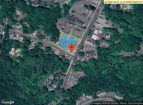
Property Record
865 Main St, South Glastonbury, CT 06073


NEARBY LISTINGS FOR SALE OR LEASE
Property Detail
865 Main St
GLAS-000011D-004140-W000153
Hartford
Commercialnec
Connecticut
X
w0153
09003C0536F
1.09 AC
2025
Glastonbury
2025
Hartford
520501
Hartford-West Hartford-East Hartford, CT
DEMOGRAPHICS near 865 Main St
1 Mile
3 Mile
5 Mile
2024 Total Population
2,446
24,094
78,853
2029 Population
2,427
24,072
78,638
Pop Growth 2024-2029
(0.78%)
(0.09%)
(0.27%)
Average Age
43
43
43
2024 Total Households
942
10,042
32,247
HH Growth 2024-2029
(0.85%)
(0.11%)
(0.29%)
Median Household Inc
$143,469
$106,289
$108,842
Avg Household Size
2.60
2.40
2.40
2024 Avg HH Vehicles
2.00
2.00
2.00
Median Home Value
$432,484
$347,488
$317,257
Median Year Built
1967
1970
1970
Nearby Places
Map Layers
Map Styles
 Street
 Aerial
- Restaurants
- Banks
- Shops
- Fitness
- Groceries
PUBLIC TRANSPORTATION
COMMUTER RAIL
DRIVE
WALK
Distance
17 min
9.9 mi
DRIVE
WALK
Distance
17 min
9.9 mi
AIRPORT
Bradley International
DRIVE
WALK
Distance
Bradley International
46 min
25.9 mi
Tweed/New Haven
DRIVE
WALK
Distance
Tweed/New Haven
58 min
38.7 mi
Freight Ports
Port of New Haven
DRIVE
WALK
Distance
Port of New Haven
53 min
36.4 mi
Nearby Properties
Address
Land Use
TOTAL SIZE
Lot Size
Zoning
Address
Land Use
TOTAL SIZE
Lot Size
Zoning
81,507 SF
21.60 AC
R-20
Address
Land Use
TOTAL SIZE
Lot Size
Zoning
49,219 SF
31.72 AC
Address
Land Use
TOTAL SIZE
Lot Size
Zoning
33.30 AC
R-20
Address
Land Use
TOTAL SIZE
Lot Size
Zoning
55.64 AC
Address
Land Use
TOTAL SIZE
Lot Size
Zoning
87,037 SF
10.44 AC
R-20
Address
Land Use
TOTAL SIZE
Lot Size
Zoning
9.09 AC
R-20
Address
Land Use
TOTAL SIZE
Lot Size
Zoning
188,427 SF
8.55 AC
SRD
Address
Land Use
TOTAL SIZE
Lot Size
Zoning
13.85 AC
R-20
Address
Land Use
TOTAL SIZE
Lot Size
Zoning
13.61 AC
RC
Address
Land Use
TOTAL SIZE
Lot Size
Zoning
8.56 AC
TC
Address
Land Use
TOTAL SIZE
Lot Size
Zoning
38.84 AC
RC
Address
Land Use
TOTAL SIZE
Lot Size
Zoning
15,395 SF
158.10 AC
R-25
Address
Land Use
TOTAL SIZE
Lot Size
Zoning
85,262 SF
34.64 AC
Address
Land Use
TOTAL SIZE
Lot Size
Zoning
11.80 AC
R-20
Address
Land Use
TOTAL SIZE
Lot Size
Zoning
61,651 SF
9.98 AC
Address
Land Use
TOTAL SIZE
Lot Size
Zoning
57,457 SF
34.79 AC
Address
Land Use
TOTAL SIZE
Lot Size
Zoning
103,162 SF
8.80 AC
RC
Address
Land Use
TOTAL SIZE
Lot Size
Zoning
55,914 SF
3.36 AC
RC
Address
Land Use
TOTAL SIZE
Lot Size
Zoning
216,532 SF
10.10 AC
R-20
Address
Land Use
TOTAL SIZE
Lot Size
Zoning
89,728 SF
3.03 AC
RC
Address
Land Use
TOTAL SIZE
Lot Size
Zoning
9.10 AC
R-20
Address
Land Use
TOTAL SIZE
Lot Size
Zoning
58,884 SF
5.61 AC
R-20
Address
Land Use
TOTAL SIZE
Lot Size
Zoning
49,576 SF
3.73 AC
RC
Address
Land Use
TOTAL SIZE
Lot Size
Zoning
99,034 SF
10.89 AC
RC
Address
Land Use
TOTAL SIZE
Lot Size
Zoning
41,175 SF
12.67 AC
RC
Address
Land Use
TOTAL SIZE
Lot Size
Zoning
75 AC
R-20
Address
Land Use
TOTAL SIZE
Lot Size
Zoning
169,708 SF
14.54 AC
BP-2
Address
Land Use
TOTAL SIZE
Lot Size
Zoning
57,480 SF
27.70 AC
RL
Address
Land Use
TOTAL SIZE
Lot Size
Zoning
46.19 AC
R-20
Address
Land Use
TOTAL SIZE
Lot Size
Zoning
12,673 SF
56.01 AC
R-20
The World's #1 Commercial Real Estate Marketplace
Connect with us
© 2025 CoStar Group
The information above has been obtained from sources believed reliable. While we do not doubt its accuracy we have not verified it and make no guarantee, warranty or representation about it. It is your responsibility to independently confirm its accuracy and completeness. Any projections, opinions, assumptions, or estimates used are for example only and do not represent the current or future performance of the property. The value of this transaction to you depends on tax and other factors which should be evaluated by your tax, financial, and legal advisors. You and your advisors should conduct a careful, independent investigation of the property to determine to your satisfaction the suitability of the property for your needs.