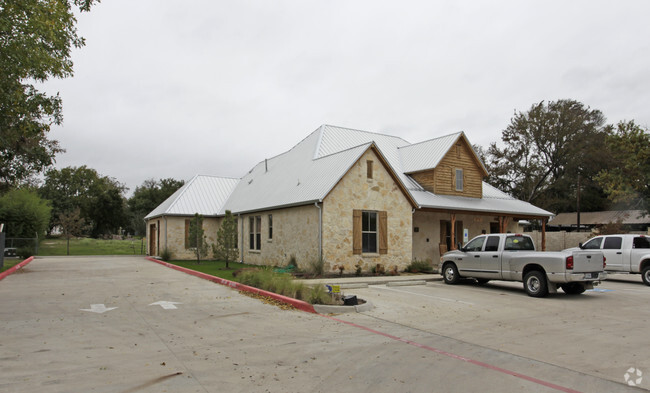
Property Record
875 N Main St, Mansfield, TX 76063


NEARBY LISTINGS FOR SALE OR LEASE
Property Detail
875 N Main St
Dallas-Fort Worth-Arlington, TX
Circle Ks
40445402
CIRCLE KS BLOCK 1 LOT 1
Commercialnec
Tarrant
X
Texas
48251C0100J
1
2024
0.71 AC
2025
Southeast Ft Worth
113509
Dallas/Ft Worth
4,917 SF
DEMOGRAPHICS near 875 N Main St
1 Mile
3 Mile
5 Mile
2024 Total Population
7,742
54,303
141,914
2029 Population
8,260
58,182
151,896
Pop Growth 2024-2029
+ 6.69%
+ 7.14%
+ 7.03%
Average Age
35
38
37
2024 Total Households
2,829
18,199
46,088
HH Growth 2024-2029
+ 6.79%
+ 7.21%
+ 7.19%
Median Household Inc
$67,850
$95,764
$97,712
Avg Household Size
2.60
2.90
3.00
2024 Avg HH Vehicles
2.00
2.00
2.00
Median Home Value
$231,388
$320,091
$303,045
Median Year Built
2001
2000
2002
Nearby Places
Map Layers
Map Styles
 Street
 Aerial
- Restaurants
- Banks
- Shops
- Fitness
- Groceries
PUBLIC TRANSPORTATION
AIRPORT
Dallas-Fort Worth International
DRIVE
WALK
Distance
Dallas-Fort Worth International
41 min
28.1 mi
Dallas Love Field
DRIVE
WALK
Distance
Dallas Love Field
52 min
36.7 mi
Freight Ports
Port of Shreveport
DRIVE
WALK
Distance
Port of Shreveport
243 min
222.4 mi
Nearby Properties
Address
Land Use
TOTAL SIZE
Lot Size
Zoning
Address
Land Use
TOTAL SIZE
Lot Size
Zoning
426,667 SF
12.87 AC
Address
Land Use
TOTAL SIZE
Lot Size
Zoning
348,951 SF
18.66 AC
Address
Land Use
TOTAL SIZE
Lot Size
Zoning
317,142 SF
11.40 AC
Address
Land Use
TOTAL SIZE
Lot Size
Zoning
160,000 SF
26.90 AC
Address
Land Use
TOTAL SIZE
Lot Size
Zoning
413,000 SF
19.16 AC
Address
Land Use
TOTAL SIZE
Lot Size
Zoning
298,988 SF
7.16 AC
Address
Land Use
TOTAL SIZE
Lot Size
Zoning
273,381 SF
8.32 AC
Address
Land Use
TOTAL SIZE
Lot Size
Zoning
276,467 SF
7.61 AC
Address
Land Use
TOTAL SIZE
Lot Size
Zoning
249,922 SF
17.26 AC
Address
Land Use
TOTAL SIZE
Lot Size
Zoning
255,134 SF
21.62 AC
Address
Land Use
TOTAL SIZE
Lot Size
Zoning
170,082 SF
36.49 AC
Address
Land Use
TOTAL SIZE
Lot Size
Zoning
724,286 SF
48.41 AC
Address
Land Use
TOTAL SIZE
Lot Size
Zoning
208,630 SF
8.62 AC
Address
Land Use
TOTAL SIZE
Lot Size
Zoning
231,551 SF
25.69 AC
Address
Land Use
TOTAL SIZE
Lot Size
Zoning
171,820 SF
59.63 AC
Address
Land Use
TOTAL SIZE
Lot Size
Zoning
98,664 SF
5.47 AC
Address
Land Use
TOTAL SIZE
Lot Size
Zoning
234,580 SF
65.82 AC
Address
Land Use
TOTAL SIZE
Lot Size
Zoning
234,051 SF
5.37 AC
Address
Land Use
TOTAL SIZE
Lot Size
Zoning
Address
Land Use
TOTAL SIZE
Lot Size
Zoning
229,168 SF
6.13 AC
Address
Land Use
TOTAL SIZE
Lot Size
Zoning
53.23 AC
Address
Land Use
TOTAL SIZE
Lot Size
Zoning
318,000 SF
19.93 AC
Address
Land Use
TOTAL SIZE
Lot Size
Zoning
359,397 SF
17.31 AC
Address
Land Use
TOTAL SIZE
Lot Size
Zoning
149,494 SF
3.73 AC
Address
Land Use
TOTAL SIZE
Lot Size
Zoning
125,000 SF
18.37 AC
Address
Land Use
TOTAL SIZE
Lot Size
Zoning
663,733 SF
7.77 AC
Address
Land Use
TOTAL SIZE
Lot Size
Zoning
283,500 SF
20.43 AC
Address
Land Use
TOTAL SIZE
Lot Size
Zoning
79,070 SF
11.98 AC
Address
Land Use
TOTAL SIZE
Lot Size
Zoning
458,740 SF
28.66 AC
Address
Land Use
TOTAL SIZE
Lot Size
Zoning
92,456 SF
5.14 AC
The World's #1 Commercial Real Estate Marketplace
Connect with us
© 2026 CoStar Group
The information above has been obtained from sources believed reliable. While we do not doubt its accuracy we have not verified it and make no guarantee, warranty or representation about it. It is your responsibility to independently confirm its accuracy and completeness. Any projections, opinions, assumptions, or estimates used are for example only and do not represent the current or future performance of the property. The value of this transaction to you depends on tax and other factors which should be evaluated by your tax, financial, and legal advisors. You and your advisors should conduct a careful, independent investigation of the property to determine to your satisfaction the suitability of the property for your needs.