Property Record
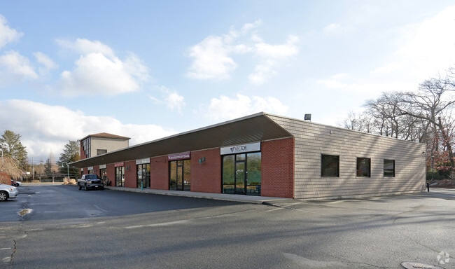
875 State Rd, Westport, MA 02790


Property Detail
875 State Rd
WPOR-000024-000000-000023
Bristol
Commercialnec
Massachusetts
R1
23
A Areas with a 1% annual chance of flooding and a 26% chance of flooding over the life of a 30-year mortgage.
5.81 AC
2025
Attleboro/New Bedford
2025
Boston
646101
Providence-Warwick, RI-MA
NEARBY LISTINGS FOR SALE OR LEASE
DEMOGRAPHICS near 875 State Rd
1 mile
3 mile
5 mile
2025 Total Population
2,345
14,203
56,544
2030 Population
2,361
14,477
57,421
Pop Growth 2025-2030
+ 0.68%
+ 1.93%
+ 1.55%
Average Age
45
44
42
2025 Total Households
973
5,579
22,588
HH Growth 2025-2030
+ 0.72%
+ 1.95%
+ 1.59%
Median Household Inc
$95,499
$88,747
$74,605
Avg Household Size
2.40
2.50
2.40
2025 Avg HH Vehicles
2.00
2.00
2.00
Median Home Value
$469,526
$499,569
$457,636
Median Year Built
1963
1973
1967
Nearby Places
Map Layers
Map Styles
 Street
 Aerial
Layers
 Traffic
 Biking
Places
Listings with unknown addresses are not visible on the map
- Restaurants
- Banks
- Shops
- Fitness
- Groceries
PUBLIC TRANSPORTATION
AIRPORT
Rhode Island Tf Green International
Drive
Walk
Distance
Rhode Island Tf Green International
47 min
30.2 mi
Freight Ports
Port of New Bedford Harbor
Drive
Walk
Distance
Port of New Bedford Harbor
17 min
10.3 mi
SALE & LEASE HISTORY
LISTING DATE
SALE/LEASE

Mar 14, 2018
For Lease
Nearby Properties
Address
Land Use
TOTAL SIZE
Lot Size
Zoning
Address
Land Use
TOTAL SIZE
Lot Size
Zoning
36.70 AC
E1
Address
Land Use
TOTAL SIZE
Lot Size
Zoning
3,792 SF
33 AC
GB
Address
Land Use
TOTAL SIZE
Lot Size
Zoning
174,416 SF
29.20 AC
CEMETA
Address
Land Use
TOTAL SIZE
Lot Size
Zoning
62,336 SF
9.85 AC
SRB
Address
Land Use
TOTAL SIZE
Lot Size
Zoning
51,709 SF
2.32 AC
GB
Address
Land Use
TOTAL SIZE
Lot Size
Zoning
Address
Land Use
TOTAL SIZE
Lot Size
Zoning
21.38 AC
LI
Address
Land Use
TOTAL SIZE
Lot Size
Zoning
31,444 SF
13 AC
E1
Address
Land Use
TOTAL SIZE
Lot Size
Zoning
55,908 SF
13.72 AC
LI
Address
Land Use
TOTAL SIZE
Lot Size
Zoning
35,343 SF
3.40 AC
R1
Address
Land Use
TOTAL SIZE
Lot Size
Zoning
34,830 SF
3.10 AC
R1
Address
Land Use
TOTAL SIZE
Lot Size
Zoning
53,708 SF
2.19 AC
GB
Address
Land Use
TOTAL SIZE
Lot Size
Zoning
11,976 SF
2.34 AC
R1
Address
Land Use
TOTAL SIZE
Lot Size
Zoning
63,300 SF
6 AC
LI
Address
Land Use
TOTAL SIZE
Lot Size
Zoning
14,033 SF
1.86 AC
HISTOR
Address
Land Use
TOTAL SIZE
Lot Size
Zoning
6.49 AC
LI
Address
Land Use
TOTAL SIZE
Lot Size
Zoning
20.20 AC
R1
Address
Land Use
TOTAL SIZE
Lot Size
Zoning
8,565 SF
5.30 AC
R1
Address
Land Use
TOTAL SIZE
Lot Size
Zoning
7 AC
E1
Address
Land Use
TOTAL SIZE
Lot Size
Zoning
33,400 SF
3.37 AC
R1
Address
Land Use
TOTAL SIZE
Lot Size
Zoning
237.32 AC
R-80
Address
Land Use
TOTAL SIZE
Lot Size
Zoning
9,657 SF
9.36 AC
GB
Address
Land Use
TOTAL SIZE
Lot Size
Zoning
54,400 SF
5.78 AC
LI
Address
Land Use
TOTAL SIZE
Lot Size
Zoning
27,604 SF
1.69 AC
GB
Address
Land Use
TOTAL SIZE
Lot Size
Zoning
6.67 AC
Address
Land Use
TOTAL SIZE
Lot Size
Zoning
5.50 AC
HISTOR
Address
Land Use
TOTAL SIZE
Lot Size
Zoning
1,844 SF
2.45 AC
R1
Address
Land Use
TOTAL SIZE
Lot Size
Zoning
24,328 SF
5.23 AC
GB
Address
Land Use
TOTAL SIZE
Lot Size
Zoning
882 SF
10 AC
R1
The World's #1 Commercial Real Estate Marketplace
Connect with us
© 2026 CoStar Group
The information above has been obtained from sources believed reliable. While we do not doubt its accuracy we have not verified it and make no guarantee, warranty or representation about it. It is your responsibility to independently confirm its accuracy and completeness. Any projections, opinions, assumptions, or estimates used are for example only and do not represent the current or future performance of the property. The value of this transaction to you depends on tax and other factors which should be evaluated by your tax, financial, and legal advisors. You and your advisors should conduct a careful, independent investigation of the property to determine to your satisfaction the suitability of the property for your needs.