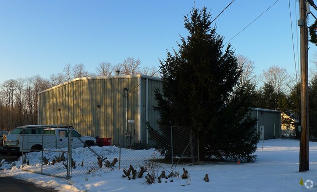
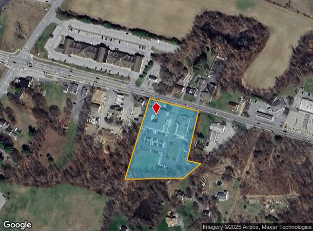
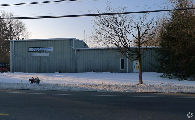
Property Record
877 Route 376, Wappingers Falls, NY 12590

NEARBY LISTINGS FOR SALE OR LEASE
Property Detail
877 Route 376
132800-6358-02-823538-0000
2.11 AC (S) 1941 0043 1639 0409
Publicschool
Dutchess
X
New York
36027C0477E
823
0
3.18 AC
2024
Fishkill
050103
Westchester/So Connecticut
29,618 SF
Dutchess County-Putnam County, NY
DEMOGRAPHICS near 877 Route 376
1 Mile
3 Mile
5 Mile
2024 Total Population
1,839
22,980
69,278
2029 Population
1,834
22,878
69,145
Pop Growth 2024-2029
(0.27%)
(0.44%)
(0.19%)
Average Age
42
43
42
2024 Total Households
600
8,051
25,162
HH Growth 2024-2029
(0.17%)
(0.48%)
(0.21%)
Median Household Inc
$134,121
$121,542
$109,315
Avg Household Size
3.00
2.80
2.70
2024 Avg HH Vehicles
3.00
2.00
2.00
Median Home Value
$384,251
$389,757
$372,832
Median Year Built
1980
1975
1972
Nearby Places
- Restaurants
- Banks
- Shops
- Fitness
- Groceries
PUBLIC TRANSPORTATION
COMMUTER RAIL
New Hamburg Station (Hudson Line - Metro-North Commuter Railroad Company (Metro-North))
DRIVE
WALK
Distance
New Hamburg Station (Hudson Line - Metro-North Commuter Railroad Company (Metro-North))
17 min
7.4 mi
AIRPORT
New York Stewart International
DRIVE
WALK
Distance
New York Stewart International
38 min
22.4 mi
Freight Ports
Port of New Haven
DRIVE
WALK
Distance
Port of New Haven
96 min
67.7 mi
Nearby Properties
Address
Land Use
TOTAL SIZE
Lot Size
Zoning
Address
Land Use
TOTAL SIZE
Lot Size
Zoning
800 SF
10.21 AC
R1
Address
Land Use
TOTAL SIZE
Lot Size
Zoning
73,316 SF
30 AC
R1
Address
Land Use
TOTAL SIZE
Lot Size
Zoning
120,294 SF
29.50 AC
B3
Address
Land Use
TOTAL SIZE
Lot Size
Zoning
4,212 SF
13.84 AC
HC
Address
Land Use
TOTAL SIZE
Lot Size
Zoning
104,800 SF
17.20 AC
R20
Address
Land Use
TOTAL SIZE
Lot Size
Zoning
151,698 SF
22.50 AC
PI
Address
Land Use
TOTAL SIZE
Lot Size
Zoning
40,553 SF
17.96 AC
R1
Address
Land Use
TOTAL SIZE
Lot Size
Zoning
512,000 SF
67 AC
AI
Address
Land Use
TOTAL SIZE
Lot Size
Zoning
328,878 SF
30.82 AC
PI
Address
Land Use
TOTAL SIZE
Lot Size
Zoning
510.80 AC
AI
Address
Land Use
TOTAL SIZE
Lot Size
Zoning
12,550 SF
1.85 AC
R1
Address
Land Use
TOTAL SIZE
Lot Size
Zoning
48,720 SF
12 AC
RMD
Address
Land Use
TOTAL SIZE
Lot Size
Zoning
25.03 AC
Address
Land Use
TOTAL SIZE
Lot Size
Zoning
68,660 SF
9.54 AC
B2
Address
Land Use
TOTAL SIZE
Lot Size
Zoning
11.55 AC
R1
Address
Land Use
TOTAL SIZE
Lot Size
Zoning
Address
Land Use
TOTAL SIZE
Lot Size
Zoning
Address
Land Use
TOTAL SIZE
Lot Size
Zoning
52,731 SF
3.97 AC
B2
Address
Land Use
TOTAL SIZE
Lot Size
Zoning
Address
Land Use
TOTAL SIZE
Lot Size
Zoning
1.50 AC
B1
Address
Land Use
TOTAL SIZE
Lot Size
Zoning
Address
Land Use
TOTAL SIZE
Lot Size
Zoning
33,180 SF
4.72 AC
B3
Address
Land Use
TOTAL SIZE
Lot Size
Zoning
84,562 SF
12.98 AC
I2
Address
Land Use
TOTAL SIZE
Lot Size
Zoning
24.69 AC
R1
Address
Land Use
TOTAL SIZE
Lot Size
Zoning
9.03 AC
B3
Address
Land Use
TOTAL SIZE
Lot Size
Zoning
59,596 SF
17.20 AC
R1
Address
Land Use
TOTAL SIZE
Lot Size
Zoning
5,374 SF
142.38 AC
R1
Address
Land Use
TOTAL SIZE
Lot Size
Zoning
34,668 SF
6.82 AC
B3
Address
Land Use
TOTAL SIZE
Lot Size
Zoning
16,800 SF
10.35 AC
R40
Address
Land Use
TOTAL SIZE
Lot Size
Zoning
9,864 SF
2 AC
B3
The World's #1 Commercial Real Estate Marketplace
Connect with us
© 2025 CoStar Group
The information above has been obtained from sources believed reliable. While we do not doubt its accuracy we have not verified it and make no guarantee, warranty or representation about it. It is your responsibility to independently confirm its accuracy and completeness. Any projections, opinions, assumptions, or estimates used are for example only and do not represent the current or future performance of the property. The value of this transaction to you depends on tax and other factors which should be evaluated by your tax, financial, and legal advisors. You and your advisors should conduct a careful, independent investigation of the property to determine to your satisfaction the suitability of the property for your needs.