Property Record
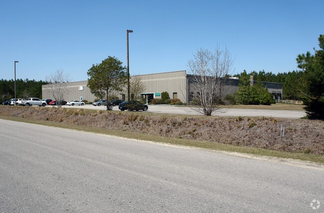
8770 Trade St, Leland, NC 28451


Property Detail
8770 Trade St
0280000820
L-41 S-4 LELAND IND PK PLAT V/310
Manufacturinglight
Brunswick
IG
North Carolina
B and X Area of moderate flood hazard, usually the area between the limits of the 100-year and 500-year floods.
41
2025
6.14 AC
2025
Leland
020102
Wilmington
38,720 SF
Wilmington, NC
NEARBY LISTINGS FOR SALE OR LEASE
DEMOGRAPHICS near 8770 Trade St
1 mile
3 mile
5 mile
2025 Total Population
2,406
14,181
30,978
2030 Population
2,775
16,358
35,794
Pop Growth 2025-2030
+ 15.34%
+ 15.35%
+ 15.55%
Average Age
46
44
44
2025 Total Households
989
5,783
12,870
HH Growth 2025-2030
+ 15.17%
+ 15.23%
+ 15.42%
Median Household Inc
$84,059
$80,376
$79,361
Avg Household Size
2.40
2.40
2.40
2025 Avg HH Vehicles
2.00
2.00
2.00
Median Home Value
$358,333
$329,055
$336,568
Median Year Built
2010
2009
2008
Nearby Places
Map Layers
Map Styles
 Street
 Aerial
Layers
 Traffic
 Biking
Places
Listings with unknown addresses are not visible on the map
- Restaurants
- Banks
- Shops
- Fitness
- Groceries
PUBLIC TRANSPORTATION
AIRPORT
Wilmington International
Drive
Walk
Distance
Wilmington International
26 min
16.5 mi
Freight Ports
Port of Wilmington
Drive
Walk
Distance
Port of Wilmington
19 min
11.0 mi
SALE & LEASE HISTORY
LISTING DATE
SALE/LEASE

Sep 06, 2022
For Lease
Nearby Properties
Address
Land Use
TOTAL SIZE
Lot Size
Zoning
Address
Land Use
TOTAL SIZE
Lot Size
Zoning
170,188 SF
59.74 AC
OI
Address
Land Use
TOTAL SIZE
Lot Size
Zoning
127,256 SF
7 AC
CLD
Address
Land Use
TOTAL SIZE
Lot Size
Zoning
28,198 SF
6.50 AC
MF
Address
Land Use
TOTAL SIZE
Lot Size
Zoning
106,450 SF
36.50 AC
OI
Address
Land Use
TOTAL SIZE
Lot Size
Zoning
10,154 SF
24.38 AC
IG
Address
Land Use
TOTAL SIZE
Lot Size
Zoning
50,639 SF
5.49 AC
CI
Address
Land Use
TOTAL SIZE
Lot Size
Zoning
45,170 SF
10.70 AC
IG
Address
Land Use
TOTAL SIZE
Lot Size
Zoning
201,200 SF
89.45 AC
IG
Address
Land Use
TOTAL SIZE
Lot Size
Zoning
102,028 SF
7.31 AC
IG
Address
Land Use
TOTAL SIZE
Lot Size
Zoning
84,236 SF
20.38 AC
R6
Address
Land Use
TOTAL SIZE
Lot Size
Zoning
505,480 SF
29.02 AC
CI
Address
Land Use
TOTAL SIZE
Lot Size
Zoning
43,776 SF
5.92 AC
R6
Address
Land Use
TOTAL SIZE
Lot Size
Zoning
30,096 SF
2.75 AC
IG
Address
Land Use
TOTAL SIZE
Lot Size
Zoning
104,252 SF
7.20 AC
IG
Address
Land Use
TOTAL SIZE
Lot Size
Zoning
176,515 SF
18.65 AC
IG
Address
Land Use
TOTAL SIZE
Lot Size
Zoning
20,446 SF
25.17 AC
IG
Address
Land Use
TOTAL SIZE
Lot Size
Zoning
2,904 SF
16.98 AC
C2
Address
Land Use
TOTAL SIZE
Lot Size
Zoning
6,306 SF
13.07 AC
R60
Address
Land Use
TOTAL SIZE
Lot Size
Zoning
77,226 SF
7.71 AC
IG
Address
Land Use
TOTAL SIZE
Lot Size
Zoning
22,254 SF
7.04 AC
C2
Address
Land Use
TOTAL SIZE
Lot Size
Zoning
6,160 SF
8.04 AC
CLD
Address
Land Use
TOTAL SIZE
Lot Size
Zoning
131.90 AC
IG
Address
Land Use
TOTAL SIZE
Lot Size
Zoning
145.64 AC
IG
Address
Land Use
TOTAL SIZE
Lot Size
Zoning
18,200 SF
3.33 AC
IG
Address
Land Use
TOTAL SIZE
Lot Size
Zoning
750.80 AC
HI
Address
Land Use
TOTAL SIZE
Lot Size
Zoning
62,740 SF
6.91 AC
IG
Address
Land Use
TOTAL SIZE
Lot Size
Zoning
7,184 SF
12.81 AC
IG
The World's #1 Commercial Real Estate Marketplace
Connect with us
© 2026 CoStar Group
The information above has been obtained from sources believed reliable. While we do not doubt its accuracy we have not verified it and make no guarantee, warranty or representation about it. It is your responsibility to independently confirm its accuracy and completeness. Any projections, opinions, assumptions, or estimates used are for example only and do not represent the current or future performance of the property. The value of this transaction to you depends on tax and other factors which should be evaluated by your tax, financial, and legal advisors. You and your advisors should conduct a careful, independent investigation of the property to determine to your satisfaction the suitability of the property for your needs.