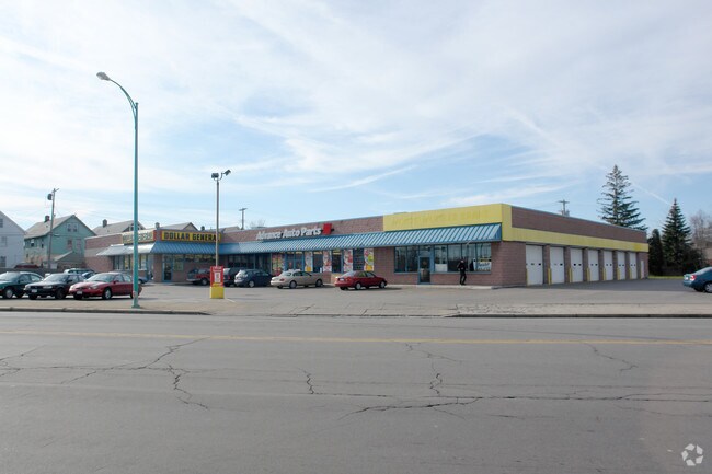
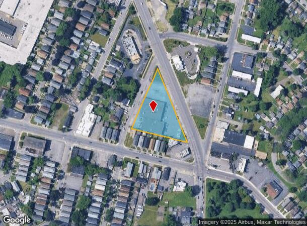
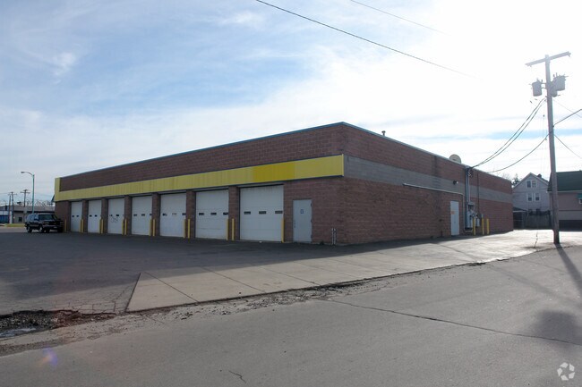
Property Record
878 Mckinley Pkwy, Buffalo, NY 14220
NEARBY LISTINGS FOR SALE OR LEASE
Property Detail
878 Mckinley Pkwy
140200-123-710-0007-001-000
125.27 NW ABBOTT RD 328.49SL 372.12WL
Storesoffices
Erie
X
New York
36029C0327J
1.000
2025
1.40 AC
2024
Greater Buffalo
000800
Buffalo/Niagara Falls
21,488 SF
Buffalo-Cheektowaga-Niagara Falls, NY
DEMOGRAPHICS near 878 Mckinley Pkwy
1 Mile
3 Mile
5 Mile
2024 Total Population
16,968
95,109
245,229
2029 Population
16,282
92,886
240,698
Pop Growth 2024-2029
(4.04%)
(2.34%)
(1.85%)
Average Age
38
39
40
2024 Total Households
7,163
41,016
108,856
HH Growth 2024-2029
(4.22%)
(2.36%)
(1.77%)
Median Household Inc
$49,057
$44,700
$46,905
Avg Household Size
2.30
2.20
2.10
2024 Avg HH Vehicles
1.00
1.00
1.00
Median Home Value
$127,396
$125,145
$145,643
Median Year Built
1946
1948
1949
Nearby Places
- Restaurants
- Banks
- Shops
- Fitness
- Groceries
PUBLIC TRANSPORTATION
AIRPORT
Buffalo Niagara International
DRIVE
WALK
Distance
Buffalo Niagara International
19 min
11.1 mi
Freight Ports
Albany, NY Port
DRIVE
WALK
Distance
Albany, NY Port
1 min
257.6 mi
SALE & LEASE HISTORY
LISTING DATE
SALE/LEASE

Oct 14, 2016
For Lease
Nearby Properties
Address
Land Use
TOTAL SIZE
Lot Size
Zoning
Address
Land Use
TOTAL SIZE
Lot Size
Zoning
1,053,391 SF
88.26 AC
D-IL
Address
Land Use
TOTAL SIZE
Lot Size
Zoning
704,072 SF
8.61 AC
N-1C
Address
Land Use
TOTAL SIZE
Lot Size
Zoning
658,732 SF
1.83 AC
N-1D
Address
Land Use
TOTAL SIZE
Lot Size
Zoning
425,796 SF
7.10 AC
D-M
Address
Land Use
TOTAL SIZE
Lot Size
Zoning
611,620 SF
2.20 AC
N-1S
Address
Land Use
TOTAL SIZE
Lot Size
Zoning
320,576 SF
1.90 AC
N-1S
Address
Land Use
TOTAL SIZE
Lot Size
Zoning
2,832 SF
2.54 AC
N-1C
Address
Land Use
TOTAL SIZE
Lot Size
Zoning
Address
Land Use
TOTAL SIZE
Lot Size
Zoning
1,322,238 SF
5.81 AC
N-1S
Address
Land Use
TOTAL SIZE
Lot Size
Zoning
175,546 SF
1.61 AC
N-1D
Address
Land Use
TOTAL SIZE
Lot Size
Zoning
615,144 SF
110.90 AC
N-1S
Address
Land Use
TOTAL SIZE
Lot Size
Zoning
286,674 SF
8.60 AC
N-1C
Address
Land Use
TOTAL SIZE
Lot Size
Zoning
362,095 SF
25.40 AC
D-IL
Address
Land Use
TOTAL SIZE
Lot Size
Zoning
972 SF
194.01 AC
D-OG
Address
Land Use
TOTAL SIZE
Lot Size
Zoning
5,340 SF
233.33 AC
D-ON
Address
Land Use
TOTAL SIZE
Lot Size
Zoning
236,005 SF
1.67 AC
N-1C
Address
Land Use
TOTAL SIZE
Lot Size
Zoning
80,440 SF
1.54 AC
N-1C
Address
Land Use
TOTAL SIZE
Lot Size
Zoning
702.40 AC
IND
Address
Land Use
TOTAL SIZE
Lot Size
Zoning
102,386 SF
7.20 AC
D-C
Address
Land Use
TOTAL SIZE
Lot Size
Zoning
48.14 AC
OP
Address
Land Use
TOTAL SIZE
Lot Size
Zoning
6,514 SF
68.20 AC
D-OG
Address
Land Use
TOTAL SIZE
Lot Size
Zoning
2,600 SF
14.80 AC
D-IL
Address
Land Use
TOTAL SIZE
Lot Size
Zoning
151,200 SF
8.29 AC
IND
Address
Land Use
TOTAL SIZE
Lot Size
Zoning
43,942 SF
14.34 AC
CBD
Address
Land Use
TOTAL SIZE
Lot Size
Zoning
55.62 AC
SPLIT ZONE
Address
Land Use
TOTAL SIZE
Lot Size
Zoning
178,610 SF
6.53 AC
D-C
Address
Land Use
TOTAL SIZE
Lot Size
Zoning
Address
Land Use
TOTAL SIZE
Lot Size
Zoning
111,801 SF
1.59 AC
N-1C
Address
Land Use
TOTAL SIZE
Lot Size
Zoning
232,570 SF
10.44 AC
D-IL
Address
Land Use
TOTAL SIZE
Lot Size
Zoning
120,440 SF
2.24 AC
N-2E
The World's #1 Commercial Real Estate Marketplace
Connect with us
© 2025 CoStar Group
The information above has been obtained from sources believed reliable. While we do not doubt its accuracy we have not verified it and make no guarantee, warranty or representation about it. It is your responsibility to independently confirm its accuracy and completeness. Any projections, opinions, assumptions, or estimates used are for example only and do not represent the current or future performance of the property. The value of this transaction to you depends on tax and other factors which should be evaluated by your tax, financial, and legal advisors. You and your advisors should conduct a careful, independent investigation of the property to determine to your satisfaction the suitability of the property for your needs.