Property Record
8780 Mastin Ave, Overland Park, KS 66212


NEARBY LISTINGS FOR SALE OR LEASE
Property Detail
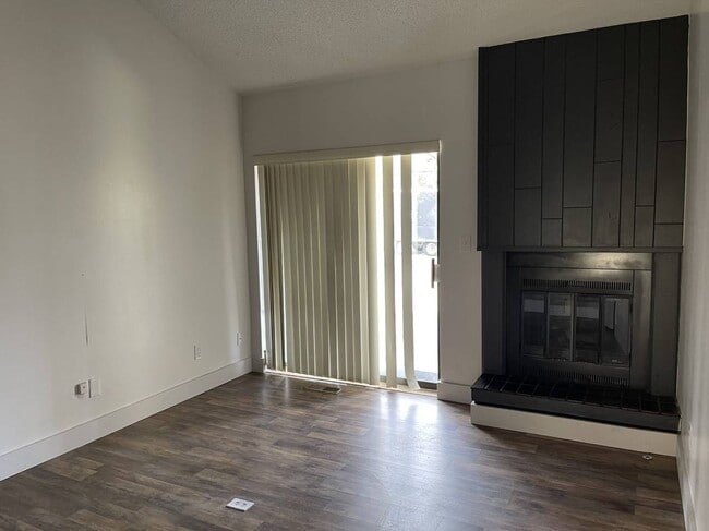
8780 Mastin Ave
Kansas City, MO-KS
Lots 28 To 119 Breyfogle
NP05600000-0047
LOTS 28 TO 119 BREYFOGLE LT 47 EX S 5 OPC 1151
Officebuilding
Johnson
X
Kansas
20091C0037G
47
2024
0.71 AC
2024
Northeast Johnson County
051912
Kansas City
4,659 SF
DEMOGRAPHICS near 8780 Mastin Ave
1 Mile
3 Mile
5 Mile
2024 Total Population
13,155
108,499
249,251
2029 Population
13,630
112,784
259,303
Pop Growth 2024-2029
+ 3.61%
+ 3.95%
+ 4.03%
Average Age
37
40
41
2024 Total Households
5,538
48,434
110,350
HH Growth 2024-2029
+ 3.77%
+ 4.14%
+ 4.20%
Median Household Inc
$72,823
$70,536
$81,077
Avg Household Size
2.30
2.20
2.20
2024 Avg HH Vehicles
2.00
2.00
2.00
Median Home Value
$231,126
$258,999
$295,833
Median Year Built
1967
1972
1976
Nearby Places
Map Layers
Map Styles
 Street
 Aerial
- Restaurants
- Banks
- Shops
- Fitness
- Groceries
PUBLIC TRANSPORTATION
AIRPORT
Kansas City International
DRIVE
WALK
Distance
Kansas City International
41 min
31.0 mi
SALE & LEASE HISTORY
LISTING DATE
SALE/LEASE

Mar 27, 2024
For Lease
Nearby Properties
Address
Land Use
TOTAL SIZE
Lot Size
Zoning
Address
Land Use
TOTAL SIZE
Lot Size
Zoning
857,568 SF
38.48 AC
PUD-G
Address
Land Use
TOTAL SIZE
Lot Size
Zoning
740,953 SF
88.91 AC
RP5
Address
Land Use
TOTAL SIZE
Lot Size
Zoning
279,588 SF
19.50 AC
RP5
Address
Land Use
TOTAL SIZE
Lot Size
Zoning
203,079 SF
8.10 AC
BP2
Address
Land Use
TOTAL SIZE
Lot Size
Zoning
202,842 SF
10.20 AC
PD
Address
Land Use
TOTAL SIZE
Lot Size
Zoning
234,968 SF
37.40 AC
R-1
Address
Land Use
TOTAL SIZE
Lot Size
Zoning
133,505 SF
16.41 AC
R-1
Address
Land Use
TOTAL SIZE
Lot Size
Zoning
512,680 SF
18.03 AC
R-1
Address
Land Use
TOTAL SIZE
Lot Size
Zoning
166,039 SF
35.38 AC
R-1
Address
Land Use
TOTAL SIZE
Lot Size
Zoning
81,051 SF
7.17 AC
R-1
Address
Land Use
TOTAL SIZE
Lot Size
Zoning
81,762 SF
9.66 AC
R-1
Address
Land Use
TOTAL SIZE
Lot Size
Zoning
146,143 SF
10.59 AC
CP-2
Address
Land Use
TOTAL SIZE
Lot Size
Zoning
411,435 SF
17.41 AC
CP-2
Address
Land Use
TOTAL SIZE
Lot Size
Zoning
79,437 SF
4.12 AC
DFD
Address
Land Use
TOTAL SIZE
Lot Size
Zoning
75,010 SF
5.53 AC
PD
Address
Land Use
TOTAL SIZE
Lot Size
Zoning
72,994 SF
7.99 AC
RP3
Address
Land Use
TOTAL SIZE
Lot Size
Zoning
85,703 SF
7.84 AC
R-1
Address
Land Use
TOTAL SIZE
Lot Size
Zoning
355,197 SF
30.05 AC
CP-2
Address
Land Use
TOTAL SIZE
Lot Size
Zoning
85,940 SF
9.08 AC
RGA
Address
Land Use
TOTAL SIZE
Lot Size
Zoning
89,002 SF
8.77 AC
R-1
Address
Land Use
TOTAL SIZE
Lot Size
Zoning
119,320 SF
19.74 AC
R-1
Address
Land Use
TOTAL SIZE
Lot Size
Zoning
139,880 SF
17.18 AC
R1
Address
Land Use
TOTAL SIZE
Lot Size
Zoning
79,737 SF
11.90 AC
R-1
Address
Land Use
TOTAL SIZE
Lot Size
Zoning
88,866 SF
21.54 AC
RS
Address
Land Use
TOTAL SIZE
Lot Size
Zoning
77,548 SF
7.21 AC
R-1
Address
Land Use
TOTAL SIZE
Lot Size
Zoning
37,499 SF
3.72 AC
PUD-G
Address
Land Use
TOTAL SIZE
Lot Size
Zoning
70,952 SF
9.98 AC
R-1
Address
Land Use
TOTAL SIZE
Lot Size
Zoning
85,469 SF
10.32 AC
CPO
Address
Land Use
TOTAL SIZE
Lot Size
Zoning
49,259 SF
12.28 AC
R-1
Address
Land Use
TOTAL SIZE
Lot Size
Zoning
71,066 SF
9.02 AC
R-1
The World's #1 Commercial Real Estate Marketplace
Connect with us
© 2026 CoStar Group
The information above has been obtained from sources believed reliable. While we do not doubt its accuracy we have not verified it and make no guarantee, warranty or representation about it. It is your responsibility to independently confirm its accuracy and completeness. Any projections, opinions, assumptions, or estimates used are for example only and do not represent the current or future performance of the property. The value of this transaction to you depends on tax and other factors which should be evaluated by your tax, financial, and legal advisors. You and your advisors should conduct a careful, independent investigation of the property to determine to your satisfaction the suitability of the property for your needs.