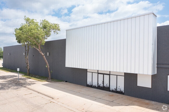
Property Record
8780 N 2Nd St, Machesney Park, IL 61115


NEARBY LISTINGS FOR SALE OR LEASE
Property Detail
8780 N 2Nd St
Rockford, IL
Machesney Park Mall Plat No 2
08-30-152-005
MACHESNEY PARK MALL PLAT NO 2 PT N1/2SEC 30- 45-2 BEG SW COR LT 4 TH NE 441.08 FT NE 325.41 FT E 180.69 FT SW 228.42 FT SE 19.76 FT SW 175 FT NW 60 FT
Commercialnec
Winnebago
X
Illinois
17201C0256E
4
2024
5.80 AC
2024
I-39 Corr/Winnebago Cnty
000101
Chicago
56,964 SF
DEMOGRAPHICS near 8780 N 2Nd St
1 Mile
3 Mile
5 Mile
2024 Total Population
8,136
37,289
102,536
2029 Population
8,050
36,664
100,874
Pop Growth 2024-2029
(1.06%)
(1.68%)
(1.62%)
Average Age
41
42
42
2024 Total Households
3,316
15,692
42,327
HH Growth 2024-2029
(1.15%)
(1.71%)
(1.65%)
Median Household Inc
$63,114
$57,679
$61,774
Avg Household Size
2.40
2.30
2.30
2024 Avg HH Vehicles
2.00
2.00
2.00
Median Home Value
$123,016
$133,997
$149,238
Median Year Built
1973
1973
1973
Nearby Places
Map Layers
Map Styles
 Street
 Aerial
- Restaurants
- Banks
- Shops
- Fitness
- Groceries
PUBLIC TRANSPORTATION
AIRPORT
Chicago/Rockford International
DRIVE
WALK
Distance
Chicago/Rockford International
32 min
15.6 mi
SALE & LEASE HISTORY
LISTING DATE
SALE/LEASE

Sep 24, 2016
For Sale
Nov 29, 2016
For Sale
Jul 31, 2017
For Lease
Jan 24, 2017
For Sale
Nearby Properties
Address
Land Use
TOTAL SIZE
Lot Size
Zoning
Address
Land Use
TOTAL SIZE
Lot Size
Zoning
189,000 SF
56.75 AC
IL - INDUS
Address
Land Use
TOTAL SIZE
Lot Size
Zoning
105,664 SF
13.34 AC
Address
Land Use
TOTAL SIZE
Lot Size
Zoning
212,200 SF
21 AC
C3
Address
Land Use
TOTAL SIZE
Lot Size
Zoning
Address
Land Use
TOTAL SIZE
Lot Size
Zoning
51,580 SF
6.13 AC
Address
Land Use
TOTAL SIZE
Lot Size
Zoning
192,604 SF
17.05 AC
Address
Land Use
TOTAL SIZE
Lot Size
Zoning
112,035 SF
8.79 AC
Address
Land Use
TOTAL SIZE
Lot Size
Zoning
114,176 SF
4.94 AC
R4
Address
Land Use
TOTAL SIZE
Lot Size
Zoning
175,502 SF
18.15 AC
Address
Land Use
TOTAL SIZE
Lot Size
Zoning
Address
Land Use
TOTAL SIZE
Lot Size
Zoning
Address
Land Use
TOTAL SIZE
Lot Size
Zoning
125,024 SF
9.91 AC
Address
Land Use
TOTAL SIZE
Lot Size
Zoning
140,085 SF
14.90 AC
Address
Land Use
TOTAL SIZE
Lot Size
Zoning
124,757 SF
13.41 AC
Address
Land Use
TOTAL SIZE
Lot Size
Zoning
Address
Land Use
TOTAL SIZE
Lot Size
Zoning
13.45 AC
Address
Land Use
TOTAL SIZE
Lot Size
Zoning
16,500 SF
10.62 AC
Address
Land Use
TOTAL SIZE
Lot Size
Zoning
160,937 SF
10 AC
CR
Address
Land Use
TOTAL SIZE
Lot Size
Zoning
140,888 SF
7.96 AC
Address
Land Use
TOTAL SIZE
Lot Size
Zoning
243,057 SF
21.38 AC
C2
Address
Land Use
TOTAL SIZE
Lot Size
Zoning
103,326 SF
10.52 AC
Address
Land Use
TOTAL SIZE
Lot Size
Zoning
Address
Land Use
TOTAL SIZE
Lot Size
Zoning
82,582 SF
7.92 AC
CR
Address
Land Use
TOTAL SIZE
Lot Size
Zoning
135,351 SF
19 AC
Address
Land Use
TOTAL SIZE
Lot Size
Zoning
10.16 AC
Address
Land Use
TOTAL SIZE
Lot Size
Zoning
85,350 SF
13.15 AC
Address
Land Use
TOTAL SIZE
Lot Size
Zoning
119,108 SF
3.06 AC
R3
Address
Land Use
TOTAL SIZE
Lot Size
Zoning
55,200 SF
10.17 AC
Address
Land Use
TOTAL SIZE
Lot Size
Zoning
44,213 SF
12.04 AC
R2
Address
Land Use
TOTAL SIZE
Lot Size
Zoning
79,643 SF
3.55 AC
The World's #1 Commercial Real Estate Marketplace
Connect with us
© 2025 CoStar Group
The information above has been obtained from sources believed reliable. While we do not doubt its accuracy we have not verified it and make no guarantee, warranty or representation about it. It is your responsibility to independently confirm its accuracy and completeness. Any projections, opinions, assumptions, or estimates used are for example only and do not represent the current or future performance of the property. The value of this transaction to you depends on tax and other factors which should be evaluated by your tax, financial, and legal advisors. You and your advisors should conduct a careful, independent investigation of the property to determine to your satisfaction the suitability of the property for your needs.