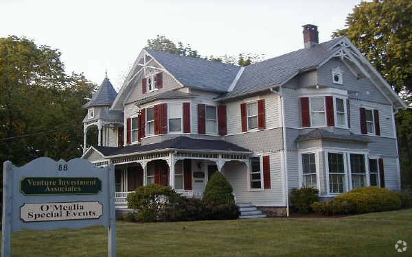
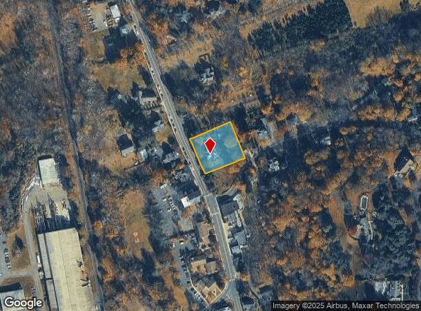
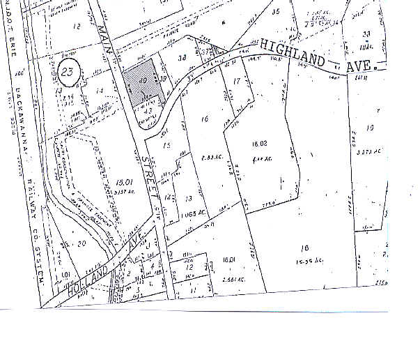
Property Record
88 W Main St, Branchburg, NJ 08876
NEARBY LISTINGS FOR SALE OR LEASE
Property Detail
88 W Main St
15-00026-0000-00040
Somerset
Vacantlandnec
New Jersey
X
40
34035C0033E
0.55 AC
2024
Route 78 East
2025
Northern New Jersey
052800
Newark, NJ-PA
4,000 SF
DEMOGRAPHICS near 88 W Main St
1 Mile
3 Mile
5 Mile
2024 Total Population
1,155
5,751
32,071
2029 Population
1,123
5,587
31,774
Pop Growth 2024-2029
(2.77%)
(2.85%)
(0.93%)
Average Age
42
43
43
2024 Total Households
390
2,052
12,270
HH Growth 2024-2029
(3.33%)
(3.07%)
(0.92%)
Median Household Inc
$159,028
$151,740
$166,673
Avg Household Size
2.70
2.70
2.60
2024 Avg HH Vehicles
2.00
2.00
2.00
Median Home Value
$786,144
$817,251
$690,354
Median Year Built
1968
1966
1983
Nearby Places
Map Layers
Map Styles
 Street
 Aerial
- Restaurants
- Banks
- Shops
- Fitness
- Groceries
PUBLIC TRANSPORTATION
AIRPORT
Newark Liberty International
DRIVE
WALK
Distance
Newark Liberty International
43 min
34.7 mi
Trenton Mercer
DRIVE
WALK
Distance
Trenton Mercer
66 min
37.9 mi
Freight Ports
Maher Terminal
DRIVE
WALK
Distance
Maher Terminal
47 min
35.2 mi
Nearby Properties
Address
Land Use
TOTAL SIZE
Lot Size
Zoning
Address
Land Use
TOTAL SIZE
Lot Size
Zoning
44.48 AC
ORL
Address
Land Use
TOTAL SIZE
Lot Size
Zoning
23.08 AC
OR
Address
Land Use
TOTAL SIZE
Lot Size
Zoning
1,290 SF
32 AC
R-5
Address
Land Use
TOTAL SIZE
Lot Size
Zoning
32,792 SF
14.26 AC
RE
Address
Land Use
TOTAL SIZE
Lot Size
Zoning
49,786 SF
13.84 AC
VN2
Address
Land Use
TOTAL SIZE
Lot Size
Zoning
32,578 SF
298.72 AC
R10
Address
Land Use
TOTAL SIZE
Lot Size
Zoning
31.95 AC
R3
Address
Land Use
TOTAL SIZE
Lot Size
Zoning
30,298 SF
33.47 AC
R10
Address
Land Use
TOTAL SIZE
Lot Size
Zoning
10,266 SF
3 AC
R10
Address
Land Use
TOTAL SIZE
Lot Size
Zoning
5,398 SF
4.90 AC
VN
Address
Land Use
TOTAL SIZE
Lot Size
Zoning
111.68 AC
R-10
Address
Land Use
TOTAL SIZE
Lot Size
Zoning
149.99 AC
R10
Address
Land Use
TOTAL SIZE
Lot Size
Zoning
22,833 SF
7 AC
R110
Address
Land Use
TOTAL SIZE
Lot Size
Zoning
Address
Land Use
TOTAL SIZE
Lot Size
Zoning
15,050 SF
5.05 AC
R110
Address
Land Use
TOTAL SIZE
Lot Size
Zoning
1,530 SF
3.37 AC
OR
Address
Land Use
TOTAL SIZE
Lot Size
Zoning
23.10 AC
LI
Address
Land Use
TOTAL SIZE
Lot Size
Zoning
64.70 AC
R110
Address
Land Use
TOTAL SIZE
Lot Size
Zoning
40,798 SF
7.01 AC
OR
Address
Land Use
TOTAL SIZE
Lot Size
Zoning
12,566 SF
4 AC
R10
Address
Land Use
TOTAL SIZE
Lot Size
Zoning
9,090 SF
6.78 AC
R10
Address
Land Use
TOTAL SIZE
Lot Size
Zoning
10,751 SF
6.23 AC
R10
Address
Land Use
TOTAL SIZE
Lot Size
Zoning
Address
Land Use
TOTAL SIZE
Lot Size
Zoning
4,554 SF
3 AC
R10
Address
Land Use
TOTAL SIZE
Lot Size
Zoning
3,417 SF
1.30 AC
VC
Address
Land Use
TOTAL SIZE
Lot Size
Zoning
12,589 SF
3 AC
RE
Address
Land Use
TOTAL SIZE
Lot Size
Zoning
24,881 SF
5 AC
R10
Address
Land Use
TOTAL SIZE
Lot Size
Zoning
11,270 SF
6.30 AC
R10
Address
Land Use
TOTAL SIZE
Lot Size
Zoning
17,652 SF
2 AC
R10
Address
Land Use
TOTAL SIZE
Lot Size
Zoning
16,028 SF
8 AC
R10
The World's #1 Commercial Real Estate Marketplace
Connect with us
© 2025 CoStar Group
The information above has been obtained from sources believed reliable. While we do not doubt its accuracy we have not verified it and make no guarantee, warranty or representation about it. It is your responsibility to independently confirm its accuracy and completeness. Any projections, opinions, assumptions, or estimates used are for example only and do not represent the current or future performance of the property. The value of this transaction to you depends on tax and other factors which should be evaluated by your tax, financial, and legal advisors. You and your advisors should conduct a careful, independent investigation of the property to determine to your satisfaction the suitability of the property for your needs.