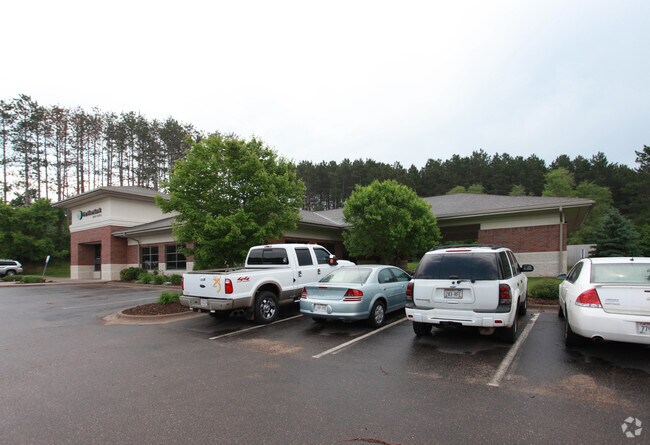
Property Record
880 6Th St N, Hudson, WI 54016

NEARBY LISTINGS FOR SALE OR LEASE
Property Detail
880 6Th St N
Minneapolis-St. Paul-Bloomington, MN-WI
SEC 13 T29N R20W PT NE NW FORMERLY LOT 4 CSM 9/2623 NKA LOT 4A CSM 13/3690 EZ-UT-1288/408
161-1063-40-160
St Croix
Commercialnec
Wisconsin
X
4,4a
27163C0269E
1.40 AC
2025
St Croix County
2024
Minneapolis/St Paul
120300
DEMOGRAPHICS near 880 6Th St N
1 Mile
3 Mile
5 Mile
2024 Total Population
3,766
19,756
51,994
2029 Population
4,054
21,341
56,124
Pop Growth 2024-2029
+ 7.65%
+ 8.02%
+ 7.94%
Average Age
42
42
43
2024 Total Households
1,519
7,951
21,374
HH Growth 2024-2029
+ 7.64%
+ 8.06%
+ 8.06%
Median Household Inc
$137,063
$107,626
$102,200
Avg Household Size
2.50
2.50
2.40
2024 Avg HH Vehicles
2.00
2.00
2.00
Median Home Value
$370,102
$357,912
$369,847
Median Year Built
1983
1982
1989
Nearby Places
Map Layers
Map Styles
 Street
 Aerial
- Restaurants
- Banks
- Shops
- Fitness
- Groceries
PUBLIC TRANSPORTATION
AIRPORT
Minneapolis-St Paul International/Wold-Chamberlain
DRIVE
WALK
Distance
Minneapolis-St Paul International/Wold-Chamberlain
44 min
29.5 mi
SALE & LEASE HISTORY
LISTING DATE
SALE/LEASE

Sep 18, 2020
For Sale
Nearby Properties
Address
Land Use
TOTAL SIZE
Lot Size
Zoning
Address
Land Use
TOTAL SIZE
Lot Size
Zoning
519,636 SF
40.40 AC
Address
Land Use
TOTAL SIZE
Lot Size
Zoning
600,000 SF
77.70 AC
Address
Land Use
TOTAL SIZE
Lot Size
Zoning
84.75 AC
Address
Land Use
TOTAL SIZE
Lot Size
Zoning
16.42 AC
Address
Land Use
TOTAL SIZE
Lot Size
Zoning
Address
Land Use
TOTAL SIZE
Lot Size
Zoning
132,967 SF
18.10 AC
Address
Land Use
TOTAL SIZE
Lot Size
Zoning
3.78 AC
Address
Land Use
TOTAL SIZE
Lot Size
Zoning
194,684 SF
14.86 AC
Address
Land Use
TOTAL SIZE
Lot Size
Zoning
43,888 SF
1.37 AC
Address
Land Use
TOTAL SIZE
Lot Size
Zoning
199,652 SF
5.02 AC
Address
Land Use
TOTAL SIZE
Lot Size
Zoning
15,072 SF
0.33 AC
Address
Land Use
TOTAL SIZE
Lot Size
Zoning
17,524 SF
4.16 AC
Address
Land Use
TOTAL SIZE
Lot Size
Zoning
11,576 SF
3.86 AC
B-2
Address
Land Use
TOTAL SIZE
Lot Size
Zoning
2.29 AC
Address
Land Use
TOTAL SIZE
Lot Size
Zoning
12,244 SF
0.69 AC
Address
Land Use
TOTAL SIZE
Lot Size
Zoning
20,300 SF
2.43 AC
I-1
Address
Land Use
TOTAL SIZE
Lot Size
Zoning
52,764 SF
4.40 AC
RM-1
Address
Land Use
TOTAL SIZE
Lot Size
Zoning
36,304 SF
2.79 AC
Address
Land Use
TOTAL SIZE
Lot Size
Zoning
5,284 SF
15.33 AC
Address
Land Use
TOTAL SIZE
Lot Size
Zoning
40,908 SF
3.17 AC
RM-1
Address
Land Use
TOTAL SIZE
Lot Size
Zoning
18,557 SF
1.94 AC
Address
Land Use
TOTAL SIZE
Lot Size
Zoning
11,554 SF
0.80 AC
I-1 & B-3
Address
Land Use
TOTAL SIZE
Lot Size
Zoning
14,820 SF
0.56 AC
Address
Land Use
TOTAL SIZE
Lot Size
Zoning
17,741 SF
0.28 AC
B-3
Address
Land Use
TOTAL SIZE
Lot Size
Zoning
1,824 SF
1.29 AC
Address
Land Use
TOTAL SIZE
Lot Size
Zoning
5,312 SF
14.88 AC
Address
Land Use
TOTAL SIZE
Lot Size
Zoning
5,588 SF
0.92 AC
B-2
Address
Land Use
TOTAL SIZE
Lot Size
Zoning
7,200 SF
7.99 AC
The World's #1 Commercial Real Estate Marketplace
Connect with us
© 2025 CoStar Group
The information above has been obtained from sources believed reliable. While we do not doubt its accuracy we have not verified it and make no guarantee, warranty or representation about it. It is your responsibility to independently confirm its accuracy and completeness. Any projections, opinions, assumptions, or estimates used are for example only and do not represent the current or future performance of the property. The value of this transaction to you depends on tax and other factors which should be evaluated by your tax, financial, and legal advisors. You and your advisors should conduct a careful, independent investigation of the property to determine to your satisfaction the suitability of the property for your needs.