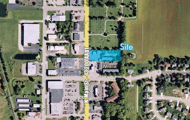
Property Record
880 N Main St, Verona, WI 53593


NEARBY LISTINGS FOR SALE OR LEASE
Property Detail
880 N Main St
Madison, WI
Assessors Plat
0509-012-6480-1
ASSESSORS PLAT PRT OUTLOT 4 DESCR AS COM AT PT IN CTR OF N MAIN ST 558.5 FT S OF SW COR OF PRAIRIE MOUND CEMETERY ALSO BEING SW COR OF ST MARYS CATHOLIC CEMETER Y TH S ALG C/L OF N MAIN ST 150.0 FT TH E ON LN PARA WITH S LN OF SD CATHOLIC CE METERY 4
Commercialnec
Dane
X
Wisconsin
55025C0584H
80
2024
1.42 AC
2024
Outlying Dane East
010802
Milwaukee/Madison
DEMOGRAPHICS near 880 N Main St
1 Mile
3 Mile
5 Mile
2024 Total Population
2,705
14,815
26,820
2029 Population
2,804
15,397
27,877
Pop Growth 2024-2029
+ 3.66%
+ 3.93%
+ 3.94%
Average Age
41
40
40
2024 Total Households
1,141
5,465
10,927
HH Growth 2024-2029
+ 3.77%
+ 4.01%
+ 4.12%
Median Household Inc
$78,450
$97,312
$102,187
Avg Household Size
2.30
2.50
2.40
2024 Avg HH Vehicles
2.00
2.00
2.00
Median Home Value
$298,504
$342,798
$353,686
Median Year Built
1983
1991
1995
Nearby Places
Map Layers
Map Styles
 Street
 Aerial
- Restaurants
- Banks
- Shops
- Fitness
- Groceries
PUBLIC TRANSPORTATION
AIRPORT
Dane County Regional/Truax Field
DRIVE
WALK
Distance
Dane County Regional/Truax Field
35 min
17.0 mi
Nearby Properties
Address
Land Use
TOTAL SIZE
Lot Size
Zoning
Address
Land Use
TOTAL SIZE
Lot Size
Zoning
77,296 SF
4.84 AC
TR-U1
Address
Land Use
TOTAL SIZE
Lot Size
Zoning
27,201 SF
7.65 AC
TR-U2
Address
Land Use
TOTAL SIZE
Lot Size
Zoning
18,242 SF
4.45 AC
TR-U1
Address
Land Use
TOTAL SIZE
Lot Size
Zoning
27,201 SF
10.08 AC
TR-U2
Address
Land Use
TOTAL SIZE
Lot Size
Zoning
290,535 SF
11.25 AC
PD
Address
Land Use
TOTAL SIZE
Lot Size
Zoning
311,672 SF
4.59 AC
PD
Address
Land Use
TOTAL SIZE
Lot Size
Zoning
324,920 SF
8.47 AC
PD
Address
Land Use
TOTAL SIZE
Lot Size
Zoning
244,074 SF
7.96 AC
SR-V2
Address
Land Use
TOTAL SIZE
Lot Size
Zoning
3.35 AC
Address
Land Use
TOTAL SIZE
Lot Size
Zoning
119,297 SF
4.19 AC
TR-P
Address
Land Use
TOTAL SIZE
Lot Size
Zoning
231,107 SF
4.59 AC
PD
Address
Land Use
TOTAL SIZE
Lot Size
Zoning
2.76 AC
Address
Land Use
TOTAL SIZE
Lot Size
Zoning
3.45 AC
SR-V2
Address
Land Use
TOTAL SIZE
Lot Size
Zoning
236,626 SF
5.63 AC
PD
Address
Land Use
TOTAL SIZE
Lot Size
Zoning
5.58 AC
Address
Land Use
TOTAL SIZE
Lot Size
Zoning
3.56 AC
Address
Land Use
TOTAL SIZE
Lot Size
Zoning
37,851 SF
3.11 AC
TR-U1
Address
Land Use
TOTAL SIZE
Lot Size
Zoning
3.96 AC
Address
Land Use
TOTAL SIZE
Lot Size
Zoning
2.43 AC
SR-V2
Address
Land Use
TOTAL SIZE
Lot Size
Zoning
3.71 AC
Address
Land Use
TOTAL SIZE
Lot Size
Zoning
152,075 SF
3.54 AC
PD
Address
Land Use
TOTAL SIZE
Lot Size
Zoning
5.23 AC
Address
Land Use
TOTAL SIZE
Lot Size
Zoning
142,001 SF
4.18 AC
SR-V2
Address
Land Use
TOTAL SIZE
Lot Size
Zoning
20,787 SF
4.56 AC
TR-U1
Address
Land Use
TOTAL SIZE
Lot Size
Zoning
3.62 AC
Address
Land Use
TOTAL SIZE
Lot Size
Zoning
7.77 AC
Address
Land Use
TOTAL SIZE
Lot Size
Zoning
6.32 AC
Address
Land Use
TOTAL SIZE
Lot Size
Zoning
48,253 SF
1.50 AC
PD
Address
Land Use
TOTAL SIZE
Lot Size
Zoning
49,234 SF
1.89 AC
TR-U1
Address
Land Use
TOTAL SIZE
Lot Size
Zoning
37,851 SF
3.21 AC
TR-U1
The World's #1 Commercial Real Estate Marketplace
Connect with us
© 2026 CoStar Group
The information above has been obtained from sources believed reliable. While we do not doubt its accuracy we have not verified it and make no guarantee, warranty or representation about it. It is your responsibility to independently confirm its accuracy and completeness. Any projections, opinions, assumptions, or estimates used are for example only and do not represent the current or future performance of the property. The value of this transaction to you depends on tax and other factors which should be evaluated by your tax, financial, and legal advisors. You and your advisors should conduct a careful, independent investigation of the property to determine to your satisfaction the suitability of the property for your needs.