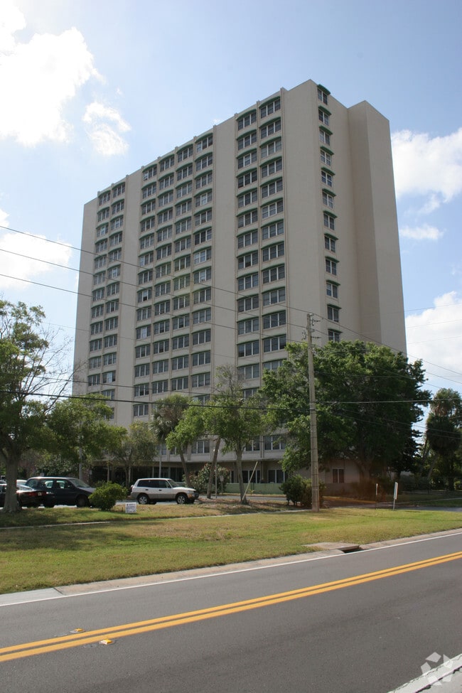
Property Record
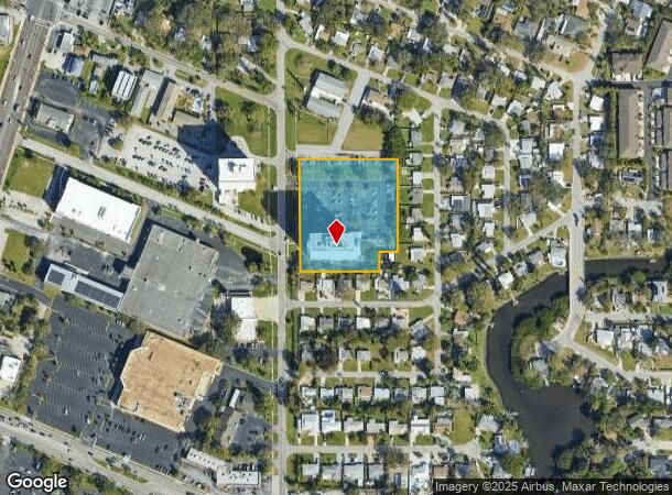
880 Oleander Way S, South Pasadena, FL 33707

NEARBY LISTINGS FOR SALE OR LEASE
Property Detail
880 Oleander Way S
30-31-16-12186-000-0003
Brookwood 1St Add
Apartment
BROOKWOOD 1ST ADD S 350FT OF TRACT A LESS E 100FT & LESS E 60FT OF W 309.45FT OF S 60FT THEREOF
AE
Pinellas
12103C0213H
Florida
2024
2.40 AC
2025
Pasadena On The Gulf
028102
Tampa/St Petersburg
148,745 SF
Tampa-St. Petersburg-Clearwater, FL
DEMOGRAPHICS near 880 Oleander Way S
1 Mile
3 Mile
5 Mile
2024 Total Population
11,185
78,274
193,904
2029 Population
11,259
78,924
196,047
Pop Growth 2024-2029
+ 0.66%
+ 0.83%
+ 1.11%
Average Age
54
49
47
2024 Total Households
6,052
38,424
90,087
HH Growth 2024-2029
+ 0.59%
+ 0.91%
+ 1.16%
Median Household Inc
$57,725
$68,524
$63,056
Avg Household Size
1.80
2.00
2.00
2024 Avg HH Vehicles
1.00
2.00
2.00
Median Home Value
$357,521
$331,584
$291,746
Median Year Built
1970
1964
1968
Nearby Places
Map Layers
Map Styles
 Street
 Aerial
- Restaurants
- Banks
- Shops
- Fitness
- Groceries
PUBLIC TRANSPORTATION
AIRPORT
St Pete-Clearwater International
DRIVE
WALK
Distance
St Pete-Clearwater International
31 min
14.4 mi
Tampa International
DRIVE
WALK
Distance
Tampa International
40 min
24.9 mi
Sarasota/Bradenton International
DRIVE
WALK
Distance
Sarasota/Bradenton International
52 min
33.3 mi
Freight Ports
Port Manatee
DRIVE
WALK
Distance
Port Manatee
39 min
25.9 mi
Nearby Properties
Address
Land Use
TOTAL SIZE
Lot Size
Zoning
Address
Land Use
TOTAL SIZE
Lot Size
Zoning
222,303 SF
10.01 AC
Address
Land Use
TOTAL SIZE
Lot Size
Zoning
209,606 SF
4.37 AC
Address
Land Use
TOTAL SIZE
Lot Size
Zoning
738,882 SF
43.34 AC
Address
Land Use
TOTAL SIZE
Lot Size
Zoning
117,157 SF
8.03 AC
Address
Land Use
TOTAL SIZE
Lot Size
Zoning
396,428 SF
19.76 AC
Address
Land Use
TOTAL SIZE
Lot Size
Zoning
89,180 SF
4.01 AC
Address
Land Use
TOTAL SIZE
Lot Size
Zoning
436,119 SF
22.24 AC
Address
Land Use
TOTAL SIZE
Lot Size
Zoning
122,243 SF
2.42 AC
Address
Land Use
TOTAL SIZE
Lot Size
Zoning
263,050 SF
34.20 AC
Address
Land Use
TOTAL SIZE
Lot Size
Zoning
142,529 SF
46.62 AC
Address
Land Use
TOTAL SIZE
Lot Size
Zoning
265,929 SF
5.43 AC
Address
Land Use
TOTAL SIZE
Lot Size
Zoning
110,968 SF
4.44 AC
Address
Land Use
TOTAL SIZE
Lot Size
Zoning
186,094 SF
11.96 AC
Address
Land Use
TOTAL SIZE
Lot Size
Zoning
181,708 SF
14.92 AC
R3
Address
Land Use
TOTAL SIZE
Lot Size
Zoning
363,074 SF
36.90 AC
Address
Land Use
TOTAL SIZE
Lot Size
Zoning
128,255 SF
4.27 AC
Address
Land Use
TOTAL SIZE
Lot Size
Zoning
127,237 SF
10.53 AC
Address
Land Use
TOTAL SIZE
Lot Size
Zoning
150,235 SF
17.90 AC
Address
Land Use
TOTAL SIZE
Lot Size
Zoning
146,000 SF
21.14 AC
Address
Land Use
TOTAL SIZE
Lot Size
Zoning
195,863 SF
18.57 AC
Address
Land Use
TOTAL SIZE
Lot Size
Zoning
156,994 SF
29.11 AC
Address
Land Use
TOTAL SIZE
Lot Size
Zoning
142,281 SF
1.57 AC
Address
Land Use
TOTAL SIZE
Lot Size
Zoning
71,873 SF
4.15 AC
Address
Land Use
TOTAL SIZE
Lot Size
Zoning
145,619 SF
1.68 AC
Address
Land Use
TOTAL SIZE
Lot Size
Zoning
144,334 SF
2.50 AC
Address
Land Use
TOTAL SIZE
Lot Size
Zoning
5.17 AC
Address
Land Use
TOTAL SIZE
Lot Size
Zoning
48,862 SF
3.72 AC
Address
Land Use
TOTAL SIZE
Lot Size
Zoning
220,805 SF
5.93 AC
Address
Land Use
TOTAL SIZE
Lot Size
Zoning
151,391 SF
3.13 AC
Address
Land Use
TOTAL SIZE
Lot Size
Zoning
154,986 SF
11.08 AC
The World's #1 Commercial Real Estate Marketplace
Connect with us
© 2026 CoStar Group
The information above has been obtained from sources believed reliable. While we do not doubt its accuracy we have not verified it and make no guarantee, warranty or representation about it. It is your responsibility to independently confirm its accuracy and completeness. Any projections, opinions, assumptions, or estimates used are for example only and do not represent the current or future performance of the property. The value of this transaction to you depends on tax and other factors which should be evaluated by your tax, financial, and legal advisors. You and your advisors should conduct a careful, independent investigation of the property to determine to your satisfaction the suitability of the property for your needs.