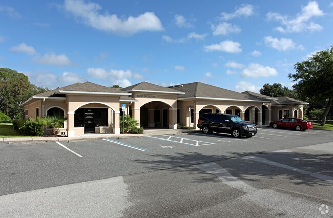
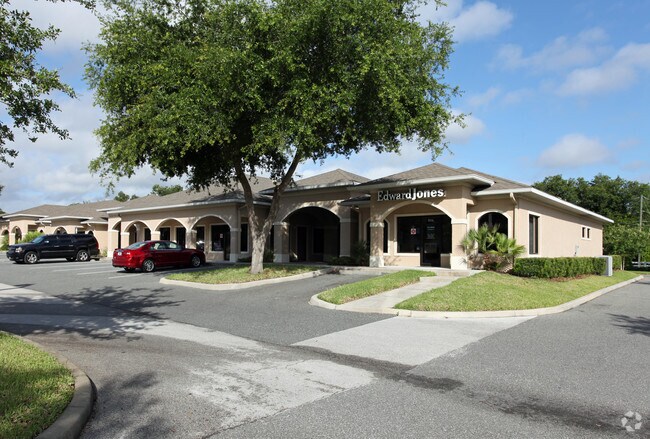
Property Record
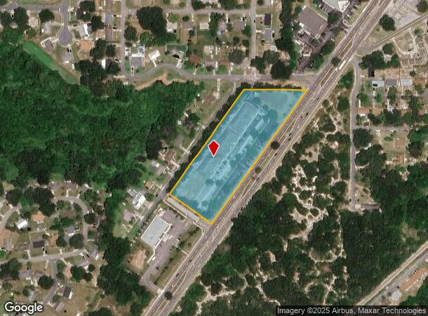
880 S Duncan Dr, Tavares, FL 32778
NEARBY LISTINGS FOR SALE OR LEASE
Property Detail
880 S Duncan Dr
Orlando-Kissimmee-Sanford, FL
Tavares Summerall Park Heights
31-19-26-0400-00N-00100
TAVARES SUMMERALL PARK HEIGHTS BLK N--LESS ANY PORTION LYING WITHIN SR 19--PB 8 PG 44 ORB 5876 PG 808
Officebuilding
Lake
X
Florida
12069C0361E
1
0
4.14 AC
2026
Lake County
030806
Orlando
22,294 SF
DEMOGRAPHICS near 880 S Duncan Dr
1 Mile
3 Mile
5 Mile
2024 Total Population
5,464
23,291
55,229
2029 Population
6,476
27,502
64,774
Pop Growth 2024-2029
+ 18.52%
+ 18.08%
+ 17.28%
Average Age
44
47
46
2024 Total Households
2,236
10,283
24,171
HH Growth 2024-2029
+ 18.83%
+ 18.14%
+ 17.18%
Median Household Inc
$51,646
$52,079
$52,791
Avg Household Size
2.20
2.10
2.20
2024 Avg HH Vehicles
1.00
1.00
2.00
Median Home Value
$160,321
$189,727
$210,703
Median Year Built
1989
1990
1986
Nearby Places
Map Layers
Map Styles
 Street
 Aerial
- Restaurants
- Banks
- Shops
- Fitness
- Groceries
PUBLIC TRANSPORTATION
AIRPORT
Orlando Sanford International
DRIVE
WALK
Distance
Orlando Sanford International
61 min
40.6 mi
Orlando International
DRIVE
WALK
Distance
Orlando International
67 min
48.5 mi
SALE & LEASE HISTORY
LISTING DATE
SALE/LEASE

Sep 25, 2016
For Lease
Nearby Properties
Address
Land Use
TOTAL SIZE
Lot Size
Zoning
Address
Land Use
TOTAL SIZE
Lot Size
Zoning
730,215 SF
151.42 AC
PD
Address
Land Use
TOTAL SIZE
Lot Size
Zoning
15,600 SF
9.32 AC
PFD
Address
Land Use
TOTAL SIZE
Lot Size
Zoning
481,096 SF
2.17 AC
PFD
Address
Land Use
TOTAL SIZE
Lot Size
Zoning
121,005 SF
6.56 AC
Address
Land Use
TOTAL SIZE
Lot Size
Zoning
85,539 SF
9.39 AC
Address
Land Use
TOTAL SIZE
Lot Size
Zoning
138,613 SF
24.59 AC
PFD
Address
Land Use
TOTAL SIZE
Lot Size
Zoning
97,053 SF
1.50 AC
PFD
Address
Land Use
TOTAL SIZE
Lot Size
Zoning
45,732 SF
5.68 AC
PD
Address
Land Use
TOTAL SIZE
Lot Size
Zoning
145,614 SF
11.27 AC
PD
Address
Land Use
TOTAL SIZE
Lot Size
Zoning
29,066 SF
0.76 AC
Address
Land Use
TOTAL SIZE
Lot Size
Zoning
149,998 SF
8.73 AC
I
Address
Land Use
TOTAL SIZE
Lot Size
Zoning
2,000 SF
3.04 AC
PFD
Address
Land Use
TOTAL SIZE
Lot Size
Zoning
45,310 SF
2.93 AC
PFD
Address
Land Use
TOTAL SIZE
Lot Size
Zoning
Address
Land Use
TOTAL SIZE
Lot Size
Zoning
146,690 SF
15.19 AC
RMF2
Address
Land Use
TOTAL SIZE
Lot Size
Zoning
36,629 SF
282.12 AC
CFD
Address
Land Use
TOTAL SIZE
Lot Size
Zoning
54,035 SF
1.65 AC
PD
Address
Land Use
TOTAL SIZE
Lot Size
Zoning
87,462 SF
4.94 AC
RMF3
Address
Land Use
TOTAL SIZE
Lot Size
Zoning
121,815 SF
33.48 AC
PD
Address
Land Use
TOTAL SIZE
Lot Size
Zoning
2,000 SF
19.74 AC
PFD
Address
Land Use
TOTAL SIZE
Lot Size
Zoning
2,000 SF
2.14 AC
PFD
Address
Land Use
TOTAL SIZE
Lot Size
Zoning
63,600 SF
1.24 AC
PD
Address
Land Use
TOTAL SIZE
Lot Size
Zoning
40,776 SF
2.28 AC
C1
Address
Land Use
TOTAL SIZE
Lot Size
Zoning
27,512 SF
3.64 AC
PD
Address
Land Use
TOTAL SIZE
Lot Size
Zoning
46,524 SF
6.87 AC
Address
Land Use
TOTAL SIZE
Lot Size
Zoning
109,792 SF
11.83 AC
RMRP
Address
Land Use
TOTAL SIZE
Lot Size
Zoning
68,015 SF
8.53 AC
C1
Address
Land Use
TOTAL SIZE
Lot Size
Zoning
31,731 SF
24.76 AC
PFD
Address
Land Use
TOTAL SIZE
Lot Size
Zoning
86.22 AC
PD
Address
Land Use
TOTAL SIZE
Lot Size
Zoning
42,515 SF
9.41 AC
HM
The World's #1 Commercial Real Estate Marketplace
Connect with us
© 2025 CoStar Group
The information above has been obtained from sources believed reliable. While we do not doubt its accuracy we have not verified it and make no guarantee, warranty or representation about it. It is your responsibility to independently confirm its accuracy and completeness. Any projections, opinions, assumptions, or estimates used are for example only and do not represent the current or future performance of the property. The value of this transaction to you depends on tax and other factors which should be evaluated by your tax, financial, and legal advisors. You and your advisors should conduct a careful, independent investigation of the property to determine to your satisfaction the suitability of the property for your needs.