Property Record
880 Technology Dr, Fayetteville, NC 28306


NEARBY LISTINGS FOR SALE OR LEASE
Property Detail
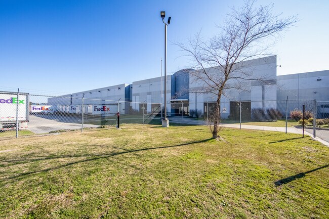
880 Technology Dr
Fayetteville, NC
Industrial Park Area
0433-25-8061
CUMBERLAND INDUSTRIAL CENTER LO:26 SE:01 PL:0094-0119
Commercialnec
Cumberland
X
North Carolina
3720043300J
26
2025
39.04 AC
2025
East Fayetteville
003003
Fayetteville
182,589 SF
DEMOGRAPHICS near 880 Technology Dr
1 Mile
3 Mile
5 Mile
2024 Total Population
1,325
16,899
46,789
2029 Population
1,324
16,891
46,624
Pop Growth 2024-2029
(0.08%)
(0.05%)
(0.35%)
Average Age
35
36
36
2024 Total Households
449
5,907
17,117
HH Growth 2024-2029
0.00%
(0.02%)
(0.36%)
Median Household Inc
$69,850
$72,893
$61,204
Avg Household Size
2.90
2.80
2.70
2024 Avg HH Vehicles
2.00
2.00
2.00
Median Home Value
$191,269
$197,777
$171,681
Median Year Built
1999
2000
1995
Nearby Places
Map Layers
Map Styles
 Street
 Aerial
- Restaurants
- Banks
- Shops
- Fitness
- Groceries
PUBLIC TRANSPORTATION
COMMUTER RAIL
Fayetteville Amtrak Station (Palmetto - Amtrak, Silver Meteor - Amtrak)
DRIVE
WALK
Distance
Fayetteville Amtrak Station (Palmetto - Amtrak, Silver Meteor - Amtrak)
14 min
9.7 mi
AIRPORT
Fayetteville Regional/Grannis Field
DRIVE
WALK
Distance
Fayetteville Regional/Grannis Field
10 min
5.0 mi
Freight Ports
Port of Wilmington
DRIVE
WALK
Distance
Port of Wilmington
120 min
85.7 mi
SALE & LEASE HISTORY
LISTING DATE
SALE/LEASE

Sep 24, 2016
For Lease
Sep 23, 2016
For Sale
Feb 12, 2020
For Sale
Aug 29, 2017
For Lease
Nearby Properties
Address
Land Use
TOTAL SIZE
Lot Size
Zoning
Address
Land Use
TOTAL SIZE
Lot Size
Zoning
1,117,824 SF
227 AC
MP
Address
Land Use
TOTAL SIZE
Lot Size
Zoning
123,423 SF
70.84 AC
A1
Address
Land Use
TOTAL SIZE
Lot Size
Zoning
66,637 SF
48.75 AC
A1
Address
Land Use
TOTAL SIZE
Lot Size
Zoning
14,000 SF
97.50 AC
MP
Address
Land Use
TOTAL SIZE
Lot Size
Zoning
500,548 SF
45.12 AC
MP
Address
Land Use
TOTAL SIZE
Lot Size
Zoning
104,048 SF
25 AC
A1
Address
Land Use
TOTAL SIZE
Lot Size
Zoning
13.78 AC
M1P-LIGHT
Address
Land Use
TOTAL SIZE
Lot Size
Zoning
259,960 SF
31 AC
MP
Address
Land Use
TOTAL SIZE
Lot Size
Zoning
21.10 AC
MP
Address
Land Use
TOTAL SIZE
Lot Size
Zoning
16.41 AC
MP
Address
Land Use
TOTAL SIZE
Lot Size
Zoning
9,404 SF
62.05 AC
RR
Address
Land Use
TOTAL SIZE
Lot Size
Zoning
1,970 SF
5.04 AC
R5A
Address
Land Use
TOTAL SIZE
Lot Size
Zoning
58,915 SF
18.75 AC
MP
Address
Land Use
TOTAL SIZE
Lot Size
Zoning
64,445 SF
37.03 AC
MP
Address
Land Use
TOTAL SIZE
Lot Size
Zoning
56,282 SF
9.68 AC
CP
Address
Land Use
TOTAL SIZE
Lot Size
Zoning
115,200 SF
33.80 AC
MP
Address
Land Use
TOTAL SIZE
Lot Size
Zoning
144,000 SF
21.30 AC
MP
Address
Land Use
TOTAL SIZE
Lot Size
Zoning
10.59 AC
CP-PLANNED
Address
Land Use
TOTAL SIZE
Lot Size
Zoning
10,200 SF
14.37 AC
C3
Address
Land Use
TOTAL SIZE
Lot Size
Zoning
2,400 SF
6.74 AC
R5A
Address
Land Use
TOTAL SIZE
Lot Size
Zoning
14,100 SF
9.05 AC
CP
Address
Land Use
TOTAL SIZE
Lot Size
Zoning
1,104 SF
4.33 AC
CP
Address
Land Use
TOTAL SIZE
Lot Size
Zoning
29,240 SF
5.33 AC
MP
Address
Land Use
TOTAL SIZE
Lot Size
Zoning
6,000 SF
5.54 AC
CP-PLANNED
Address
Land Use
TOTAL SIZE
Lot Size
Zoning
82.81 AC
CP-PLANNED
Address
Land Use
TOTAL SIZE
Lot Size
Zoning
8.37 AC
CP-PLANNED
Address
Land Use
TOTAL SIZE
Lot Size
Zoning
8,000 SF
5.73 AC
M1P-LIGHT
Address
Land Use
TOTAL SIZE
Lot Size
Zoning
49.90 AC
CP-PLANNED
Address
Land Use
TOTAL SIZE
Lot Size
Zoning
11.17 AC
C3
The World's #1 Commercial Real Estate Marketplace
Connect with us
© 2026 CoStar Group
The information above has been obtained from sources believed reliable. While we do not doubt its accuracy we have not verified it and make no guarantee, warranty or representation about it. It is your responsibility to independently confirm its accuracy and completeness. Any projections, opinions, assumptions, or estimates used are for example only and do not represent the current or future performance of the property. The value of this transaction to you depends on tax and other factors which should be evaluated by your tax, financial, and legal advisors. You and your advisors should conduct a careful, independent investigation of the property to determine to your satisfaction the suitability of the property for your needs.