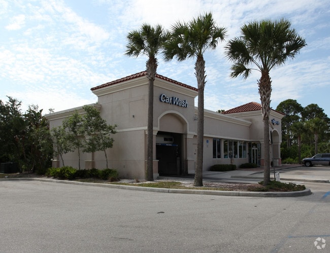
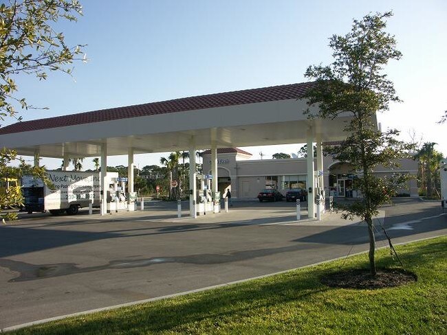
Property Record
8800 Corkscrew Rd, Estero, FL 33928

Property Detail
8800 Corkscrew Rd
33-46-25-E2-02000.0040
CORKSCREW VILLAGE PB 60 PGS 34 + 35 LOT 4
Supermarket
LEE
CPD
Florida
B and X Area of moderate flood hazard, usually the area between the limits of the 100-year and 500-year floods.
4
2024
1.06 AC
2025
Estero
050306
Southwest Florida
6,712 SF
Cape Coral-Fort Myers, FL
NEARBY LISTINGS FOR SALE OR LEASE
DEMOGRAPHICS near 8800 Corkscrew Rd
1 mile
3 mile
5 mile
2025 Total Population
5,005
50,110
91,665
2030 Population
5,606
55,472
101,504
Pop Growth 2025-2030
+ 12.01%
+ 10.70%
+ 10.73%
Average Age
56
51
50
2025 Total Households
2,277
22,998
40,599
HH Growth 2025-2030
+ 11.55%
+ 10.43%
+ 10.43%
Median Household Inc
$105,105
$90,231
$96,353
Avg Household Size
2.10
2.10
2.20
2025 Avg HH Vehicles
2.00
2.00
2.00
Median Home Value
$505,982
$459,891
$491,694
Median Year Built
2002
2002
2002
Nearby Places
Map Layers
Map Styles
 Street
 Aerial
Transit
 Traffic
 Biking
Places
Listings with unknown addresses are not visible on the map
- Restaurants
- Banks
- Shops
- Fitness
- Groceries
PUBLIC TRANSPORTATION
AIRPORT
Southwest Florida International
Drive
Walk
Distance
Southwest Florida International
20 min
13.2 mi
Freight Ports
Port Manatee
Drive
Walk
Distance
Port Manatee
128 min
113.0 mi
Nearby Properties
Address
Land Use
TOTAL SIZE
Lot Size
Zoning
Address
Land Use
TOTAL SIZE
Lot Size
Zoning
4,413,774 SF
760.09 AC
AG-2
Address
Land Use
TOTAL SIZE
Lot Size
Zoning
785,522 SF
70.04 AC
MPD
Address
Land Use
TOTAL SIZE
Lot Size
Zoning
177,930 SF
20.74 AC
MPD
Address
Land Use
TOTAL SIZE
Lot Size
Zoning
687,668 SF
27.19 AC
CPD
Address
Land Use
TOTAL SIZE
Lot Size
Zoning
20.19 AC
MPD
Address
Land Use
TOTAL SIZE
Lot Size
Zoning
395,259 SF
16.56 AC
MPD
Address
Land Use
TOTAL SIZE
Lot Size
Zoning
369,577 SF
16.39 AC
RPD
Address
Land Use
TOTAL SIZE
Lot Size
Zoning
482,782 SF
27.98 AC
CPD
Address
Land Use
TOTAL SIZE
Lot Size
Zoning
294,689 SF
17.95 AC
MPD
Address
Land Use
TOTAL SIZE
Lot Size
Zoning
345,170 SF
21.32 AC
RPD
Address
Land Use
TOTAL SIZE
Lot Size
Zoning
291,157 SF
23.38 AC
RPD
Address
Land Use
TOTAL SIZE
Lot Size
Zoning
540,648 SF
19.75 AC
MPD
Address
Land Use
TOTAL SIZE
Lot Size
Zoning
293,332 SF
7.03 AC
CPD
Address
Land Use
TOTAL SIZE
Lot Size
Zoning
320,574 SF
16.10 AC
MPD
Address
Land Use
TOTAL SIZE
Lot Size
Zoning
245,356 SF
12.54 AC
MPD
Address
Land Use
TOTAL SIZE
Lot Size
Zoning
274,691 SF
6.62 AC
MPD
Address
Land Use
TOTAL SIZE
Lot Size
Zoning
348,757 SF
69.01 AC
CF-2
Address
Land Use
TOTAL SIZE
Lot Size
Zoning
Address
Land Use
TOTAL SIZE
Lot Size
Zoning
240,044 SF
14.19 AC
MPD
Address
Land Use
TOTAL SIZE
Lot Size
Zoning
69.37 AC
RPD
Address
Land Use
TOTAL SIZE
Lot Size
Zoning
14.42 AC
RPD
Address
Land Use
TOTAL SIZE
Lot Size
Zoning
5.39 AC
RPD
Address
Land Use
TOTAL SIZE
Lot Size
Zoning
236,456 SF
27.05 AC
MPD
Address
Land Use
TOTAL SIZE
Lot Size
Zoning
239.40 AC
Address
Land Use
TOTAL SIZE
Lot Size
Zoning
166,672 SF
8.58 AC
CPD
Address
Land Use
TOTAL SIZE
Lot Size
Zoning
79,833 SF
9.16 AC
Address
Land Use
TOTAL SIZE
Lot Size
Zoning
174,712 SF
9.70 AC
MPD
Address
Land Use
TOTAL SIZE
Lot Size
Zoning
139,174 SF
4.73 AC
CPD
Address
Land Use
TOTAL SIZE
Lot Size
Zoning
151,366 SF
15.47 AC
CPD
Address
Land Use
TOTAL SIZE
Lot Size
Zoning
48,538 SF
4.46 AC
CC
The World's #1 Commercial Real Estate Marketplace
Connect with us
© 2026 CoStar Group
The information above has been obtained from sources believed reliable. While we do not doubt its accuracy we have not verified it and make no guarantee, warranty or representation about it. It is your responsibility to independently confirm its accuracy and completeness. Any projections, opinions, assumptions, or estimates used are for example only and do not represent the current or future performance of the property. The value of this transaction to you depends on tax and other factors which should be evaluated by your tax, financial, and legal advisors. You and your advisors should conduct a careful, independent investigation of the property to determine to your satisfaction the suitability of the property for your needs.