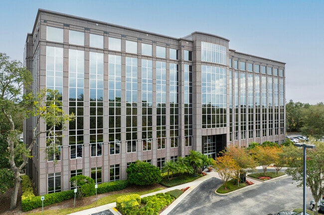
Property Record
8800 Grand Oak Cir, Tampa, FL 33637

NEARBY LISTINGS FOR SALE OR LEASE
Property Detail
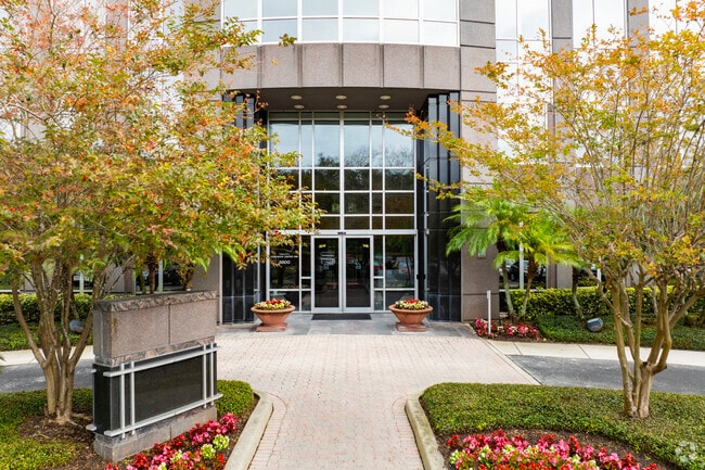
8800 Grand Oak Cir
Tampa-St. Petersburg-Clearwater, FL
Hidden River Corporate Park Phase I
A-01-28-19-1EM-000000-00004.0
HIDDEN RIVER CORPORATE PARK PHASE I LOT 4 AND LOT 9
Officebuilding
Hillsborough
X
Florida
12057C0230H
4
2024
9.52 AC
2024
Northeast Tampa
011017
Tampa/St Petersburg
134,296 SF
DEMOGRAPHICS near 8800 Grand Oak Cir
1 Mile
3 Mile
5 Mile
2024 Total Population
4,671
40,710
149,613
2029 Population
5,153
44,197
163,015
Pop Growth 2024-2029
+ 10.32%
+ 8.57%
+ 8.96%
Average Age
35
38
36
2024 Total Households
2,190
16,549
60,528
HH Growth 2024-2029
+ 10.64%
+ 8.80%
+ 9.12%
Median Household Inc
$58,963
$59,657
$49,304
Avg Household Size
2.10
2.40
2.30
2024 Avg HH Vehicles
1.00
2.00
2.00
Median Home Value
$269,999
$307,802
$285,537
Median Year Built
2000
1986
1988
Nearby Places
Map Layers
Map Styles
 Street
 Aerial
- Restaurants
- Banks
- Shops
- Fitness
- Groceries
PUBLIC TRANSPORTATION
AIRPORT
Tampa International
DRIVE
WALK
Distance
Tampa International
33 min
21.8 mi
St Pete-Clearwater International
DRIVE
WALK
Distance
St Pete-Clearwater International
50 min
31.9 mi
SALE & LEASE HISTORY
LISTING DATE
SALE/LEASE

Sep 25, 2016
For Lease
Sep 22, 2020
For Lease
Nearby Properties
Address
Land Use
TOTAL SIZE
Lot Size
Zoning
Address
Land Use
TOTAL SIZE
Lot Size
Zoning
702,607 SF
63.42 AC
RCP
Address
Land Use
TOTAL SIZE
Lot Size
Zoning
727,236 SF
61.10 AC
CU
Address
Land Use
TOTAL SIZE
Lot Size
Zoning
319,292 SF
31.71 AC
PD
Address
Land Use
TOTAL SIZE
Lot Size
Zoning
594,270 SF
22.99 AC
PD
Address
Land Use
TOTAL SIZE
Lot Size
Zoning
306,031 SF
16.15 AC
PD-A
Address
Land Use
TOTAL SIZE
Lot Size
Zoning
287,530 SF
9.09 AC
PD
Address
Land Use
TOTAL SIZE
Lot Size
Zoning
706,512 SF
76.54 AC
PD
Address
Land Use
TOTAL SIZE
Lot Size
Zoning
207,965 SF
20.94 AC
PD-A
Address
Land Use
TOTAL SIZE
Lot Size
Zoning
598,043 SF
48.18 AC
PD
Address
Land Use
TOTAL SIZE
Lot Size
Zoning
285,330 SF
34.74 AC
RDC-12
Address
Land Use
TOTAL SIZE
Lot Size
Zoning
280,650 SF
11.92 AC
UMU-20
Address
Land Use
TOTAL SIZE
Lot Size
Zoning
163,045 SF
32.18 AC
PD
Address
Land Use
TOTAL SIZE
Lot Size
Zoning
127,528 SF
11.45 AC
PD-A
Address
Land Use
TOTAL SIZE
Lot Size
Zoning
210,916 SF
16.22 AC
PROF
Address
Land Use
TOTAL SIZE
Lot Size
Zoning
170,172 SF
18.08 AC
RCP
Address
Land Use
TOTAL SIZE
Lot Size
Zoning
155,769 SF
18.53 AC
CMU-12
Address
Land Use
TOTAL SIZE
Lot Size
Zoning
228,193 SF
18.87 AC
RMFA
Address
Land Use
TOTAL SIZE
Lot Size
Zoning
217,070 SF
20.83 AC
R-18
Address
Land Use
TOTAL SIZE
Lot Size
Zoning
156,816 SF
8.32 AC
PD-A
Address
Land Use
TOTAL SIZE
Lot Size
Zoning
279,841 SF
24.62 AC
R-18
Address
Land Use
TOTAL SIZE
Lot Size
Zoning
172,220 SF
16.66 AC
RCP
Address
Land Use
TOTAL SIZE
Lot Size
Zoning
117,961 SF
8.32 AC
RMC-20
Address
Land Use
TOTAL SIZE
Lot Size
Zoning
133,644 SF
8.85 AC
PD-A
Address
Land Use
TOTAL SIZE
Lot Size
Zoning
74,897 SF
10.02 AC
RCP
Address
Land Use
TOTAL SIZE
Lot Size
Zoning
175,203 SF
16.05 AC
UMU-20
Address
Land Use
TOTAL SIZE
Lot Size
Zoning
117,354 SF
24.82 AC
PD
Address
Land Use
TOTAL SIZE
Lot Size
Zoning
151,287 SF
9.02 AC
RCP
Address
Land Use
TOTAL SIZE
Lot Size
Zoning
128,616 SF
5.55 AC
PD
Address
Land Use
TOTAL SIZE
Lot Size
Zoning
143,511 SF
2.31 AC
PD-A
Address
Land Use
TOTAL SIZE
Lot Size
Zoning
203,146 SF
10.14 AC
SPI-UC-3
The World's #1 Commercial Real Estate Marketplace
Connect with us
© 2026 CoStar Group
The information above has been obtained from sources believed reliable. While we do not doubt its accuracy we have not verified it and make no guarantee, warranty or representation about it. It is your responsibility to independently confirm its accuracy and completeness. Any projections, opinions, assumptions, or estimates used are for example only and do not represent the current or future performance of the property. The value of this transaction to you depends on tax and other factors which should be evaluated by your tax, financial, and legal advisors. You and your advisors should conduct a careful, independent investigation of the property to determine to your satisfaction the suitability of the property for your needs.