Property Record
8800 Grandhaven Ave, Upper Marlboro, MD 20772


NEARBY LISTINGS FOR SALE OR LEASE
-
-
View all Upper Marlboro listings for sale on LoopNet.com
Property Detail
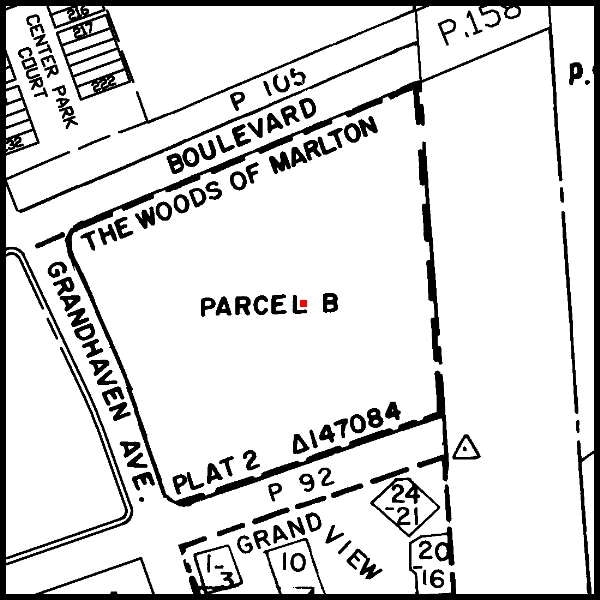
8800 Grandhaven Ave
Washington-Arlington-Alexandria, DC-VA-MD-WV
The Woods Of Marlton
15-1788512
PARCEL B
Apartment
Prince George's
X
Maryland
24033C0270E
b
2024
8.94 AC
2025
Outlying PG County South
800707
Washington, DC
DEMOGRAPHICS near 8800 Grandhaven Ave
1 Mile
3 Mile
5 Mile
2024 Total Population
6,193
18,396
50,505
2029 Population
6,013
17,889
49,367
Pop Growth 2024-2029
(2.91%)
(2.76%)
(2.25%)
Average Age
40
43
42
2024 Total Households
2,352
6,673
18,332
HH Growth 2024-2029
(3.02%)
(2.85%)
(2.34%)
Median Household Inc
$110,456
$123,371
$130,347
Avg Household Size
2.60
2.70
2.70
2024 Avg HH Vehicles
2.00
2.00
2.00
Median Home Value
$340,640
$396,356
$412,284
Median Year Built
1988
1990
1993
Nearby Places
Map Layers
Map Styles
 Street
 Aerial
- Restaurants
- Banks
- Shops
- Fitness
- Groceries
PUBLIC TRANSPORTATION
AIRPORT
Ronald Reagan Washington Ntl
DRIVE
WALK
Distance
Ronald Reagan Washington Ntl
46 min
23.7 mi
Baltimore/Washington International Thurgood Marshall
DRIVE
WALK
Distance
Baltimore/Washington International Thurgood Marshall
59 min
37.3 mi
Freight Ports
Port of Baltimore
DRIVE
WALK
Distance
Port of Baltimore
66 min
42.9 mi
Nearby Properties
Address
Land Use
TOTAL SIZE
Lot Size
Zoning
Address
Land Use
TOTAL SIZE
Lot Size
Zoning
190,603 SF
16.08 AC
RMF20
Address
Land Use
TOTAL SIZE
Lot Size
Zoning
55,450 SF
7.76 AC
CGO
Address
Land Use
TOTAL SIZE
Lot Size
Zoning
132,574 SF
25 AC
AR
Address
Land Use
TOTAL SIZE
Lot Size
Zoning
48,247 SF
26.15 AC
AR
Address
Land Use
TOTAL SIZE
Lot Size
Zoning
106,182 SF
7.07 AC
RMF20
Address
Land Use
TOTAL SIZE
Lot Size
Zoning
2.49 AC
CGO
Address
Land Use
TOTAL SIZE
Lot Size
Zoning
29,206 SF
4.57 AC
CGO
Address
Land Use
TOTAL SIZE
Lot Size
Zoning
55,547 SF
10 AC
RR
Address
Land Use
TOTAL SIZE
Lot Size
Zoning
44,710 SF
10.05 AC
ROS
Address
Land Use
TOTAL SIZE
Lot Size
Zoning
10,662 SF
1.72 AC
CGO
Address
Land Use
TOTAL SIZE
Lot Size
Zoning
1,400 SF
4.27 AC
CGO
Address
Land Use
TOTAL SIZE
Lot Size
Zoning
76,336 SF
5.93 AC
CGO
Address
Land Use
TOTAL SIZE
Lot Size
Zoning
35,125 SF
21.47 AC
RR
Address
Land Use
TOTAL SIZE
Lot Size
Zoning
34,226 SF
21.72 AC
AR
Address
Land Use
TOTAL SIZE
Lot Size
Zoning
341.03 AC
ROS
Address
Land Use
TOTAL SIZE
Lot Size
Zoning
398.62 AC
ROS
Address
Land Use
TOTAL SIZE
Lot Size
Zoning
20,858 SF
5.12 AC
RR
Address
Land Use
TOTAL SIZE
Lot Size
Zoning
2,280 SF
0.83 AC
CGO
Address
Land Use
TOTAL SIZE
Lot Size
Zoning
180.78 AC
AR
Address
Land Use
TOTAL SIZE
Lot Size
Zoning
3,570 SF
1.11 AC
CGO
Address
Land Use
TOTAL SIZE
Lot Size
Zoning
2,882 SF
1.27 AC
CS
Address
Land Use
TOTAL SIZE
Lot Size
Zoning
13,652 SF
13.18 AC
AG
Address
Land Use
TOTAL SIZE
Lot Size
Zoning
7,000 SF
0.49 AC
CGO
Address
Land Use
TOTAL SIZE
Lot Size
Zoning
246.36 AC
ROS
Address
Land Use
TOTAL SIZE
Lot Size
Zoning
216.17 AC
ROS
Address
Land Use
TOTAL SIZE
Lot Size
Zoning
15,100 SF
8.82 AC
AR
Address
Land Use
TOTAL SIZE
Lot Size
Zoning
12,020 SF
393.91 AC
AR
Address
Land Use
TOTAL SIZE
Lot Size
Zoning
46,887 SF
24.53 AC
AR
Address
Land Use
TOTAL SIZE
Lot Size
Zoning
1,248 SF
0.82 AC
CGO
Address
Land Use
TOTAL SIZE
Lot Size
Zoning
1,050 SF
0.51 AC
CGO
The World's #1 Commercial Real Estate Marketplace
Connect with us
© 2026 CoStar Group
The information above has been obtained from sources believed reliable. While we do not doubt its accuracy we have not verified it and make no guarantee, warranty or representation about it. It is your responsibility to independently confirm its accuracy and completeness. Any projections, opinions, assumptions, or estimates used are for example only and do not represent the current or future performance of the property. The value of this transaction to you depends on tax and other factors which should be evaluated by your tax, financial, and legal advisors. You and your advisors should conduct a careful, independent investigation of the property to determine to your satisfaction the suitability of the property for your needs.