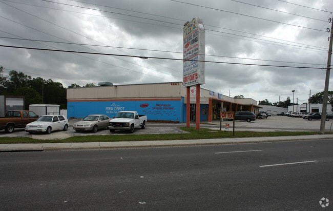
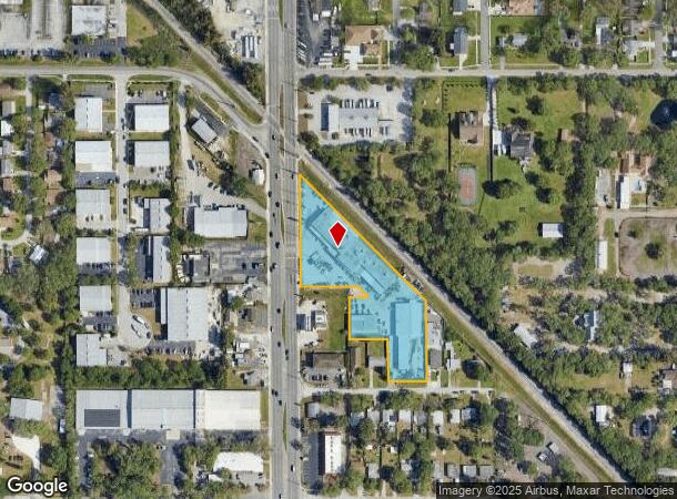
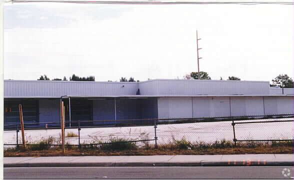
Property Record
8801 66Th St N, Pinellas Park, FL 33782

NEARBY LISTINGS FOR SALE OR LEASE
Property Detail
8801 66Th St N
Tampa-St. Petersburg-Clearwater, FL
Pinellas Farms
20-30-16-69804-300-5602
PINELLAS FARMS SW 1/4, THAT PT OF FARM 56 LYING SWLY OF RR & N 1/2 OF VAC 88TH AVE N ADJ ON S PER O.R. 15663/1961 ALL DESC BEG NE COR OF 88TH AVE N & SR #693 TH N 349FT (S) TO SW R/W OF RR TH SELY 515FT(S) ALG RR R/W TO C/L OF VAC 88TH AVE N TH W 167
Parkingstructure
Pinellas
X
Florida
12103C0201J
1
2024
2.59 AC
2025
South Pinellas
024904
Tampa/St Petersburg
39,348 SF
DEMOGRAPHICS near 8801 66Th St N
1 Mile
3 Mile
5 Mile
2024 Total Population
11,325
99,831
263,231
2029 Population
11,211
100,219
263,884
Pop Growth 2024-2029
(1.01%)
+ 0.39%
+ 0.25%
Average Age
43
45
46
2024 Total Households
4,576
43,136
118,946
HH Growth 2024-2029
(1.20%)
+ 0.34%
+ 0.16%
Median Household Inc
$56,309
$57,276
$57,103
Avg Household Size
2.30
2.20
2.10
2024 Avg HH Vehicles
2.00
2.00
2.00
Median Home Value
$252,169
$218,816
$223,662
Median Year Built
1977
1976
1974
Nearby Places
Map Layers
Map Styles
 Street
 Aerial
- Restaurants
- Banks
- Shops
- Fitness
- Groceries
PUBLIC TRANSPORTATION
AIRPORT
St Pete-Clearwater International
DRIVE
WALK
Distance
St Pete-Clearwater International
18 min
7.8 mi
Tampa International
DRIVE
WALK
Distance
Tampa International
30 min
18.8 mi
Freight Ports
Port Manatee
DRIVE
WALK
Distance
Port Manatee
47 min
33.7 mi
Nearby Properties
Address
Land Use
TOTAL SIZE
Lot Size
Zoning
Address
Land Use
TOTAL SIZE
Lot Size
Zoning
459,848 SF
19.74 AC
R6
Address
Land Use
TOTAL SIZE
Lot Size
Zoning
372,013 SF
10.10 AC
Address
Land Use
TOTAL SIZE
Lot Size
Zoning
382,389 SF
13.62 AC
Address
Land Use
TOTAL SIZE
Lot Size
Zoning
404,899 SF
35.35 AC
Address
Land Use
TOTAL SIZE
Lot Size
Zoning
358,681 SF
11.70 AC
Address
Land Use
TOTAL SIZE
Lot Size
Zoning
402,681 SF
18.40 AC
Address
Land Use
TOTAL SIZE
Lot Size
Zoning
227,858 SF
64.31 AC
AE
Address
Land Use
TOTAL SIZE
Lot Size
Zoning
294,478 SF
44.79 AC
M1
Address
Land Use
TOTAL SIZE
Lot Size
Zoning
206,685 SF
16.75 AC
RPD5
Address
Land Use
TOTAL SIZE
Lot Size
Zoning
267,649 SF
17.86 AC
Address
Land Use
TOTAL SIZE
Lot Size
Zoning
582,271 SF
17.14 AC
Address
Land Use
TOTAL SIZE
Lot Size
Zoning
249,699 SF
15 AC
Address
Land Use
TOTAL SIZE
Lot Size
Zoning
10,474 SF
660.47 AC
R3
Address
Land Use
TOTAL SIZE
Lot Size
Zoning
174,082 SF
17.08 AC
C2
Address
Land Use
TOTAL SIZE
Lot Size
Zoning
193,194 SF
13.53 AC
Address
Land Use
TOTAL SIZE
Lot Size
Zoning
360,137 SF
37.64 AC
AE
Address
Land Use
TOTAL SIZE
Lot Size
Zoning
211,684 SF
14.48 AC
M1
Address
Land Use
TOTAL SIZE
Lot Size
Zoning
172,600 SF
20.57 AC
Address
Land Use
TOTAL SIZE
Lot Size
Zoning
172,768 SF
15.05 AC
RPD20
Address
Land Use
TOTAL SIZE
Lot Size
Zoning
687,675 SF
67.89 AC
M1
Address
Land Use
TOTAL SIZE
Lot Size
Zoning
159,667 SF
20 AC
AE
Address
Land Use
TOTAL SIZE
Lot Size
Zoning
125,218 SF
13.51 AC
Address
Land Use
TOTAL SIZE
Lot Size
Zoning
297,508 SF
36.80 AC
Address
Land Use
TOTAL SIZE
Lot Size
Zoning
196,000 SF
13.06 AC
Address
Land Use
TOTAL SIZE
Lot Size
Zoning
226,561 SF
24.34 AC
Address
Land Use
TOTAL SIZE
Lot Size
Zoning
116,358 SF
12.74 AC
Address
Land Use
TOTAL SIZE
Lot Size
Zoning
248,572 SF
15.22 AC
PSP
Address
Land Use
TOTAL SIZE
Lot Size
Zoning
104,130 SF
4.87 AC
AE
Address
Land Use
TOTAL SIZE
Lot Size
Zoning
276,561 SF
12.24 AC
Address
Land Use
TOTAL SIZE
Lot Size
Zoning
130,331 SF
12.83 AC
C2
The World's #1 Commercial Real Estate Marketplace
Connect with us
© 2025 CoStar Group
The information above has been obtained from sources believed reliable. While we do not doubt its accuracy we have not verified it and make no guarantee, warranty or representation about it. It is your responsibility to independently confirm its accuracy and completeness. Any projections, opinions, assumptions, or estimates used are for example only and do not represent the current or future performance of the property. The value of this transaction to you depends on tax and other factors which should be evaluated by your tax, financial, and legal advisors. You and your advisors should conduct a careful, independent investigation of the property to determine to your satisfaction the suitability of the property for your needs.