Property Record
8802 Cliff Allen Pt, Colorado Springs, CO 80908
NEARBY LISTINGS FOR SALE OR LEASE
-
-
-
NEC E. Woodmen Rd. & Marksheffel rd
Colorado Springs, CO 80908
$1,050,000 - $3,550,000
1.28 - 3.13 AC Lot
Land
-
7452 Solace Forest View, Colorado Spgs
Colorado Springs, CO 80927
Rent Upon Request
1.58 AC Lots
Land
-
-
-
-
View all Colorado Springs listings for sale on LoopNet.com
Property Detail
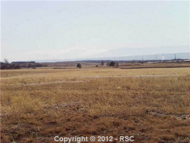
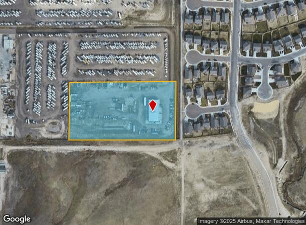
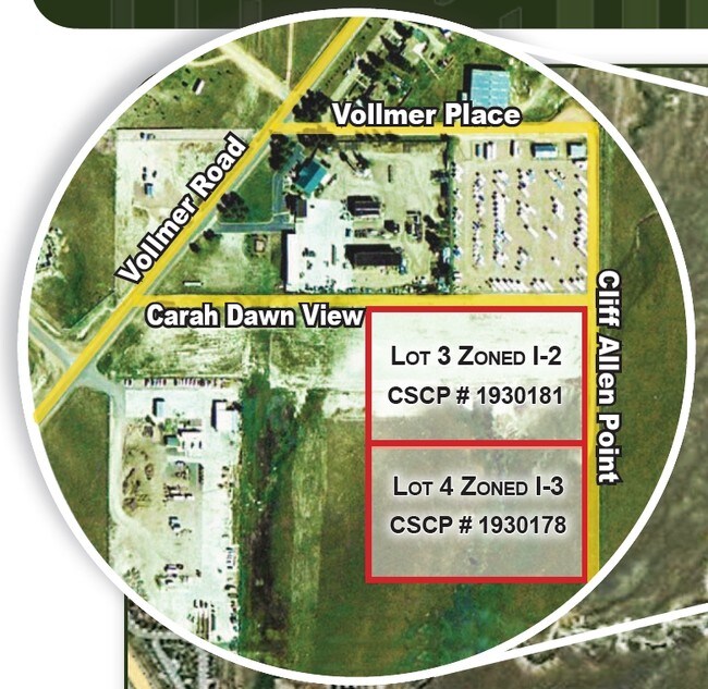
8802 Cliff Allen Pt
Colorado Springs, CO
Barbarick Sub - Amended Plat
52330-02-013
LOT 4 AMENDED PLAT BARBARICK SUB
Commercialacreage
El Paso
X
Colorado
08041C0533G
4
2024
5.29 AC
2025
Northeast
007603
Colorado Springs
DEMOGRAPHICS near 8802 Cliff Allen Pt
1 Mile
3 Mile
5 Mile
2024 Total Population
2,621
46,985
146,398
2029 Population
2,817
50,360
154,179
Pop Growth 2024-2029
+ 7.48%
+ 7.18%
+ 5.31%
Average Age
35
35
36
2024 Total Households
868
15,428
50,393
HH Growth 2024-2029
+ 7.72%
+ 7.42%
+ 5.47%
Median Household Inc
$110,200
$117,249
$109,047
Avg Household Size
3.00
3.00
2.90
2024 Avg HH Vehicles
2.00
2.00
2.00
Median Home Value
$594,203
$475,015
$434,728
Median Year Built
2011
2011
2005
Nearby Places
Map Layers
Map Styles
 Street
 Aerial
- Restaurants
- Banks
- Shops
- Fitness
- Groceries
PUBLIC TRANSPORTATION
AIRPORT
City of Colorado Springs Municipal
DRIVE
WALK
Distance
City of Colorado Springs Municipal
27 min
14.3 mi
Freight Ports
Tulsa Port Of Catoosa
DRIVE
WALK
Distance
Tulsa Port Of Catoosa
732 min
687.4 mi
Nearby Properties
Address
Land Use
TOTAL SIZE
Lot Size
Zoning
Address
Land Use
TOTAL SIZE
Lot Size
Zoning
1,129,761 SF
32.88 AC
MX-M HR AO
Address
Land Use
TOTAL SIZE
Lot Size
Zoning
356,093 SF
16.27 AC
R-5 AO SS
Address
Land Use
TOTAL SIZE
Lot Size
Zoning
262,950 SF
13.23 AC
PDZ AO
Address
Land Use
TOTAL SIZE
Lot Size
Zoning
80,503 SF
14.36 AC
PDZ AO
Address
Land Use
TOTAL SIZE
Lot Size
Zoning
35,197 SF
8.38 AC
PDZ AO
Address
Land Use
TOTAL SIZE
Lot Size
Zoning
58,630 SF
17.84 AC
A-5 CAD-O
Address
Land Use
TOTAL SIZE
Lot Size
Zoning
Address
Land Use
TOTAL SIZE
Lot Size
Zoning
53,103 SF
8.93 AC
RR-5
Address
Land Use
TOTAL SIZE
Lot Size
Zoning
48,363 SF
5.60 AC
A AO SS
Address
Land Use
TOTAL SIZE
Lot Size
Zoning
116,367 SF
0.09 AC
Address
Land Use
TOTAL SIZE
Lot Size
Zoning
24,942 SF
6.89 AC
RR-5
Address
Land Use
TOTAL SIZE
Lot Size
Zoning
408,505 SF
20.39 AC
MX-M AO
Address
Land Use
TOTAL SIZE
Lot Size
Zoning
27,950 SF
17.19 AC
MX-M AO
Address
Land Use
TOTAL SIZE
Lot Size
Zoning
352,714 SF
22.77 AC
PDZ AO
Address
Land Use
TOTAL SIZE
Lot Size
Zoning
83,825 SF
5.16 AC
MX-M HR AO
Address
Land Use
TOTAL SIZE
Lot Size
Zoning
329,040 SF
19.99 AC
PDZ AO
Address
Land Use
TOTAL SIZE
Lot Size
Zoning
16,306 SF
4.89 AC
A AO
Address
Land Use
TOTAL SIZE
Lot Size
Zoning
207,499 SF
23.29 AC
MX-L/CR AO
Address
Land Use
TOTAL SIZE
Lot Size
Zoning
76,727 SF
2.71 AC
PBC HR AO
Address
Land Use
TOTAL SIZE
Lot Size
Zoning
89,482 SF
10.85 AC
MX-M/CR AO
Address
Land Use
TOTAL SIZE
Lot Size
Zoning
45,032 SF
4.97 AC
PF AO SS
Address
Land Use
TOTAL SIZE
Lot Size
Zoning
10,516 SF
2 AC
MX-L/CR AO
Address
Land Use
TOTAL SIZE
Lot Size
Zoning
340,555 SF
12.73 AC
PDZ AO
Address
Land Use
TOTAL SIZE
Lot Size
Zoning
69,546 SF
7 AC
MX-M AO
Address
Land Use
TOTAL SIZE
Lot Size
Zoning
304,846 SF
11.14 AC
MX-L/CR AO
Address
Land Use
TOTAL SIZE
Lot Size
Zoning
14,774 SF
7.64 AC
MX-L/CR PF
Address
Land Use
TOTAL SIZE
Lot Size
Zoning
19,614 SF
11.10 AC
RR-5
Address
Land Use
TOTAL SIZE
Lot Size
Zoning
63,170 SF
3.91 AC
MX-M AO
Address
Land Use
TOTAL SIZE
Lot Size
Zoning
12.18 AC
A SS AO
Address
Land Use
TOTAL SIZE
Lot Size
Zoning
11,998 SF
3.66 AC
RR-5 CAD-O
The World's #1 Commercial Real Estate Marketplace
Connect with us
© 2026 CoStar Group
The information above has been obtained from sources believed reliable. While we do not doubt its accuracy we have not verified it and make no guarantee, warranty or representation about it. It is your responsibility to independently confirm its accuracy and completeness. Any projections, opinions, assumptions, or estimates used are for example only and do not represent the current or future performance of the property. The value of this transaction to you depends on tax and other factors which should be evaluated by your tax, financial, and legal advisors. You and your advisors should conduct a careful, independent investigation of the property to determine to your satisfaction the suitability of the property for your needs.