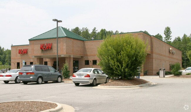
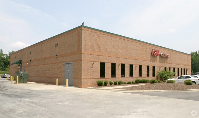
Property Record
881 Curry Dr, Asheboro, NC 27205

NEARBY LISTINGS FOR SALE OR LEASE
Property Detail
881 Curry Dr
Greensboro-High Point, NC
Vuncannon Properties
7750-20-2309
VUNCANNON PROPERTIES;L12 PL:PB112-PG86
Officebuilding
Randolph
X
North Carolina
3710775000J
12
2025
5.56 AC
2025
SW Randolph County
030600
Greensboro/Winston-Salem
23,649 SF
DEMOGRAPHICS near 881 Curry Dr
1 Mile
3 Mile
5 Mile
2024 Total Population
2,603
19,955
34,370
2029 Population
2,702
20,770
35,780
Pop Growth 2024-2029
+ 3.80%
+ 4.08%
+ 4.10%
Average Age
42
41
41
2024 Total Households
1,120
8,309
13,731
HH Growth 2024-2029
+ 3.84%
+ 4.09%
+ 4.11%
Median Household Inc
$49,448
$46,569
$48,517
Avg Household Size
2.20
2.30
2.40
2024 Avg HH Vehicles
2.00
2.00
2.00
Median Home Value
$150,785
$147,150
$153,582
Median Year Built
1976
1974
1976
Nearby Places
Map Layers
Map Styles
 Street
 Aerial
- Restaurants
- Banks
- Shops
- Fitness
- Groceries
PUBLIC TRANSPORTATION
AIRPORT
Piedmont Triad International
DRIVE
WALK
Distance
Piedmont Triad International
50 min
39.6 mi
Nearby Properties
Address
Land Use
TOTAL SIZE
Lot Size
Zoning
Address
Land Use
TOTAL SIZE
Lot Size
Zoning
312,205 SF
6.83 AC
B2
Address
Land Use
TOTAL SIZE
Lot Size
Zoning
3,196 SF
24.89 AC
RA6 (CZ)
Address
Land Use
TOTAL SIZE
Lot Size
Zoning
221,524 SF
22.11 AC
B2 (CZ)
Address
Land Use
TOTAL SIZE
Lot Size
Zoning
24.92 AC
B2
Address
Land Use
TOTAL SIZE
Lot Size
Zoning
5.24 AC
B3
Address
Land Use
TOTAL SIZE
Lot Size
Zoning
111,408 SF
125.85 AC
I3 (CZ)
Address
Land Use
TOTAL SIZE
Lot Size
Zoning
44,912 SF
25.15 AC
I1
Address
Land Use
TOTAL SIZE
Lot Size
Zoning
720 SF
62.64 AC
HI-CD
Address
Land Use
TOTAL SIZE
Lot Size
Zoning
84,329 SF
71.50 AC
I2
Address
Land Use
TOTAL SIZE
Lot Size
Zoning
94,956 SF
15.15 AC
B2
Address
Land Use
TOTAL SIZE
Lot Size
Zoning
52,741 SF
2.53 AC
B2
Address
Land Use
TOTAL SIZE
Lot Size
Zoning
52,741 SF
2.15 AC
B2
Address
Land Use
TOTAL SIZE
Lot Size
Zoning
136,877 SF
25.59 AC
I1
Address
Land Use
TOTAL SIZE
Lot Size
Zoning
193,214 SF
17.06 AC
I1
Address
Land Use
TOTAL SIZE
Lot Size
Zoning
35,502 SF
2.83 AC
B2
Address
Land Use
TOTAL SIZE
Lot Size
Zoning
18,144 SF
2.91 AC
B2
Address
Land Use
TOTAL SIZE
Lot Size
Zoning
47,797 SF
2.61 AC
B2 (CZ)
Address
Land Use
TOTAL SIZE
Lot Size
Zoning
5.58 AC
B2
Address
Land Use
TOTAL SIZE
Lot Size
Zoning
43,046 SF
4.09 AC
B2
Address
Land Use
TOTAL SIZE
Lot Size
Zoning
59,830 SF
0.85 AC
RA6
Address
Land Use
TOTAL SIZE
Lot Size
Zoning
75,024 SF
2.02 AC
B2
Address
Land Use
TOTAL SIZE
Lot Size
Zoning
8,614 SF
7.40 AC
RA6
Address
Land Use
TOTAL SIZE
Lot Size
Zoning
13,888 SF
3.43 AC
B1 (CZ)
Address
Land Use
TOTAL SIZE
Lot Size
Zoning
76,560 SF
7.12 AC
B2
Address
Land Use
TOTAL SIZE
Lot Size
Zoning
24.22 AC
I1
Address
Land Use
TOTAL SIZE
Lot Size
Zoning
22,810 SF
2.92 AC
B2
Address
Land Use
TOTAL SIZE
Lot Size
Zoning
52,901 SF
6.11 AC
B2
Address
Land Use
TOTAL SIZE
Lot Size
Zoning
19.11 AC
B2 (CZ)
Address
Land Use
TOTAL SIZE
Lot Size
Zoning
8,815 SF
2.57 AC
RA6
Address
Land Use
TOTAL SIZE
Lot Size
Zoning
25,855 SF
3.19 AC
OA6
The World's #1 Commercial Real Estate Marketplace
Connect with us
© 2025 CoStar Group
The information above has been obtained from sources believed reliable. While we do not doubt its accuracy we have not verified it and make no guarantee, warranty or representation about it. It is your responsibility to independently confirm its accuracy and completeness. Any projections, opinions, assumptions, or estimates used are for example only and do not represent the current or future performance of the property. The value of this transaction to you depends on tax and other factors which should be evaluated by your tax, financial, and legal advisors. You and your advisors should conduct a careful, independent investigation of the property to determine to your satisfaction the suitability of the property for your needs.