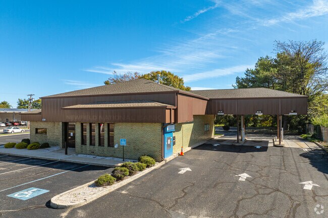
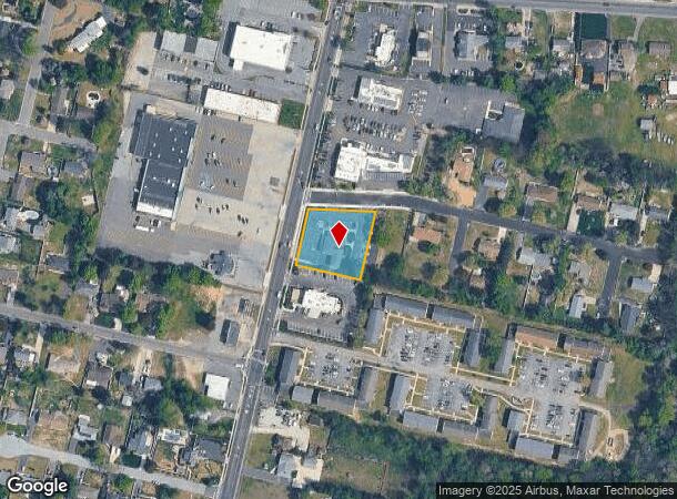
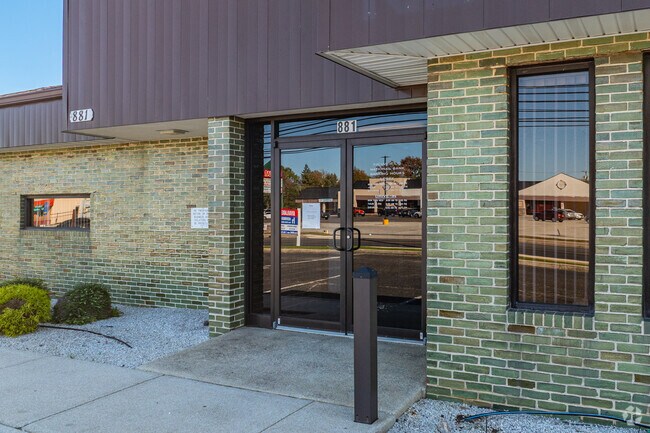
Property Record
881 N Main Rd, Vineland, NJ 08360
NEARBY LISTINGS FOR SALE OR LEASE
Property Detail
881 N Main Rd
14-02501-0000-00099
Cumberland
Commercialnec
New Jersey
X
99
34011C0201E
0.67 AC
2024
Vineland/Bridgeton
2025
Philadelphia
040702
Vineland-Bridgeton, NJ
DEMOGRAPHICS near 881 N Main Rd
1 Mile
3 Mile
5 Mile
2024 Total Population
5,935
45,155
68,489
2029 Population
6,084
45,998
69,752
Pop Growth 2024-2029
+ 2.51%
+ 1.87%
+ 1.84%
Average Age
40
40
40
2024 Total Households
2,152
16,573
25,116
HH Growth 2024-2029
+ 2.56%
+ 1.88%
+ 1.80%
Median Household Inc
$87,857
$66,435
$70,478
Avg Household Size
2.70
2.60
2.60
2024 Avg HH Vehicles
2.00
2.00
2.00
Median Home Value
$240,101
$226,829
$233,732
Median Year Built
1971
1967
1970
Nearby Places
Map Layers
Map Styles
 Street
 Aerial
- Restaurants
- Banks
- Shops
- Fitness
- Groceries
PUBLIC TRANSPORTATION
AIRPORT
Atlantic City International
DRIVE
WALK
Distance
Atlantic City International
61 min
28.8 mi
Philadelphia International
DRIVE
WALK
Distance
Philadelphia International
63 min
39.8 mi
Freight Ports
Broadway Terminal - Pier 5
DRIVE
WALK
Distance
Broadway Terminal - Pier 5
48 min
31.3 mi
Nearby Properties
Address
Land Use
TOTAL SIZE
Lot Size
Zoning
Address
Land Use
TOTAL SIZE
Lot Size
Zoning
156.67 AC
R4
Address
Land Use
TOTAL SIZE
Lot Size
Zoning
69.16 AC
R5
Address
Land Use
TOTAL SIZE
Lot Size
Zoning
28.47 AC
RI
Address
Land Use
TOTAL SIZE
Lot Size
Zoning
5 AC
R2
Address
Land Use
TOTAL SIZE
Lot Size
Zoning
29.39 AC
B3
Address
Land Use
TOTAL SIZE
Lot Size
Zoning
8.93 AC
R1
Address
Land Use
TOTAL SIZE
Lot Size
Zoning
25.52 AC
R5
Address
Land Use
TOTAL SIZE
Lot Size
Zoning
8.53 AC
R-3
Address
Land Use
TOTAL SIZE
Lot Size
Zoning
40 AC
R5
Address
Land Use
TOTAL SIZE
Lot Size
Zoning
Address
Land Use
TOTAL SIZE
Lot Size
Zoning
17.01 AC
R3
Address
Land Use
TOTAL SIZE
Lot Size
Zoning
11.91 AC
R5
Address
Land Use
TOTAL SIZE
Lot Size
Zoning
32.41 AC
A
Address
Land Use
TOTAL SIZE
Lot Size
Zoning
18.45 AC
R4
Address
Land Use
TOTAL SIZE
Lot Size
Zoning
10.23 AC
I2
Address
Land Use
TOTAL SIZE
Lot Size
Zoning
20.61 AC
R2
Address
Land Use
TOTAL SIZE
Lot Size
Zoning
7.24 AC
R4
Address
Land Use
TOTAL SIZE
Lot Size
Zoning
7.20 AC
R4
Address
Land Use
TOTAL SIZE
Lot Size
Zoning
24,820 SF
15 AC
R3
Address
Land Use
TOTAL SIZE
Lot Size
Zoning
19.82 AC
R5
Address
Land Use
TOTAL SIZE
Lot Size
Zoning
Address
Land Use
TOTAL SIZE
Lot Size
Zoning
7.71 AC
B3
Address
Land Use
TOTAL SIZE
Lot Size
Zoning
18.25 AC
R3
Address
Land Use
TOTAL SIZE
Lot Size
Zoning
11.79 AC
R3
Address
Land Use
TOTAL SIZE
Lot Size
Zoning
13.07 AC
B3
Address
Land Use
TOTAL SIZE
Lot Size
Zoning
10.14 AC
B2
Address
Land Use
TOTAL SIZE
Lot Size
Zoning
87 SF
R2
Address
Land Use
TOTAL SIZE
Lot Size
Zoning
69.47 AC
A
Address
Land Use
TOTAL SIZE
Lot Size
Zoning
2.51 AC
R2
Address
Land Use
TOTAL SIZE
Lot Size
Zoning
13.38 AC
R3
The World's #1 Commercial Real Estate Marketplace
Connect with us
© 2025 CoStar Group
The information above has been obtained from sources believed reliable. While we do not doubt its accuracy we have not verified it and make no guarantee, warranty or representation about it. It is your responsibility to independently confirm its accuracy and completeness. Any projections, opinions, assumptions, or estimates used are for example only and do not represent the current or future performance of the property. The value of this transaction to you depends on tax and other factors which should be evaluated by your tax, financial, and legal advisors. You and your advisors should conduct a careful, independent investigation of the property to determine to your satisfaction the suitability of the property for your needs.