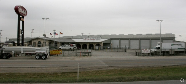
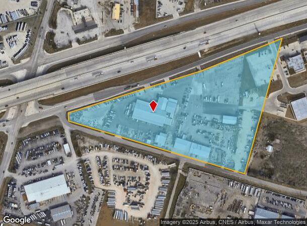
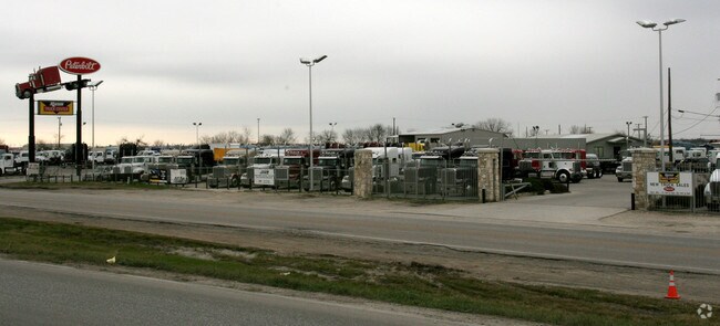
Property Record
8810 Interstate 10 E, Converse, TX 78109
Property Detail
8810 Interstate 10 E
San Antonio-New Braunfels, TX
NCB 16567 BLK 7 LOT 3 EX SE TRI 210 (12.708) 5089 BLK 7 SE TRI 210 OF 3 RUSH ENTPRS
16567-007-0030
BEXAR
Autorepair
Texas
B and X Area of moderate flood hazard, usually the area between the limits of the 100-year and 500-year floods.
3
2024
13.85 AC
2025
South
131802
San Antonio
37,021 SF
NEARBY LISTINGS FOR SALE OR LEASE
DEMOGRAPHICS near 8810 Interstate 10 E
1 mile
3 mile
5 mile
2025 Total Population
4,504
52,548
138,209
2030 Population
4,935
56,873
146,777
Pop Growth 2025-2030
+ 9.57%
+ 8.23%
+ 6.20%
Average Age
35
35
36
2025 Total Households
1,454
16,927
45,748
HH Growth 2025-2030
+ 9.70%
+ 8.39%
+ 6.29%
Median Household Inc
$96,213
$83,988
$74,188
Avg Household Size
3.10
3.10
3.00
2025 Avg HH Vehicles
2.00
2.00
2.00
Median Home Value
$272,896
$260,857
$240,136
Median Year Built
2010
2007
2000
Nearby Places
Map Layers
Map Styles
 Street
 Aerial
Transit
 Traffic
 Biking
Places
Listings with unknown addresses are not visible on the map
- Restaurants
- Banks
- Shops
- Fitness
- Groceries
PUBLIC TRANSPORTATION
AIRPORT
San Antonio International
Drive
Walk
Distance
San Antonio International
28 min
19.7 mi
Nearby Properties
Address
Land Use
TOTAL SIZE
Lot Size
Zoning
Address
Land Use
TOTAL SIZE
Lot Size
Zoning
116,536 SF
13.84 AC
Address
Land Use
TOTAL SIZE
Lot Size
Zoning
435,592 SF
31.43 AC
Address
Land Use
TOTAL SIZE
Lot Size
Zoning
249,633 SF
7.04 AC
Address
Land Use
TOTAL SIZE
Lot Size
Zoning
252,465 SF
37.40 AC
Address
Land Use
TOTAL SIZE
Lot Size
Zoning
230,659 SF
15.48 AC
Address
Land Use
TOTAL SIZE
Lot Size
Zoning
74.65 AC
Address
Land Use
TOTAL SIZE
Lot Size
Zoning
28.60 AC
Address
Land Use
TOTAL SIZE
Lot Size
Zoning
232,554 SF
13.19 AC
Address
Land Use
TOTAL SIZE
Lot Size
Zoning
325,434 SF
21.47 AC
Address
Land Use
TOTAL SIZE
Lot Size
Zoning
258,063 SF
24.55 AC
Address
Land Use
TOTAL SIZE
Lot Size
Zoning
35.72 AC
Address
Land Use
TOTAL SIZE
Lot Size
Zoning
336,913 SF
17.28 AC
Address
Land Use
TOTAL SIZE
Lot Size
Zoning
361,780 SF
19.99 AC
Address
Land Use
TOTAL SIZE
Lot Size
Zoning
24.75 AC
Address
Land Use
TOTAL SIZE
Lot Size
Zoning
16,647 SF
852.16 AC
Address
Land Use
TOTAL SIZE
Lot Size
Zoning
183,611 SF
10.13 AC
Address
Land Use
TOTAL SIZE
Lot Size
Zoning
83,178 SF
22.50 AC
Address
Land Use
TOTAL SIZE
Lot Size
Zoning
171,175 SF
9.99 AC
Address
Land Use
TOTAL SIZE
Lot Size
Zoning
174,550 SF
10.78 AC
Address
Land Use
TOTAL SIZE
Lot Size
Zoning
2,129 SF
46.59 AC
Address
Land Use
TOTAL SIZE
Lot Size
Zoning
221.68 AC
Address
Land Use
TOTAL SIZE
Lot Size
Zoning
154,817 SF
20.49 AC
Address
Land Use
TOTAL SIZE
Lot Size
Zoning
276,006 SF
13 AC
Address
Land Use
TOTAL SIZE
Lot Size
Zoning
120,226 SF
12.25 AC
Address
Land Use
TOTAL SIZE
Lot Size
Zoning
28,093 SF
10.74 AC
Address
Land Use
TOTAL SIZE
Lot Size
Zoning
205,372 SF
21.38 AC
Address
Land Use
TOTAL SIZE
Lot Size
Zoning
67,642 SF
22.18 AC
Address
Land Use
TOTAL SIZE
Lot Size
Zoning
95,925 SF
7.39 AC
Address
Land Use
TOTAL SIZE
Lot Size
Zoning
4,621 SF
43.39 AC
Address
Land Use
TOTAL SIZE
Lot Size
Zoning
76,900 SF
21.81 AC
The World's #1 Commercial Real Estate Marketplace
Connect with us
© 2026 CoStar Group
The information above has been obtained from sources believed reliable. While we do not doubt its accuracy we have not verified it and make no guarantee, warranty or representation about it. It is your responsibility to independently confirm its accuracy and completeness. Any projections, opinions, assumptions, or estimates used are for example only and do not represent the current or future performance of the property. The value of this transaction to you depends on tax and other factors which should be evaluated by your tax, financial, and legal advisors. You and your advisors should conduct a careful, independent investigation of the property to determine to your satisfaction the suitability of the property for your needs.