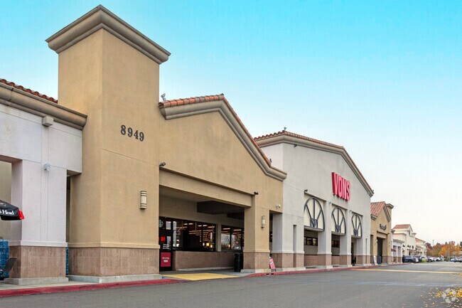
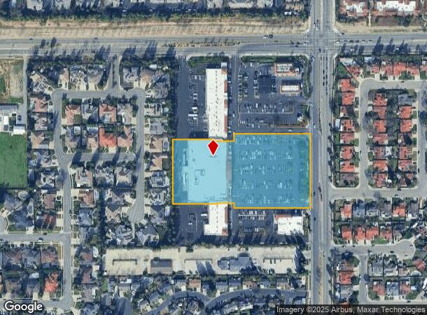
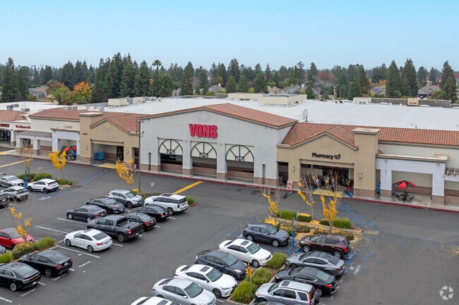
Property Record
8821 N Cedar Ave, Fresno, CA 93720
NEARBY LISTINGS FOR SALE OR LEASE
Property Detail
8821 N Cedar Ave
403-021-32
Parcel
Supermarket
4.41 AC IN PAR D P/M 93-10 BK 55 PGS 43-45
X
Fresno
06019C1560H
California
2025
4.41 AC
2025
Woodward
005507
Fresno
50,610 SF
Fresno, CA
DEMOGRAPHICS near 8821 N Cedar Ave
1 Mile
3 Mile
5 Mile
2024 Total Population
19,539
100,778
220,029
2029 Population
19,958
103,074
225,488
Pop Growth 2024-2029
+ 2.14%
+ 2.28%
+ 2.48%
Average Age
40
40
39
2024 Total Households
7,767
38,024
82,694
HH Growth 2024-2029
+ 2.16%
+ 2.25%
+ 2.44%
Median Household Inc
$115,507
$99,899
$78,191
Avg Household Size
2.50
2.60
2.60
2024 Avg HH Vehicles
2.00
2.00
2.00
Median Home Value
$427,319
$420,745
$396,071
Median Year Built
1993
1992
1984
Nearby Places
Map Layers
Map Styles
 Street
 Aerial
- Restaurants
- Banks
- Shops
- Fitness
- Groceries
PUBLIC TRANSPORTATION
AIRPORT
Fresno Yosemite International
DRIVE
WALK
Distance
Fresno Yosemite International
16 min
8.5 mi
Freight Ports
Port of Stockton
DRIVE
WALK
Distance
Port of Stockton
156 min
128.4 mi
Nearby Properties
Address
Land Use
TOTAL SIZE
Lot Size
Zoning
Address
Land Use
TOTAL SIZE
Lot Size
Zoning
39.39 AC
Address
Land Use
TOTAL SIZE
Lot Size
Zoning
413,093 SF
33.19 AC
CP
Address
Land Use
TOTAL SIZE
Lot Size
Zoning
693,292 SF
29.86 AC
CP
Address
Land Use
TOTAL SIZE
Lot Size
Zoning
143,370 SF
6.92 AC
CP
Address
Land Use
TOTAL SIZE
Lot Size
Zoning
180,770 SF
19.03 AC
PCC
Address
Land Use
TOTAL SIZE
Lot Size
Zoning
180,161 SF
10.38 AC
Address
Land Use
TOTAL SIZE
Lot Size
Zoning
239,000 SF
20.34 AC
R2
Address
Land Use
TOTAL SIZE
Lot Size
Zoning
239,437 SF
31.16 AC
RA
Address
Land Use
TOTAL SIZE
Lot Size
Zoning
192,062 SF
11.50 AC
RS5
Address
Land Use
TOTAL SIZE
Lot Size
Zoning
188,913 SF
7.90 AC
Address
Land Use
TOTAL SIZE
Lot Size
Zoning
184,694 SF
9.99 AC
SPLIT
Address
Land Use
TOTAL SIZE
Lot Size
Zoning
119,869 SF
11.08 AC
C1
Address
Land Use
TOTAL SIZE
Lot Size
Zoning
328,887 SF
16.34 AC
R3
Address
Land Use
TOTAL SIZE
Lot Size
Zoning
212,354 SF
13.12 AC
R2
Address
Land Use
TOTAL SIZE
Lot Size
Zoning
188,177 SF
5.58 AC
CP
Address
Land Use
TOTAL SIZE
Lot Size
Zoning
174,577 SF
8.40 AC
RM1
Address
Land Use
TOTAL SIZE
Lot Size
Zoning
181,538 SF
0.01 AC
CP
Address
Land Use
TOTAL SIZE
Lot Size
Zoning
104,902 SF
8 AC
C6
Address
Land Use
TOTAL SIZE
Lot Size
Zoning
251,904 SF
16.70 AC
SPLIT
Address
Land Use
TOTAL SIZE
Lot Size
Zoning
200,826 SF
19.23 AC
R2
Address
Land Use
TOTAL SIZE
Lot Size
Zoning
152,550 SF
9.23 AC
R3
Address
Land Use
TOTAL SIZE
Lot Size
Zoning
208,444 SF
11.75 AC
R3
Address
Land Use
TOTAL SIZE
Lot Size
Zoning
175,117 SF
10 AC
C1
Address
Land Use
TOTAL SIZE
Lot Size
Zoning
78,774 SF
2.10 AC
CP
Address
Land Use
TOTAL SIZE
Lot Size
Zoning
132,084 SF
9.68 AC
RM1
Address
Land Use
TOTAL SIZE
Lot Size
Zoning
8.80 AC
AE5
Address
Land Use
TOTAL SIZE
Lot Size
Zoning
129,860 SF
6.10 AC
The World's #1 Commercial Real Estate Marketplace
Connect with us
© 2026 CoStar Group
The information above has been obtained from sources believed reliable. While we do not doubt its accuracy we have not verified it and make no guarantee, warranty or representation about it. It is your responsibility to independently confirm its accuracy and completeness. Any projections, opinions, assumptions, or estimates used are for example only and do not represent the current or future performance of the property. The value of this transaction to you depends on tax and other factors which should be evaluated by your tax, financial, and legal advisors. You and your advisors should conduct a careful, independent investigation of the property to determine to your satisfaction the suitability of the property for your needs.