Property Record
883 Middleboro Rd, Blanchester, OH 45107
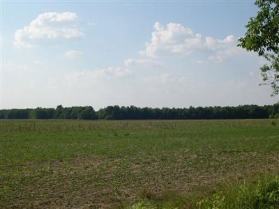

Property Detail
883 Middleboro Rd
Wilmington, OH
MS 4365 SP 220060103000400(11.000A) R 100.013A 26DUP SR45-255 SP 220060103000300(34.000A) R 111.013A 23DUP SR 44-131 21 SP HU
220-06-01-03-0000-00
CLINTON
Agriculturalland
Ohio
A3
1-13
B and X Area of moderate flood hazard, usually the area between the limits of the 100-year and 500-year floods.
100.01 AC
2025
Ohio South Area
2025
Other Market Areas
964900
NEARBY LISTINGS FOR SALE OR LEASE
DEMOGRAPHICS near 883 Middleboro Rd
1 mile
3 mile
5 mile
2025 Total Population
3,357
6,262
10,546
2030 Population
3,374
6,324
10,682
Pop Growth 2025-2030
+ 0.51%
+ 0.99%
+ 1.29%
Average Age
41
41
41
2025 Total Households
1,329
2,449
3,994
HH Growth 2025-2030
+ 0.53%
+ 0.94%
+ 1.20%
Median Household Inc
$47,343
$61,833
$72,117
Avg Household Size
2.40
2.50
2.60
2025 Avg HH Vehicles
2.00
2.00
2.00
Median Home Value
$168,224
$200,973
$231,046
Median Year Built
1970
1973
1976
Nearby Places
Map Layers
Map Styles
 Street
 Aerial
Layers
 Traffic
 Biking
Places
Listings with unknown addresses are not visible on the map
- Restaurants
- Banks
- Shops
- Fitness
- Groceries
Nearby Properties
Address
Land Use
TOTAL SIZE
Lot Size
Zoning
Address
Land Use
TOTAL SIZE
Lot Size
Zoning
114,436 SF
46.31 AC
PUB
Address
Land Use
TOTAL SIZE
Lot Size
Zoning
71,601 SF
2.19 AC
PUB
Address
Land Use
TOTAL SIZE
Lot Size
Zoning
50,938 SF
5.67 AC
PUB
Address
Land Use
TOTAL SIZE
Lot Size
Zoning
269,586 SF
41.92 AC
I1
Address
Land Use
TOTAL SIZE
Lot Size
Zoning
72,415 SF
11.18 AC
B5
Address
Land Use
TOTAL SIZE
Lot Size
Zoning
6,864 SF
4.27 AC
PUB
Address
Land Use
TOTAL SIZE
Lot Size
Zoning
2,200 SF
5.09 AC
PD
Address
Land Use
TOTAL SIZE
Lot Size
Zoning
30,789 SF
5 AC
Address
Land Use
TOTAL SIZE
Lot Size
Zoning
1,340 SF
4.30 AC
B2
Address
Land Use
TOTAL SIZE
Lot Size
Zoning
42,706 SF
5.41 AC
R6
Address
Land Use
TOTAL SIZE
Lot Size
Zoning
179.45 AC
A3
Address
Land Use
TOTAL SIZE
Lot Size
Zoning
17,278 SF
1.74 AC
R6
Address
Land Use
TOTAL SIZE
Lot Size
Zoning
24,726 SF
3.53 AC
R6
Address
Land Use
TOTAL SIZE
Lot Size
Zoning
173.25 AC
A3
Address
Land Use
TOTAL SIZE
Lot Size
Zoning
98,620 SF
4.97 AC
I1
Address
Land Use
TOTAL SIZE
Lot Size
Zoning
2,688 SF
39.70 AC
I2
Address
Land Use
TOTAL SIZE
Lot Size
Zoning
1,880 SF
6.19 AC
Address
Land Use
TOTAL SIZE
Lot Size
Zoning
133.87 AC
A3
Address
Land Use
TOTAL SIZE
Lot Size
Zoning
133.67 AC
A3
Address
Land Use
TOTAL SIZE
Lot Size
Zoning
122.63 AC
A3
Address
Land Use
TOTAL SIZE
Lot Size
Zoning
125.97 AC
RR
Address
Land Use
TOTAL SIZE
Lot Size
Zoning
124.15 AC
A3
Address
Land Use
TOTAL SIZE
Lot Size
Zoning
119.86 AC
A3
Address
Land Use
TOTAL SIZE
Lot Size
Zoning
5,961 SF
1.56 AC
Address
Land Use
TOTAL SIZE
Lot Size
Zoning
12.81 AC
Address
Land Use
TOTAL SIZE
Lot Size
Zoning
3,004 SF
3.03 AC
R6
Address
Land Use
TOTAL SIZE
Lot Size
Zoning
107.65 AC
RR
Address
Land Use
TOTAL SIZE
Lot Size
Zoning
114.50 AC
A3
Address
Land Use
TOTAL SIZE
Lot Size
Zoning
10,050 SF
1.02 AC
B5
The World's #1 Commercial Real Estate Marketplace
Connect with us
© 2026 CoStar Group
The information above has been obtained from sources believed reliable. While we do not doubt its accuracy we have not verified it and make no guarantee, warranty or representation about it. It is your responsibility to independently confirm its accuracy and completeness. Any projections, opinions, assumptions, or estimates used are for example only and do not represent the current or future performance of the property. The value of this transaction to you depends on tax and other factors which should be evaluated by your tax, financial, and legal advisors. You and your advisors should conduct a careful, independent investigation of the property to determine to your satisfaction the suitability of the property for your needs.