Property Record
883 Paddock Ave, Meriden, CT 06450


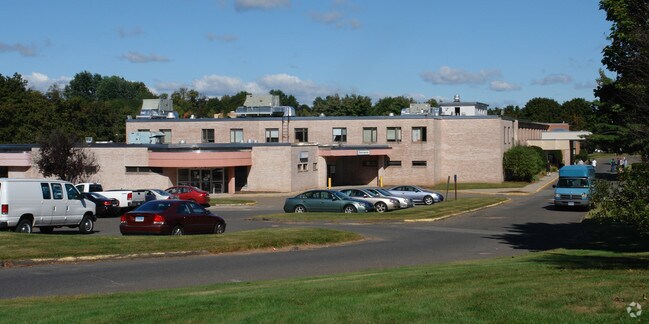
Property Detail
883 Paddock Ave
MERI-000912-000316L-000011-000100
South Central Ct
Governmentalpublicusegeneral
Connecticut
S-R
11-100
B and X Area of moderate flood hazard, usually the area between the limits of the 100-year and 500-year floods.
11.02 AC
0
Meriden
2025
Westchester/So Connecticut
171201
New Haven, CT
NEARBY LISTINGS FOR SALE OR LEASE
DEMOGRAPHICS near 883 Paddock Ave
1 mile
3 mile
5 mile
2025 Total Population
3,687
50,539
101,844
2030 Population
3,715
50,929
102,565
Pop Growth 2025-2030
+ 0.76%
+ 0.77%
+ 0.71%
Average Age
45
41
42
2025 Total Households
1,434
20,184
40,772
HH Growth 2025-2030
+ 0.63%
+ 0.72%
+ 0.66%
Median Household Inc
$140,929
$71,316
$80,245
Avg Household Size
2.40
2.40
2.40
2025 Avg HH Vehicles
2.00
2.00
2.00
Median Home Value
$323,694
$262,460
$283,888
Median Year Built
1978
1960
1962
Nearby Places
Map Layers
Map Styles
 Street
 Aerial
Transit
 Traffic
 Biking
Places
Listings with unknown addresses are not visible on the map
- Restaurants
- Banks
- Shops
- Fitness
- Groceries
PUBLIC TRANSPORTATION
COMMUTER RAIL
Meriden (Hartford Line - CONN DOT)
Drive
Walk
Distance
Meriden (Hartford Line - CONN DOT)
6 min
3.4 mi
Wallingford (Hartford Line - CONN DOT)
Drive
Walk
Distance
Wallingford (Hartford Line - CONN DOT)
10 min
4.9 mi
AIRPORT
Tweed/New Haven
Drive
Walk
Distance
Tweed/New Haven
33 min
21.5 mi
Freight Ports
Port of New Haven
Drive
Walk
Distance
Port of New Haven
28 min
19.2 mi
Nearby Properties
Address
Land Use
TOTAL SIZE
Lot Size
Zoning
Address
Land Use
TOTAL SIZE
Lot Size
Zoning
2,400 SF
38.29 AC
M-3
Address
Land Use
TOTAL SIZE
Lot Size
Zoning
267,249 SF
27.55 AC
R-1
Address
Land Use
TOTAL SIZE
Lot Size
Zoning
34.10 AC
C-3
Address
Land Use
TOTAL SIZE
Lot Size
Zoning
10.38 AC
M-1
Address
Land Use
TOTAL SIZE
Lot Size
Zoning
329,296 SF
35.55 AC
IX
Address
Land Use
TOTAL SIZE
Lot Size
Zoning
339,844 SF
52.43 AC
M-4
Address
Land Use
TOTAL SIZE
Lot Size
Zoning
291,405 SF
104.81 AC
WI
Address
Land Use
TOTAL SIZE
Lot Size
Zoning
119,598 SF
18.43 AC
RF40
Address
Land Use
TOTAL SIZE
Lot Size
Zoning
172,027 SF
18.04 AC
RF40
Address
Land Use
TOTAL SIZE
Lot Size
Zoning
26.45 AC
RF40
Address
Land Use
TOTAL SIZE
Lot Size
Zoning
153,180 SF
3.07 AC
TODH
Address
Land Use
TOTAL SIZE
Lot Size
Zoning
187,914 SF
16.13 AC
IX
Address
Land Use
TOTAL SIZE
Lot Size
Zoning
1.67 AC
TODP
Address
Land Use
TOTAL SIZE
Lot Size
Zoning
203,692 SF
21.22 AC
IX
Address
Land Use
TOTAL SIZE
Lot Size
Zoning
18.70 AC
RF40
Address
Land Use
TOTAL SIZE
Lot Size
Zoning
166,724 SF
21.79 AC
M-2
Address
Land Use
TOTAL SIZE
Lot Size
Zoning
9.75 AC
RF40
Address
Land Use
TOTAL SIZE
Lot Size
Zoning
84,919 SF
7.53 AC
C-1
Address
Land Use
TOTAL SIZE
Lot Size
Zoning
228,233 SF
1.97 AC
TODH
Address
Land Use
TOTAL SIZE
Lot Size
Zoning
48,942 SF
6.74 AC
RF40
Address
Land Use
TOTAL SIZE
Lot Size
Zoning
19.47 AC
RF40
Address
Land Use
TOTAL SIZE
Lot Size
Zoning
81,496 SF
5.96 AC
WI
Address
Land Use
TOTAL SIZE
Lot Size
Zoning
71,501 SF
6.84 AC
R18
Address
Land Use
TOTAL SIZE
Lot Size
Zoning
94,044 SF
5.48 AC
WI
Address
Land Use
TOTAL SIZE
Lot Size
Zoning
20,330 SF
174.02 AC
WI
Address
Land Use
TOTAL SIZE
Lot Size
Zoning
115,951 SF
14.77 AC
M-1
Address
Land Use
TOTAL SIZE
Lot Size
Zoning
171,057 SF
25.06 AC
M-4
Address
Land Use
TOTAL SIZE
Lot Size
Zoning
98,894 SF
44.82 AC
WI
Address
Land Use
TOTAL SIZE
Lot Size
Zoning
18.61 AC
C-2
The World's #1 Commercial Real Estate Marketplace
Connect with us
© 2026 CoStar Group
The information above has been obtained from sources believed reliable. While we do not doubt its accuracy we have not verified it and make no guarantee, warranty or representation about it. It is your responsibility to independently confirm its accuracy and completeness. Any projections, opinions, assumptions, or estimates used are for example only and do not represent the current or future performance of the property. The value of this transaction to you depends on tax and other factors which should be evaluated by your tax, financial, and legal advisors. You and your advisors should conduct a careful, independent investigation of the property to determine to your satisfaction the suitability of the property for your needs.