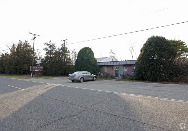
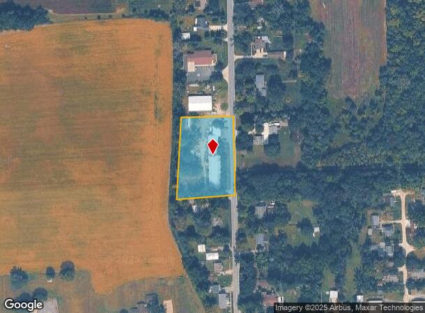
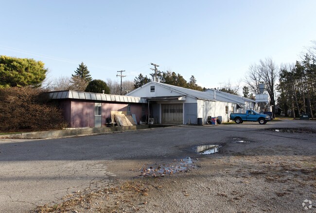
Property Record
8842 Bunton Rd, Willis, MI 48191
NEARBY LISTINGS FOR SALE OR LEASE
-
-
View all Willis listings for sale on LoopNet.com
Property Detail
8842 Bunton Rd
20-02-400-021
SE4 SEC 2
Commercialnec
Washtenaw
X
Michigan
26161C0445E
1.78 AC
2025
Washtenaw E of 23
2025
Detroit
420000
Ann Arbor, MI
16,688 SF
DEMOGRAPHICS near 8842 Bunton Rd
1 Mile
3 Mile
5 Mile
2024 Total Population
864
19,440
52,592
2029 Population
869
19,285
51,715
Pop Growth 2024-2029
+ 0.58%
(0.80%)
(1.67%)
Average Age
44
39
40
2024 Total Households
349
7,080
21,096
HH Growth 2024-2029
+ 0.29%
(0.73%)
(1.77%)
Median Household Inc
$102,885
$77,815
$73,152
Avg Household Size
2.50
2.70
2.40
2024 Avg HH Vehicles
2.00
2.00
2.00
Median Home Value
$296,773
$232,043
$222,111
Median Year Built
1998
1998
1982
Nearby Places
Map Layers
Map Styles
 Street
 Aerial
- Restaurants
- Banks
- Shops
- Fitness
- Groceries
PUBLIC TRANSPORTATION
AIRPORT
Detroit Metro Wayne County
DRIVE
WALK
Distance
Detroit Metro Wayne County
30 min
19.5 mi
Windsor International
DRIVE
WALK
Distance
Windsor International
67 min
45.1 mi
Freight Ports
DRIVE
WALK
Distance
74 min
51.5 mi
Nearby Properties
Address
Land Use
TOTAL SIZE
Lot Size
Zoning
Address
Land Use
TOTAL SIZE
Lot Size
Zoning
11,847 SF
91.35 AC
II
Address
Land Use
TOTAL SIZE
Lot Size
Zoning
97.69 AC
Address
Land Use
TOTAL SIZE
Lot Size
Zoning
1,960 SF
59.97 AC
Address
Land Use
TOTAL SIZE
Lot Size
Zoning
161,042 SF
26.29 AC
II
Address
Land Use
TOTAL SIZE
Lot Size
Zoning
2,700 SF
75.82 AC
Address
Land Use
TOTAL SIZE
Lot Size
Zoning
1,744 SF
41.75 AC
BI
Address
Land Use
TOTAL SIZE
Lot Size
Zoning
54.32 AC
RMH MOB
Address
Land Use
TOTAL SIZE
Lot Size
Zoning
80.11 AC
Address
Land Use
TOTAL SIZE
Lot Size
Zoning
4,442 SF
42.38 AC
RMH MOB
Address
Land Use
TOTAL SIZE
Lot Size
Zoning
6,000 SF
15 AC
DI
Address
Land Use
TOTAL SIZE
Lot Size
Zoning
35.89 AC
RMH MOB
Address
Land Use
TOTAL SIZE
Lot Size
Zoning
20 AC
DI
Address
Land Use
TOTAL SIZE
Lot Size
Zoning
8,580 SF
28.50 AC
Address
Land Use
TOTAL SIZE
Lot Size
Zoning
5,515 SF
89.67 AC
BLANK
Address
Land Use
TOTAL SIZE
Lot Size
Zoning
1.25 AC
Address
Land Use
TOTAL SIZE
Lot Size
Zoning
9,310 SF
38.46 AC
Address
Land Use
TOTAL SIZE
Lot Size
Zoning
15,540 SF
52.16 AC
Address
Land Use
TOTAL SIZE
Lot Size
Zoning
45,550 SF
4.91 AC
Address
Land Use
TOTAL SIZE
Lot Size
Zoning
12,000 SF
4.25 AC
II
Address
Land Use
TOTAL SIZE
Lot Size
Zoning
11,000 SF
35.61 AC
Address
Land Use
TOTAL SIZE
Lot Size
Zoning
1,320 SF
29.19 AC
AG
Address
Land Use
TOTAL SIZE
Lot Size
Zoning
24,000 SF
4.92 AC
II
Address
Land Use
TOTAL SIZE
Lot Size
Zoning
952 SF
4.92 AC
II
Address
Land Use
TOTAL SIZE
Lot Size
Zoning
69.94 AC
BI
Address
Land Use
TOTAL SIZE
Lot Size
Zoning
50.55 AC
Address
Land Use
TOTAL SIZE
Lot Size
Zoning
12,400 SF
12.81 AC
M2 GEN
Address
Land Use
TOTAL SIZE
Lot Size
Zoning
3,943 SF
0.88 AC
C1 GEN
Address
Land Use
TOTAL SIZE
Lot Size
Zoning
10,400 SF
16.96 AC
M1 LIG
Address
Land Use
TOTAL SIZE
Lot Size
Zoning
231.77 AC
BLANK
Address
Land Use
TOTAL SIZE
Lot Size
Zoning
38,710 SF
4.57 AC
BLANK
The World's #1 Commercial Real Estate Marketplace
Connect with us
© 2025 CoStar Group
The information above has been obtained from sources believed reliable. While we do not doubt its accuracy we have not verified it and make no guarantee, warranty or representation about it. It is your responsibility to independently confirm its accuracy and completeness. Any projections, opinions, assumptions, or estimates used are for example only and do not represent the current or future performance of the property. The value of this transaction to you depends on tax and other factors which should be evaluated by your tax, financial, and legal advisors. You and your advisors should conduct a careful, independent investigation of the property to determine to your satisfaction the suitability of the property for your needs.