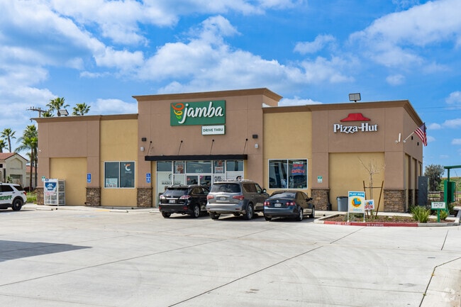
Property Record
8847 Avenue 280, Visalia, CA 93277


NEARBY LISTINGS FOR SALE OR LEASE
Property Detail
8847 Avenue 280
Visalia-Porterville, CA
Parcel Map 5254
119-850-003-000
POR PAR 1 PARCEL MAP 5254PM 53-61
Supermarket
Tulare
2024
California
2025
1.43 AC
002010
NW Outlying Tulare County
4,070 SF
Visalia/Porterville
DEMOGRAPHICS near 8847 Avenue 280
1 Mile
3 Mile
5 Mile
2024 Total Population
63
22,634
87,958
2029 Population
64
23,505
91,159
Pop Growth 2024-2029
+ 1.59%
+ 3.85%
+ 3.64%
Average Age
39
39
37
2024 Total Households
21
7,917
29,861
HH Growth 2024-2029
0.00%
+ 3.85%
+ 3.67%
Median Household Inc
$93,749
$82,400
$74,752
Avg Household Size
3.10
2.70
2.90
2024 Avg HH Vehicles
3.00
2.00
2.00
Median Home Value
$399,999
$314,165
$307,109
Median Year Built
1992
1989
1986
Nearby Places
Map Layers
Map Styles
 Street
 Aerial
- Restaurants
- Banks
- Shops
- Fitness
- Groceries
SALE & LEASE HISTORY
LISTING DATE
SALE/LEASE

May 21, 2019
For Sale
Dec 09, 2020
For Sale
Apr 19, 2018
For Lease
Nearby Properties
Address
Land Use
TOTAL SIZE
Lot Size
Zoning
Address
Land Use
TOTAL SIZE
Lot Size
Zoning
42,084 SF
9.18 AC
RM2
Address
Land Use
TOTAL SIZE
Lot Size
Zoning
121,380 SF
24.96 AC
QP
Address
Land Use
TOTAL SIZE
Lot Size
Zoning
6.96 AC
Address
Land Use
TOTAL SIZE
Lot Size
Zoning
178,626 SF
11.39 AC
PA
Address
Land Use
TOTAL SIZE
Lot Size
Zoning
Address
Land Use
TOTAL SIZE
Lot Size
Zoning
19.34 AC
QP
Address
Land Use
TOTAL SIZE
Lot Size
Zoning
549,395 SF
29.81 AC
IL
Address
Land Use
TOTAL SIZE
Lot Size
Zoning
33,981 SF
18.12 AC
Address
Land Use
TOTAL SIZE
Lot Size
Zoning
78,751 SF
2.67 AC
R-M-2
Address
Land Use
TOTAL SIZE
Lot Size
Zoning
10.13 AC
Address
Land Use
TOTAL SIZE
Lot Size
Zoning
Address
Land Use
TOTAL SIZE
Lot Size
Zoning
103,000 SF
11.17 AC
CCM
Address
Land Use
TOTAL SIZE
Lot Size
Zoning
32,048 SF
2.81 AC
CSO
Address
Land Use
TOTAL SIZE
Lot Size
Zoning
51,362 SF
1.61 AC
CH
Address
Land Use
TOTAL SIZE
Lot Size
Zoning
50,318 SF
1.94 AC
Address
Land Use
TOTAL SIZE
Lot Size
Zoning
60,871 SF
9.54 AC
Address
Land Use
TOTAL SIZE
Lot Size
Zoning
2,131 SF
17.53 AC
Address
Land Use
TOTAL SIZE
Lot Size
Zoning
262,720 SF
12.81 AC
X
Address
Land Use
TOTAL SIZE
Lot Size
Zoning
93,656 SF
4.52 AC
CCM
Address
Land Use
TOTAL SIZE
Lot Size
Zoning
3.26 AC
Address
Land Use
TOTAL SIZE
Lot Size
Zoning
234,442 SF
11.59 AC
IL
Address
Land Use
TOTAL SIZE
Lot Size
Zoning
67,857 SF
3.62 AC
RM3
Address
Land Use
TOTAL SIZE
Lot Size
Zoning
172.33 AC
Address
Land Use
TOTAL SIZE
Lot Size
Zoning
151,160 SF
20.48 AC
Address
Land Use
TOTAL SIZE
Lot Size
Zoning
29,763 SF
1.69 AC
CH
Address
Land Use
TOTAL SIZE
Lot Size
Zoning
43,490 SF
7.70 AC
QP
The World's #1 Commercial Real Estate Marketplace
Connect with us
© 2025 CoStar Group
The information above has been obtained from sources believed reliable. While we do not doubt its accuracy we have not verified it and make no guarantee, warranty or representation about it. It is your responsibility to independently confirm its accuracy and completeness. Any projections, opinions, assumptions, or estimates used are for example only and do not represent the current or future performance of the property. The value of this transaction to you depends on tax and other factors which should be evaluated by your tax, financial, and legal advisors. You and your advisors should conduct a careful, independent investigation of the property to determine to your satisfaction the suitability of the property for your needs.