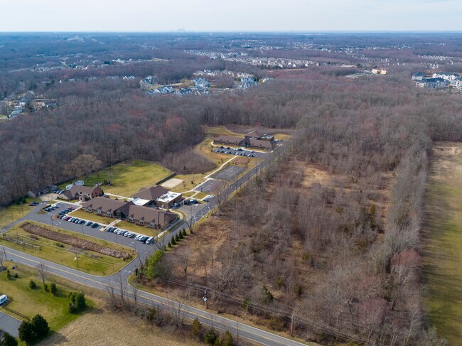
Property Record
885 Route 70 Pike E, Evesham, NJ 08053


NEARBY LISTINGS FOR SALE OR LEASE
Property Detail
885 Route 70 Pike E
Philadelphia-Camden-Wilmington, PA-NJ-DE-MD
Georgetowne Sec 01
13-00017-0000-00002
ADDITIONAL LOTS: MED TWP 901/1.02
Vacantlandnec
Burlington
X
New Jersey
34005C0263F
2
2024
5.83 AC
2025
South Burlington County
704007
Philadelphia
DEMOGRAPHICS near 885 Route 70 Pike E
1 Mile
3 Mile
5 Mile
2024 Total Population
5,302
45,735
112,144
2029 Population
5,425
46,573
113,883
Pop Growth 2024-2029
+ 2.32%
+ 1.83%
+ 1.55%
Average Age
41
43
43
2024 Total Households
2,192
17,748
43,924
HH Growth 2024-2029
+ 2.33%
+ 1.91%
+ 1.55%
Median Household Inc
$109,649
$125,440
$123,585
Avg Household Size
2.30
2.50
2.50
2024 Avg HH Vehicles
2.00
2.00
2.00
Median Home Value
$362,344
$369,829
$358,896
Median Year Built
1998
1986
1984
Nearby Places
Map Layers
Map Styles
 Street
 Aerial
- Restaurants
- Banks
- Shops
- Fitness
- Groceries
PUBLIC TRANSPORTATION
COMMUTER RAIL
Lindenwold (Njt) (Atlantic City Line - NJ Transit Commuter Rail (NJ Transit))
DRIVE
WALK
Distance
Lindenwold (Njt) (Atlantic City Line - NJ Transit Commuter Rail (NJ Transit))
21 min
10.0 mi
AIRPORT
Philadelphia International
DRIVE
WALK
Distance
Philadelphia International
42 min
27.2 mi
Trenton Mercer
DRIVE
WALK
Distance
Trenton Mercer
55 min
36.2 mi
Freight Ports
Port of Philadelphia
DRIVE
WALK
Distance
Port of Philadelphia
26 min
17.3 mi
SALE & LEASE HISTORY
LISTING DATE
SALE/LEASE

May 22, 2020
For Sale
Nearby Properties
Address
Land Use
TOTAL SIZE
Lot Size
Zoning
Address
Land Use
TOTAL SIZE
Lot Size
Zoning
1,896 SF
93.79 AC
LD
Address
Land Use
TOTAL SIZE
Lot Size
Zoning
50.60 AC
PPE
Address
Land Use
TOTAL SIZE
Lot Size
Zoning
53.35 AC
LD
Address
Land Use
TOTAL SIZE
Lot Size
Zoning
58.48 AC
MD
Address
Land Use
TOTAL SIZE
Lot Size
Zoning
52.30 AC
MD
Address
Land Use
TOTAL SIZE
Lot Size
Zoning
Address
Land Use
TOTAL SIZE
Lot Size
Zoning
2,600 SF
37.38 AC
AH-1
Address
Land Use
TOTAL SIZE
Lot Size
Zoning
Address
Land Use
TOTAL SIZE
Lot Size
Zoning
9.38 AC
C-1
Address
Land Use
TOTAL SIZE
Lot Size
Zoning
42.80 AC
MF
Address
Land Use
TOTAL SIZE
Lot Size
Zoning
3 AC
GMN
Address
Land Use
TOTAL SIZE
Lot Size
Zoning
23.43 AC
INS
Address
Land Use
TOTAL SIZE
Lot Size
Zoning
16.60 AC
Address
Land Use
TOTAL SIZE
Lot Size
Zoning
62.20 AC
GMN
Address
Land Use
TOTAL SIZE
Lot Size
Zoning
13,636 SF
23 AC
HC-1
Address
Land Use
TOTAL SIZE
Lot Size
Zoning
140.84 AC
MD
Address
Land Use
TOTAL SIZE
Lot Size
Zoning
10,000 SF
10.80 AC
RD-1
Address
Land Use
TOTAL SIZE
Lot Size
Zoning
34.74 AC
PPE/
Address
Land Use
TOTAL SIZE
Lot Size
Zoning
22.74 AC
HC-1
Address
Land Use
TOTAL SIZE
Lot Size
Zoning
24.49 AC
Address
Land Use
TOTAL SIZE
Lot Size
Zoning
128.02 AC
PPE
Address
Land Use
TOTAL SIZE
Lot Size
Zoning
Address
Land Use
TOTAL SIZE
Lot Size
Zoning
11.54 AC
MD
Address
Land Use
TOTAL SIZE
Lot Size
Zoning
46.66 AC
AH3
Address
Land Use
TOTAL SIZE
Lot Size
Zoning
86.30 AC
PPE
Address
Land Use
TOTAL SIZE
Lot Size
Zoning
9.88 AC
PPE
Address
Land Use
TOTAL SIZE
Lot Size
Zoning
23.70 AC
HM
Address
Land Use
TOTAL SIZE
Lot Size
Zoning
19.60 AC
C-1
Address
Land Use
TOTAL SIZE
Lot Size
Zoning
13.74 AC
C-1
Address
Land Use
TOTAL SIZE
Lot Size
Zoning
10.15 AC
INS
The World's #1 Commercial Real Estate Marketplace
Connect with us
© 2026 CoStar Group
The information above has been obtained from sources believed reliable. While we do not doubt its accuracy we have not verified it and make no guarantee, warranty or representation about it. It is your responsibility to independently confirm its accuracy and completeness. Any projections, opinions, assumptions, or estimates used are for example only and do not represent the current or future performance of the property. The value of this transaction to you depends on tax and other factors which should be evaluated by your tax, financial, and legal advisors. You and your advisors should conduct a careful, independent investigation of the property to determine to your satisfaction the suitability of the property for your needs.