Property Record
8850 Shaver Rd, Portage, MI 49024


NEARBY LISTINGS FOR SALE OR LEASE
Property Detail
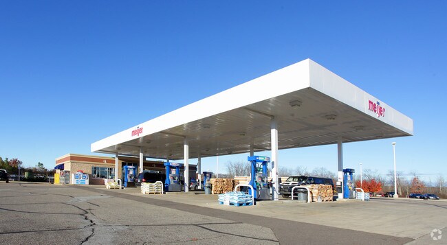
8850 Shaver Rd
Kalamazoo-Portage, MI
T3S-R11W SEC 21BEG AT THE SW CORNER OF SW 1/4, TH N 1320 FT, TH E 617 FT, TH N 1320 FT TH E 43 FT, TH S 1324.32 FT, TH E
10-00021-185-A
Kalamazoo
Commercialnec
Michigan
2021
67.55 AC
2022
Southern Kalamazoo County
0020021006
West Michigan
188,352 SF
DEMOGRAPHICS near 8850 Shaver Rd
1 Mile
3 Mile
5 Mile
2024 Total Population
2,058
34,292
72,880
2029 Population
2,050
34,149
72,501
Pop Growth 2024-2029
(0.39%)
(0.42%)
(0.52%)
Average Age
42
41
40
2024 Total Households
895
14,481
29,958
HH Growth 2024-2029
(0.34%)
(0.44%)
(0.56%)
Median Household Inc
$73,443
$72,600
$73,418
Avg Household Size
2.30
2.30
2.40
2024 Avg HH Vehicles
2.00
2.00
2.00
Median Home Value
$238,600
$235,723
$233,125
Median Year Built
1975
1978
1976
Nearby Places
Map Layers
Map Styles
 Street
 Aerial
- Restaurants
- Banks
- Shops
- Fitness
- Groceries
PUBLIC TRANSPORTATION
COMMUTER RAIL
Kalamazoo (Blue Water - Amtrak, Wolverine - Amtrak)
DRIVE
WALK
Distance
Kalamazoo (Blue Water - Amtrak, Wolverine - Amtrak)
18 min
8.1 mi
AIRPORT
Kalamazoo/Battle Creek International
DRIVE
WALK
Distance
Kalamazoo/Battle Creek International
18 min
7.0 mi
Freight Ports
Port of Toledo
DRIVE
WALK
Distance
Port of Toledo
182 min
148.4 mi
Nearby Properties
Address
Land Use
TOTAL SIZE
Lot Size
Zoning
Address
Land Use
TOTAL SIZE
Lot Size
Zoning
35,119 SF
50.85 AC
RM-1
Address
Land Use
TOTAL SIZE
Lot Size
Zoning
19.39 AC
OTR
Address
Land Use
TOTAL SIZE
Lot Size
Zoning
383,638 SF
25.85 AC
B-2
Address
Land Use
TOTAL SIZE
Lot Size
Zoning
16.71 AC
B-2
Address
Land Use
TOTAL SIZE
Lot Size
Zoning
9.47 AC
Address
Land Use
TOTAL SIZE
Lot Size
Zoning
61,533 SF
8.42 AC
B-2
Address
Land Use
TOTAL SIZE
Lot Size
Zoning
18.57 AC
Address
Land Use
TOTAL SIZE
Lot Size
Zoning
1,776 SF
17 AC
PD
Address
Land Use
TOTAL SIZE
Lot Size
Zoning
16.58 AC
Address
Land Use
TOTAL SIZE
Lot Size
Zoning
6,874 SF
163.50 AC
PD
Address
Land Use
TOTAL SIZE
Lot Size
Zoning
28.49 AC
I-2
Address
Land Use
TOTAL SIZE
Lot Size
Zoning
151,395 SF
33.79 AC
CPD
Address
Land Use
TOTAL SIZE
Lot Size
Zoning
66.34 AC
B-3
Address
Land Use
TOTAL SIZE
Lot Size
Zoning
13.77 AC
B-2
Address
Land Use
TOTAL SIZE
Lot Size
Zoning
26,700 SF
17 AC
RM-1
Address
Land Use
TOTAL SIZE
Lot Size
Zoning
8,040 SF
18.11 AC
RM-1
Address
Land Use
TOTAL SIZE
Lot Size
Zoning
32,094 SF
13.95 AC
PD
Address
Land Use
TOTAL SIZE
Lot Size
Zoning
21,180 SF
13.12 AC
RM-1
Address
Land Use
TOTAL SIZE
Lot Size
Zoning
7.36 AC
B-2
Address
Land Use
TOTAL SIZE
Lot Size
Zoning
20,760 SF
12.86 AC
RM-1
Address
Land Use
TOTAL SIZE
Lot Size
Zoning
9,246 SF
10.24 AC
RM-1
Address
Land Use
TOTAL SIZE
Lot Size
Zoning
168,173 SF
16.32 AC
I-2
Address
Land Use
TOTAL SIZE
Lot Size
Zoning
103,007 SF
8.02 AC
B-2
Address
Land Use
TOTAL SIZE
Lot Size
Zoning
5,880 SF
9.65 AC
RM-1
Address
Land Use
TOTAL SIZE
Lot Size
Zoning
8.92 AC
PD
Address
Land Use
TOTAL SIZE
Lot Size
Zoning
29,341 SF
5.72 AC
B-2
Address
Land Use
TOTAL SIZE
Lot Size
Zoning
26.89 AC
PD
Address
Land Use
TOTAL SIZE
Lot Size
Zoning
35,419 SF
6.70 AC
B-3
Address
Land Use
TOTAL SIZE
Lot Size
Zoning
120,324 SF
10.67 AC
OS-1
The World's #1 Commercial Real Estate Marketplace
Connect with us
© 2025 CoStar Group
The information above has been obtained from sources believed reliable. While we do not doubt its accuracy we have not verified it and make no guarantee, warranty or representation about it. It is your responsibility to independently confirm its accuracy and completeness. Any projections, opinions, assumptions, or estimates used are for example only and do not represent the current or future performance of the property. The value of this transaction to you depends on tax and other factors which should be evaluated by your tax, financial, and legal advisors. You and your advisors should conduct a careful, independent investigation of the property to determine to your satisfaction the suitability of the property for your needs.