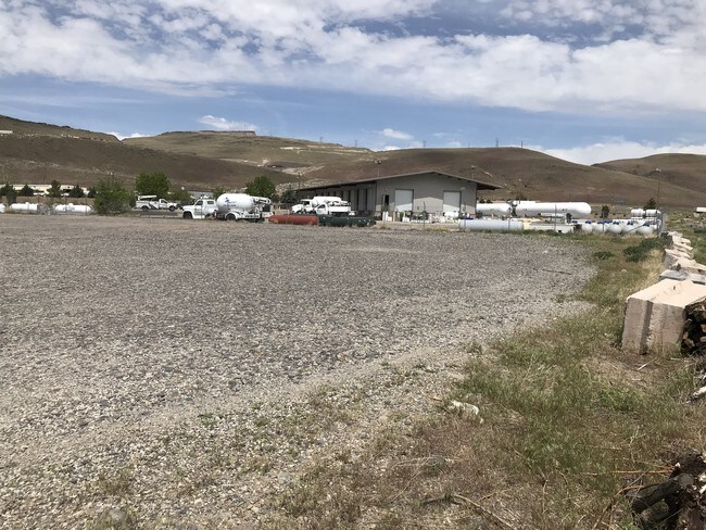
Property Record
8860 Canyon River Ct, Sparks, NV 89434


NEARBY LISTINGS FOR SALE OR LEASE
Property Detail
8860 Canyon River Ct
Reno, NV
_Unspecified
084-090-29
ROS 3644 PAR 2A
Industrialacreage
Washoe
X
Nevada
32031C3088G
c&d
2025
2.30 AC
2026
N Outlying Washoe County
003501
Reno/Sparks
DEMOGRAPHICS near 8860 Canyon River Ct
1 Mile
3 Mile
5 Mile
2024 Total Population
171
1,212
8,496
2029 Population
181
1,284
8,967
Pop Growth 2024-2029
+ 5.85%
+ 5.94%
+ 5.54%
Average Age
46
46
45
2024 Total Households
73
518
3,517
HH Growth 2024-2029
+ 5.48%
+ 5.79%
+ 5.57%
Median Household Inc
$42,361
$42,400
$81,911
Avg Household Size
2.30
2.30
2.40
2024 Avg HH Vehicles
2.00
2.00
2.00
Median Home Value
$227,027
$227,170
$437,885
Median Year Built
1992
1992
1999
Nearby Places
Map Layers
Map Styles
 Street
 Aerial
- Restaurants
- Banks
- Shops
- Fitness
- Groceries
PUBLIC TRANSPORTATION
AIRPORT
Reno/Tahoe International
DRIVE
WALK
Distance
Reno/Tahoe International
35 min
15.3 mi
Freight Ports
Port of Stockton
DRIVE
WALK
Distance
Port of Stockton
219 min
189.6 mi
SALE & LEASE HISTORY
LISTING DATE
SALE/LEASE

May 24, 2019
For Lease
Nearby Properties
Address
Land Use
TOTAL SIZE
Lot Size
Zoning
Address
Land Use
TOTAL SIZE
Lot Size
Zoning
561,000 SF
45.75 AC
I
Address
Land Use
TOTAL SIZE
Lot Size
Zoning
351,452 SF
71.90 AC
I
Address
Land Use
TOTAL SIZE
Lot Size
Zoning
53,248 SF
19.50 AC
I
Address
Land Use
TOTAL SIZE
Lot Size
Zoning
45,150 SF
4.50 AC
I
Address
Land Use
TOTAL SIZE
Lot Size
Zoning
12,156 SF
1,534.49 AC
I-2;INDUST
Address
Land Use
TOTAL SIZE
Lot Size
Zoning
64,539 SF
10 AC
I2
Address
Land Use
TOTAL SIZE
Lot Size
Zoning
99.81 AC
GR
Address
Land Use
TOTAL SIZE
Lot Size
Zoning
80,879 SF
8.75 AC
I-1;INDUST
Address
Land Use
TOTAL SIZE
Lot Size
Zoning
1,280 SF
43.32 AC
I
Address
Land Use
TOTAL SIZE
Lot Size
Zoning
2,680 SF
36.57 AC
I
Address
Land Use
TOTAL SIZE
Lot Size
Zoning
31,440 SF
29.38 AC
GR
Address
Land Use
TOTAL SIZE
Lot Size
Zoning
8,715 SF
30.03 AC
Address
Land Use
TOTAL SIZE
Lot Size
Zoning
8,500 SF
35.23 AC
P
Address
Land Use
TOTAL SIZE
Lot Size
Zoning
9,120 SF
6.75 AC
I
Address
Land Use
TOTAL SIZE
Lot Size
Zoning
1.18 AC
F;FORESTED
Address
Land Use
TOTAL SIZE
Lot Size
Zoning
21.81 AC
I 95%/RDS
Address
Land Use
TOTAL SIZE
Lot Size
Zoning
2.78 AC
PUD /;PUB
Address
Land Use
TOTAL SIZE
Lot Size
Zoning
20,000 SF
2.56 AC
I
Address
Land Use
TOTAL SIZE
Lot Size
Zoning
9,900 SF
3.02 AC
I
Address
Land Use
TOTAL SIZE
Lot Size
Zoning
7,700 SF
2.68 AC
I
Address
Land Use
TOTAL SIZE
Lot Size
Zoning
542.79 AC
GR
Address
Land Use
TOTAL SIZE
Lot Size
Zoning
331.98 AC
GR
Address
Land Use
TOTAL SIZE
Lot Size
Zoning
11,880 SF
3.13 AC
I
Address
Land Use
TOTAL SIZE
Lot Size
Zoning
2,368 SF
1.77 AC
I
Address
Land Use
TOTAL SIZE
Lot Size
Zoning
7,497 SF
624.08 AC
PR 27% / G
Address
Land Use
TOTAL SIZE
Lot Size
Zoning
18.52 AC
GR
Address
Land Use
TOTAL SIZE
Lot Size
Zoning
1,056 SF
4.23 AC
I
Address
Land Use
TOTAL SIZE
Lot Size
Zoning
40.90 AC
Address
Land Use
TOTAL SIZE
Lot Size
Zoning
15.49 AC
GR
Address
Land Use
TOTAL SIZE
Lot Size
Zoning
500 SF
645 AC
GR
The World's #1 Commercial Real Estate Marketplace
Connect with us
© 2026 CoStar Group
The information above has been obtained from sources believed reliable. While we do not doubt its accuracy we have not verified it and make no guarantee, warranty or representation about it. It is your responsibility to independently confirm its accuracy and completeness. Any projections, opinions, assumptions, or estimates used are for example only and do not represent the current or future performance of the property. The value of this transaction to you depends on tax and other factors which should be evaluated by your tax, financial, and legal advisors. You and your advisors should conduct a careful, independent investigation of the property to determine to your satisfaction the suitability of the property for your needs.