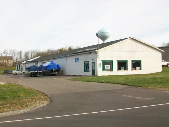
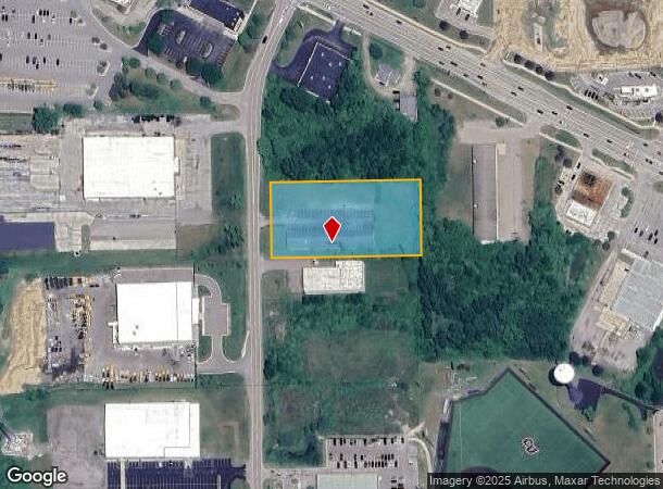
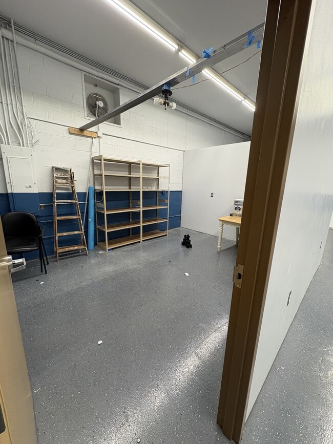
Property Record
887 Grand Oaks Dr, Howell, MI 48843
Current Lease Availabilities
NEARBY LISTINGS FOR SALE OR LEASE
Property Detail
887 Grand Oaks Dr
Detroit-Warren-Dearborn, MI
Gd Oaks Commercial Pk
11-05-301-002
SEC 5 T2N R5E GRAND OAKS COMMERCIAL PARK, LOT 2
Industrialgeneral
Livingston
X
Michigan
26093C0309D
2
2025
1.85 AC
2025
Livingston County
742403
Detroit
9,200 SF
DEMOGRAPHICS near 887 Grand Oaks Dr
1 Mile
3 Mile
5 Mile
2024 Total Population
3,865
25,679
51,032
2029 Population
3,982
26,433
52,532
Pop Growth 2024-2029
+ 3.03%
+ 2.94%
+ 2.94%
Average Age
40
41
43
2024 Total Households
1,696
10,293
20,416
HH Growth 2024-2029
+ 2.95%
+ 2.89%
+ 2.93%
Median Household Inc
$70,280
$86,698
$86,628
Avg Household Size
2.20
2.50
2.40
2024 Avg HH Vehicles
2.00
2.00
2.00
Median Home Value
$274,193
$284,244
$295,558
Median Year Built
1998
1994
1992
Nearby Places
- Restaurants
- Banks
- Shops
- Fitness
- Groceries
PUBLIC TRANSPORTATION
AIRPORT
Bishop International
DRIVE
WALK
Distance
Bishop International
57 min
42.6 mi
Freight Ports
Port of Toledo
DRIVE
WALK
Distance
Port of Toledo
104 min
85.8 mi
Nearby Properties
Address
Land Use
TOTAL SIZE
Lot Size
Zoning
Address
Land Use
TOTAL SIZE
Lot Size
Zoning
1,296 SF
19.42 AC
MUPUD
Address
Land Use
TOTAL SIZE
Lot Size
Zoning
93,620 SF
17.47 AC
MUPUD
Address
Land Use
TOTAL SIZE
Lot Size
Zoning
344,387 SF
27.72 AC
I-1
Address
Land Use
TOTAL SIZE
Lot Size
Zoning
199,635 SF
19.85 AC
RPUD
Address
Land Use
TOTAL SIZE
Lot Size
Zoning
210,003 SF
29.17 AC
MUPUD
Address
Land Use
TOTAL SIZE
Lot Size
Zoning
15.74 AC
RM
Address
Land Use
TOTAL SIZE
Lot Size
Zoning
161,366 SF
18.67 AC
HDR
Address
Land Use
TOTAL SIZE
Lot Size
Zoning
165,868 SF
27.80 AC
HDR
Address
Land Use
TOTAL SIZE
Lot Size
Zoning
87,349 SF
9.68 AC
C,RM,PUD
Address
Land Use
TOTAL SIZE
Lot Size
Zoning
60,900 SF
5.74 AC
NRPUD
Address
Land Use
TOTAL SIZE
Lot Size
Zoning
166,550 SF
20 AC
IND
Address
Land Use
TOTAL SIZE
Lot Size
Zoning
53,494 SF
10 AC
MUPUD
Address
Land Use
TOTAL SIZE
Lot Size
Zoning
220,091 SF
21.88 AC
NRPUD
Address
Land Use
TOTAL SIZE
Lot Size
Zoning
134,688 SF
14.97 AC
NRPUD
Address
Land Use
TOTAL SIZE
Lot Size
Zoning
96,896 SF
12.11 AC
HDR
Address
Land Use
TOTAL SIZE
Lot Size
Zoning
91,380 SF
11.55 AC
HDR
Address
Land Use
TOTAL SIZE
Lot Size
Zoning
57,582 SF
5.32 AC
C,RM,PUD
Address
Land Use
TOTAL SIZE
Lot Size
Zoning
79,801 SF
10.60 AC
B-2
Address
Land Use
TOTAL SIZE
Lot Size
Zoning
121,850 SF
11.85 AC
I-1
Address
Land Use
TOTAL SIZE
Lot Size
Zoning
121,265 SF
15.10 AC
RCD
Address
Land Use
TOTAL SIZE
Lot Size
Zoning
65,560 SF
2.56 AC
NRPUD
Address
Land Use
TOTAL SIZE
Lot Size
Zoning
246 SF
32.70 AC
I-1
Address
Land Use
TOTAL SIZE
Lot Size
Zoning
73,296 SF
7 AC
HDR
Address
Land Use
TOTAL SIZE
Lot Size
Zoning
116,885 SF
13.78 AC
RCD
Address
Land Use
TOTAL SIZE
Lot Size
Zoning
57,736 SF
4.84 AC
R-M
Address
Land Use
TOTAL SIZE
Lot Size
Zoning
74,030 SF
5.33 AC
Address
Land Use
TOTAL SIZE
Lot Size
Zoning
40,005 SF
4.87 AC
RM
Address
Land Use
TOTAL SIZE
Lot Size
Zoning
40,005 SF
3.30 AC
RM
Address
Land Use
TOTAL SIZE
Lot Size
Zoning
12,870 SF
5.04 AC
C,RM,PUD
Address
Land Use
TOTAL SIZE
Lot Size
Zoning
88,520 SF
9.45 AC
NRPUD
The World's #1 Commercial Real Estate Marketplace
Connect with us
© 2025 CoStar Group
The information above has been obtained from sources believed reliable. While we do not doubt its accuracy we have not verified it and make no guarantee, warranty or representation about it. It is your responsibility to independently confirm its accuracy and completeness. Any projections, opinions, assumptions, or estimates used are for example only and do not represent the current or future performance of the property. The value of this transaction to you depends on tax and other factors which should be evaluated by your tax, financial, and legal advisors. You and your advisors should conduct a careful, independent investigation of the property to determine to your satisfaction the suitability of the property for your needs.