Property Record
888 Baldwin Rd, Ojai, CA 93023
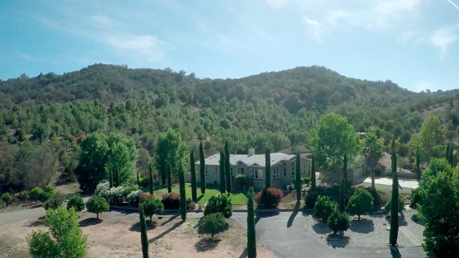

Property Detail
888 Baldwin Rd
032-0-010-120
PR APN 0320010070
Orchard
Ventura
OS40AC
California
B and X Area of moderate flood hazard, usually the area between the limits of the 100-year and 500-year floods.
80.79 AC
2024
Ojai/NW County
2025
Los Angeles
009500
Oxnard-Thousand Oaks-Ventura, CA
NEARBY LISTINGS FOR SALE OR LEASE
-
-
View all Ojai listings for sale on LoopNet.com
DEMOGRAPHICS near 888 Baldwin Rd
1 mile
3 mile
5 mile
2025 Total Population
460
16,525
24,139
2030 Population
458
16,415
23,928
Pop Growth 2025-2030
(0.43%)
(0.67%)
(0.87%)
Average Age
47
45
46
2025 Total Households
179
6,254
9,436
HH Growth 2025-2030
(0.56%)
(0.82%)
(1.05%)
Median Household Inc
$102,381
$90,443
$88,819
Avg Household Size
2.50
2.60
2.50
2025 Avg HH Vehicles
3.00
2.00
2.00
Median Home Value
$1,036,000
$770,424
$830,260
Median Year Built
1977
1966
1966
Nearby Places
Map Layers
Map Styles
 Street
 Aerial
Layers
 Traffic
 Biking
Places
Listings with unknown addresses are not visible on the map
- Restaurants
- Banks
- Shops
- Fitness
- Groceries
SALE & LEASE HISTORY
LISTING DATE
SALE/LEASE

Oct 23, 2017
For Sale
Nearby Properties
Address
Land Use
TOTAL SIZE
Lot Size
Zoning
Address
Land Use
TOTAL SIZE
Lot Size
Zoning
37,790 SF
5.13 AC
RPD-10U
Address
Land Use
TOTAL SIZE
Lot Size
Zoning
4,900 SF
11.01 AC
Address
Land Use
TOTAL SIZE
Lot Size
Zoning
1.93 AC
CPD
Address
Land Use
TOTAL SIZE
Lot Size
Zoning
126.17 AC
OS20AC
Address
Land Use
TOTAL SIZE
Lot Size
Zoning
1,440 SF
98.32 AC
AE
Address
Land Use
TOTAL SIZE
Lot Size
Zoning
50.69 AC
OS80AC
Address
Land Use
TOTAL SIZE
Lot Size
Zoning
15,668 SF
1.46 AC
CPD
Address
Land Use
TOTAL SIZE
Lot Size
Zoning
36.30 AC
RA20AC
Address
Land Use
TOTAL SIZE
Lot Size
Zoning
107.07 AC
OS80AC
Address
Land Use
TOTAL SIZE
Lot Size
Zoning
0.67 AC
Address
Land Use
TOTAL SIZE
Lot Size
Zoning
2,257 SF
162.04 AC
Address
Land Use
TOTAL SIZE
Lot Size
Zoning
11.06 AC
CPD R-
Address
Land Use
TOTAL SIZE
Lot Size
Zoning
1,170 SF
106.57 AC
Address
Land Use
TOTAL SIZE
Lot Size
Zoning
2,971 SF
15.14 AC
OS20AC
Address
Land Use
TOTAL SIZE
Lot Size
Zoning
36.20 AC
AE
Address
Land Use
TOTAL SIZE
Lot Size
Zoning
3,630 SF
45.17 AC
OS-40
Address
Land Use
TOTAL SIZE
Lot Size
Zoning
83.56 AC
Address
Land Use
TOTAL SIZE
Lot Size
Zoning
0.39 AC
R1
Address
Land Use
TOTAL SIZE
Lot Size
Zoning
3,320 SF
5 AC
RA5AC
Address
Land Use
TOTAL SIZE
Lot Size
Zoning
37,014 SF
1.41 AC
M1
Address
Land Use
TOTAL SIZE
Lot Size
Zoning
115.80 AC
RE
Address
Land Use
TOTAL SIZE
Lot Size
Zoning
8,538 SF
3.84 AC
RE1AC
Address
Land Use
TOTAL SIZE
Lot Size
Zoning
4,452 SF
40.06 AC
OS80AC
Address
Land Use
TOTAL SIZE
Lot Size
Zoning
434 SF
0.50 AC
CPD
Address
Land Use
TOTAL SIZE
Lot Size
Zoning
1.20 AC
RPD-4U
Address
Land Use
TOTAL SIZE
Lot Size
Zoning
3,024 SF
328.74 AC
AEA-E/
Address
Land Use
TOTAL SIZE
Lot Size
Zoning
1,050 SF
0.77 AC
CPD
Address
Land Use
TOTAL SIZE
Lot Size
Zoning
3,019 SF
11.28 AC
RE2AC
Address
Land Use
TOTAL SIZE
Lot Size
Zoning
4,862 SF
34.23 AC
OS40AC
Address
Land Use
TOTAL SIZE
Lot Size
Zoning
12,951 SF
1.35 AC
CPD
The World's #1 Commercial Real Estate Marketplace
Connect with us
© 2026 CoStar Group
The information above has been obtained from sources believed reliable. While we do not doubt its accuracy we have not verified it and make no guarantee, warranty or representation about it. It is your responsibility to independently confirm its accuracy and completeness. Any projections, opinions, assumptions, or estimates used are for example only and do not represent the current or future performance of the property. The value of this transaction to you depends on tax and other factors which should be evaluated by your tax, financial, and legal advisors. You and your advisors should conduct a careful, independent investigation of the property to determine to your satisfaction the suitability of the property for your needs.