Property Record
888 Shoe Factory Rd, Elgin, IL 60120


NEARBY LISTINGS FOR SALE OR LEASE
Property Detail
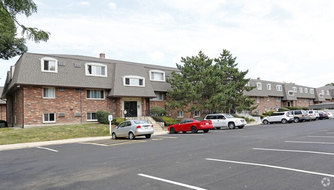
888 Shoe Factory Rd
Chicago-Naperville-Elgin, IL-IN-WI
Third Add To Blackhawk Manor
06-07-109-001-0000
(THIRD) ADD TO (BLACKHAWK)(MANOR) SUB PT OF SECS 6 & 7 SEC 07-41-09
Apartment
Cook
X
Illinois
17089C0167H
222,2
2023
6.81 AC
2025
Northeast Elgin-Cook
804403
Chicago
DEMOGRAPHICS near 888 Shoe Factory Rd
1 Mile
3 Mile
5 Mile
2024 Total Population
14,906
82,795
175,281
2029 Population
14,531
81,711
172,979
Pop Growth 2024-2029
(2.52%)
(1.31%)
(1.31%)
Average Age
38
38
39
2024 Total Households
5,041
28,024
59,727
HH Growth 2024-2029
(2.90%)
(1.42%)
(1.45%)
Median Household Inc
$82,676
$75,896
$83,211
Avg Household Size
2.80
2.80
2.80
2024 Avg HH Vehicles
2.00
2.00
2.00
Median Home Value
$225,016
$212,495
$240,791
Median Year Built
1976
1970
1977
Nearby Places
Map Layers
Map Styles
 Street
 Aerial
- Restaurants
- Banks
- Shops
- Fitness
- Groceries
PUBLIC TRANSPORTATION
COMMUTER RAIL
Elgin Station (Milwaukee District West Line - Northeast Illinois Regional Commuter Railroad (Metra))
DRIVE
WALK
Distance
Elgin Station (Milwaukee District West Line - Northeast Illinois Regional Commuter Railroad (Metra))
6 min
2.5 mi
National Street Station (Milwaukee District West Line - Northeast Illinois Regional Commuter Railroad (Metra))
DRIVE
WALK
Distance
National Street Station (Milwaukee District West Line - Northeast Illinois Regional Commuter Railroad (Metra))
8 min
3.2 mi
AIRPORT
Chicago O'Hare International
DRIVE
WALK
Distance
Chicago O'Hare International
32 min
25.5 mi
Freight Ports
Port Milwaukee
DRIVE
WALK
Distance
Port Milwaukee
111 min
81.8 mi
Nearby Properties
Address
Land Use
TOTAL SIZE
Lot Size
Zoning
Address
Land Use
TOTAL SIZE
Lot Size
Zoning
551,248 SF
28.94 AC
Address
Land Use
TOTAL SIZE
Lot Size
Zoning
23.54 AC
Address
Land Use
TOTAL SIZE
Lot Size
Zoning
27.33 AC
Address
Land Use
TOTAL SIZE
Lot Size
Zoning
108.60 AC
Address
Land Use
TOTAL SIZE
Lot Size
Zoning
51,091 SF
3.52 AC
Address
Land Use
TOTAL SIZE
Lot Size
Zoning
431,318 SF
20 AC
Address
Land Use
TOTAL SIZE
Lot Size
Zoning
Address
Land Use
TOTAL SIZE
Lot Size
Zoning
Address
Land Use
TOTAL SIZE
Lot Size
Zoning
35,808 SF
11.40 AC
Address
Land Use
TOTAL SIZE
Lot Size
Zoning
Address
Land Use
TOTAL SIZE
Lot Size
Zoning
176,799 SF
10 AC
Address
Land Use
TOTAL SIZE
Lot Size
Zoning
38,550 SF
0.60 AC
Address
Land Use
TOTAL SIZE
Lot Size
Zoning
93,341 SF
3.67 AC
Address
Land Use
TOTAL SIZE
Lot Size
Zoning
71,725 SF
49.30 AC
Address
Land Use
TOTAL SIZE
Lot Size
Zoning
Address
Land Use
TOTAL SIZE
Lot Size
Zoning
154,483 SF
10 AC
Address
Land Use
TOTAL SIZE
Lot Size
Zoning
Address
Land Use
TOTAL SIZE
Lot Size
Zoning
Address
Land Use
TOTAL SIZE
Lot Size
Zoning
Address
Land Use
TOTAL SIZE
Lot Size
Zoning
137,500 SF
12.51 AC
Address
Land Use
TOTAL SIZE
Lot Size
Zoning
123,844 SF
11.51 AC
Address
Land Use
TOTAL SIZE
Lot Size
Zoning
151,977 SF
7 AC
Address
Land Use
TOTAL SIZE
Lot Size
Zoning
227,125 SF
2.79 AC
Address
Land Use
TOTAL SIZE
Lot Size
Zoning
193,530 SF
0.57 AC
Address
Land Use
TOTAL SIZE
Lot Size
Zoning
120,075 SF
10.70 AC
Address
Land Use
TOTAL SIZE
Lot Size
Zoning
1.30 AC
Address
Land Use
TOTAL SIZE
Lot Size
Zoning
Address
Land Use
TOTAL SIZE
Lot Size
Zoning
23.97 AC
The World's #1 Commercial Real Estate Marketplace
Connect with us
© 2026 CoStar Group
The information above has been obtained from sources believed reliable. While we do not doubt its accuracy we have not verified it and make no guarantee, warranty or representation about it. It is your responsibility to independently confirm its accuracy and completeness. Any projections, opinions, assumptions, or estimates used are for example only and do not represent the current or future performance of the property. The value of this transaction to you depends on tax and other factors which should be evaluated by your tax, financial, and legal advisors. You and your advisors should conduct a careful, independent investigation of the property to determine to your satisfaction the suitability of the property for your needs.