Property Record
889 Anderson Ferry Rd, Cincinnati, OH 45238

NEARBY LISTINGS FOR SALE OR LEASE
Property Detail
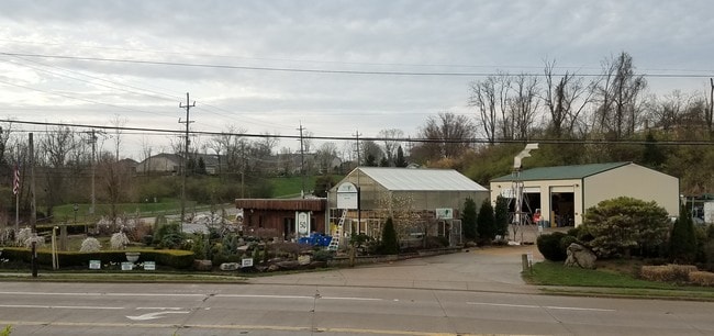
889 Anderson Ferry Rd
540-0063-0013
J W Bacons Estate
Storebuilding
SWC RAPID RUN & ANDERSON FERRY 2.3169 ACS R1-T3-S18
X
Hamilton
21037C0025E
Ohio
2024
2.32 AC
2024
Forest Park/West
021303
Cincinnati/Dayton
1,478 SF
Cincinnati, OH-KY-IN
DEMOGRAPHICS near 889 Anderson Ferry Rd
1 Mile
3 Mile
5 Mile
2024 Total Population
12,556
94,025
189,462
2029 Population
12,218
92,818
188,850
Pop Growth 2024-2029
(2.69%)
(1.28%)
(0.32%)
Average Age
40
38
38
2024 Total Households
4,865
37,091
76,995
HH Growth 2024-2029
(2.77%)
(1.42%)
(0.40%)
Median Household Inc
$77,494
$53,098
$52,453
Avg Household Size
2.50
2.40
2.40
2024 Avg HH Vehicles
2.00
2.00
2.00
Median Home Value
$158,984
$152,966
$167,091
Median Year Built
1959
1960
1962
Nearby Places
Map Layers
Map Styles
 Street
 Aerial
- Restaurants
- Banks
- Shops
- Fitness
- Groceries
PUBLIC TRANSPORTATION
COMMUTER RAIL
DRIVE
WALK
Distance
15 min
5.7 mi
AIRPORT
Cincinnati/Northern Kentucky International
DRIVE
WALK
Distance
Cincinnati/Northern Kentucky International
34 min
17.8 mi
SALE & LEASE HISTORY
LISTING DATE
SALE/LEASE

Apr 09, 2019
For Sale
Nearby Properties
Address
Land Use
TOTAL SIZE
Lot Size
Zoning
Address
Land Use
TOTAL SIZE
Lot Size
Zoning
26.62 AC
Address
Land Use
TOTAL SIZE
Lot Size
Zoning
458,800 SF
49.35 AC
Address
Land Use
TOTAL SIZE
Lot Size
Zoning
30.43 AC
AA
Address
Land Use
TOTAL SIZE
Lot Size
Zoning
316,800 SF
15.66 AC
Address
Land Use
TOTAL SIZE
Lot Size
Zoning
17,857 SF
26.60 AC
CGA
Address
Land Use
TOTAL SIZE
Lot Size
Zoning
23.05 AC
Address
Land Use
TOTAL SIZE
Lot Size
Zoning
12.28 AC
AA
Address
Land Use
TOTAL SIZE
Lot Size
Zoning
8.18 AC
SF4
Address
Land Use
TOTAL SIZE
Lot Size
Zoning
13.44 AC
Address
Land Use
TOTAL SIZE
Lot Size
Zoning
25,200 SF
6.15 AC
Address
Land Use
TOTAL SIZE
Lot Size
Zoning
Address
Land Use
TOTAL SIZE
Lot Size
Zoning
6,537 SF
12.55 AC
Address
Land Use
TOTAL SIZE
Lot Size
Zoning
1,873 SF
12.20 AC
Address
Land Use
TOTAL SIZE
Lot Size
Zoning
25,795 SF
2.84 AC
DD
Address
Land Use
TOTAL SIZE
Lot Size
Zoning
12.72 AC
DD
Address
Land Use
TOTAL SIZE
Lot Size
Zoning
59,330 SF
8.57 AC
Address
Land Use
TOTAL SIZE
Lot Size
Zoning
125,405 SF
16.69 AC
SF6
Address
Land Use
TOTAL SIZE
Lot Size
Zoning
6,000 SF
11.92 AC
G
Address
Land Use
TOTAL SIZE
Lot Size
Zoning
62,160 SF
13.70 AC
RM20
Address
Land Use
TOTAL SIZE
Lot Size
Zoning
55,572 SF
6.12 AC
C
Address
Land Use
TOTAL SIZE
Lot Size
Zoning
14.01 AC
CGA
Address
Land Use
TOTAL SIZE
Lot Size
Zoning
1,329 SF
3.16 AC
SF4
Address
Land Use
TOTAL SIZE
Lot Size
Zoning
30.39 AC
A2
Address
Land Use
TOTAL SIZE
Lot Size
Zoning
19,730 SF
0.16 AC
SF2
Address
Land Use
TOTAL SIZE
Lot Size
Zoning
3,654 SF
10.82 AC
E
Address
Land Use
TOTAL SIZE
Lot Size
Zoning
40,080 SF
4.14 AC
SF6
Address
Land Use
TOTAL SIZE
Lot Size
Zoning
76,739 SF
11.44 AC
SF6
Address
Land Use
TOTAL SIZE
Lot Size
Zoning
24,222 SF
3.91 AC
CGA
Address
Land Use
TOTAL SIZE
Lot Size
Zoning
47,504 SF
14.37 AC
RM20
Address
Land Use
TOTAL SIZE
Lot Size
Zoning
15,998 SF
13.71 AC
SF10
The World's #1 Commercial Real Estate Marketplace
Connect with us
© 2025 CoStar Group
The information above has been obtained from sources believed reliable. While we do not doubt its accuracy we have not verified it and make no guarantee, warranty or representation about it. It is your responsibility to independently confirm its accuracy and completeness. Any projections, opinions, assumptions, or estimates used are for example only and do not represent the current or future performance of the property. The value of this transaction to you depends on tax and other factors which should be evaluated by your tax, financial, and legal advisors. You and your advisors should conduct a careful, independent investigation of the property to determine to your satisfaction the suitability of the property for your needs.