Property Record
89 Carol Ln, Oakley, CA 94561


Property Detail
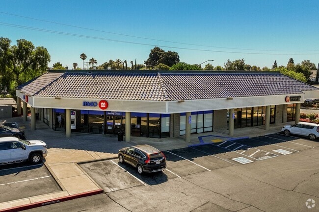
89 Carol Ln
Oakland-Fremont-Berkeley, CA
POR SEC 22 T2N R2E
037-110-032-2
CONTRA COSTA
Autorepair
California
B and X Area of moderate flood hazard, usually the area between the limits of the 100-year and 500-year floods.
1.97 AC
2025
Antioch/Pittsburg
2025
East Bay/Oakland
302005
NEARBY LISTINGS FOR SALE OR LEASE
DEMOGRAPHICS near 89 Carol Ln
1 mile
3 mile
5 mile
2025 Total Population
13,712
71,624
174,684
2030 Population
13,948
72,924
177,322
Pop Growth 2025-2030
+ 1.72%
+ 1.82%
+ 1.51%
Average Age
39
39
39
2025 Total Households
4,625
21,518
52,937
HH Growth 2025-2030
+ 1.88%
+ 1.82%
+ 1.50%
Median Household Inc
$104,315
$123,996
$116,219
Avg Household Size
2.90
3.30
3.20
2025 Avg HH Vehicles
3.00
3.00
2.00
Median Home Value
$680,662
$725,446
$726,399
Median Year Built
1988
1994
1993
Nearby Places
Map Layers
Map Styles
 Street
 Aerial
Layers
 Traffic
 Biking
Places
Listings with unknown addresses are not visible on the map
- Restaurants
- Banks
- Shops
- Fitness
- Groceries
PUBLIC TRANSPORTATION
AIRPORT
Stockton Metro
Drive
Walk
Distance
Stockton Metro
59 min
37.1 mi
Metro Oakland International
Drive
Walk
Distance
Metro Oakland International
64 min
49.0 mi
Freight Ports
Port of Stockton
Drive
Walk
Distance
Port of Stockton
54 min
34.8 mi
Nearby Properties
Address
Land Use
TOTAL SIZE
Lot Size
Zoning
Address
Land Use
TOTAL SIZE
Lot Size
Zoning
24,286 SF
13.89 AC
Address
Land Use
TOTAL SIZE
Lot Size
Zoning
9,999 SF
32.23 AC
Address
Land Use
TOTAL SIZE
Lot Size
Zoning
55.08 AC
Address
Land Use
TOTAL SIZE
Lot Size
Zoning
479,414 SF
30.53 AC
Address
Land Use
TOTAL SIZE
Lot Size
Zoning
28,078 SF
6.46 AC
Address
Land Use
TOTAL SIZE
Lot Size
Zoning
449,174 SF
38.31 AC
Address
Land Use
TOTAL SIZE
Lot Size
Zoning
145,503 SF
25.05 AC
Address
Land Use
TOTAL SIZE
Lot Size
Zoning
497,235 SF
26.26 AC
Address
Land Use
TOTAL SIZE
Lot Size
Zoning
220,840 SF
13.67 AC
Address
Land Use
TOTAL SIZE
Lot Size
Zoning
443,591 SF
23.43 AC
Address
Land Use
TOTAL SIZE
Lot Size
Zoning
115,013 SF
6.54 AC
Address
Land Use
TOTAL SIZE
Lot Size
Zoning
97,310 SF
5.85 AC
Address
Land Use
TOTAL SIZE
Lot Size
Zoning
184,623 SF
6.59 AC
Address
Land Use
TOTAL SIZE
Lot Size
Zoning
12,410 SF
5.38 AC
Address
Land Use
TOTAL SIZE
Lot Size
Zoning
40,054 SF
3.39 AC
Address
Land Use
TOTAL SIZE
Lot Size
Zoning
24,156 SF
14.47 AC
Address
Land Use
TOTAL SIZE
Lot Size
Zoning
13,468 SF
8.77 AC
Address
Land Use
TOTAL SIZE
Lot Size
Zoning
126,509 SF
11.47 AC
Address
Land Use
TOTAL SIZE
Lot Size
Zoning
147,868 SF
7.83 AC
Address
Land Use
TOTAL SIZE
Lot Size
Zoning
40,995 SF
10.59 AC
Address
Land Use
TOTAL SIZE
Lot Size
Zoning
96,956 SF
10.49 AC
Address
Land Use
TOTAL SIZE
Lot Size
Zoning
141,267 SF
12.75 AC
Address
Land Use
TOTAL SIZE
Lot Size
Zoning
206,866 SF
12.21 AC
Address
Land Use
TOTAL SIZE
Lot Size
Zoning
150,783 SF
5.79 AC
Address
Land Use
TOTAL SIZE
Lot Size
Zoning
39,418 SF
3.08 AC
Address
Land Use
TOTAL SIZE
Lot Size
Zoning
62,861 SF
27.55 AC
Address
Land Use
TOTAL SIZE
Lot Size
Zoning
36,915 SF
6.90 AC
Address
Land Use
TOTAL SIZE
Lot Size
Zoning
37,339 SF
6.68 AC
Address
Land Use
TOTAL SIZE
Lot Size
Zoning
58,039 SF
9.92 AC
Address
Land Use
TOTAL SIZE
Lot Size
Zoning
1,107 SF
425.97 AC
The World's #1 Commercial Real Estate Marketplace
Connect with us
© 2026 CoStar Group
The information above has been obtained from sources believed reliable. While we do not doubt its accuracy we have not verified it and make no guarantee, warranty or representation about it. It is your responsibility to independently confirm its accuracy and completeness. Any projections, opinions, assumptions, or estimates used are for example only and do not represent the current or future performance of the property. The value of this transaction to you depends on tax and other factors which should be evaluated by your tax, financial, and legal advisors. You and your advisors should conduct a careful, independent investigation of the property to determine to your satisfaction the suitability of the property for your needs.