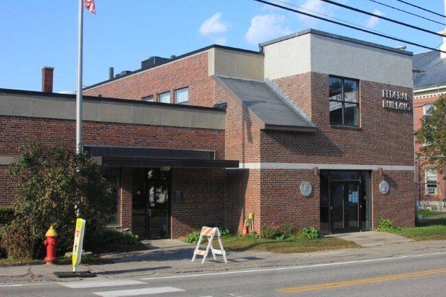
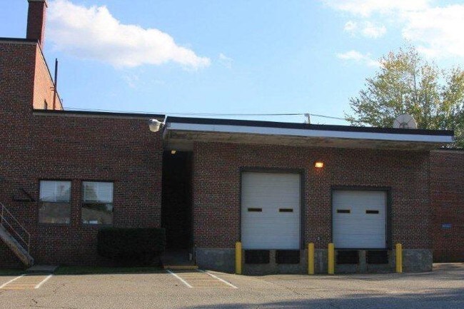
Property Record
89 Court St, Machias, ME 04654

NEARBY LISTINGS FOR SALE OR LEASE
Property Detail
89 Court St
MCHA-000014-000000-000089
Washington
Taxexempt
Maine
X
89
23029C1629E
0.86 AC
2025
Maine North & Bangor
2024
Other Market Areas
956200
DEMOGRAPHICS near 89 Court St
1 Mile
3 Mile
5 Mile
2024 Total Population
1,695
2,835
4,409
2029 Population
1,762
2,918
4,507
Pop Growth 2024-2029
+ 3.95%
+ 2.93%
+ 2.22%
Average Age
43
43
43
2024 Total Households
697
1,161
1,809
HH Growth 2024-2029
+ 4.30%
+ 3.19%
+ 2.27%
Median Household Inc
$22,884
$32,428
$38,738
Avg Household Size
1.90
2.10
2.20
2024 Avg HH Vehicles
1.00
1.00
2.00
Median Home Value
$110,457
$126,325
$138,202
Median Year Built
1972
1975
1976
Nearby Places
Map Layers
Map Styles
 Street
 Aerial
- Restaurants
- Banks
- Shops
- Fitness
- Groceries
SALE & LEASE HISTORY
LISTING DATE
SALE/LEASE

Sep 25, 2016
For Lease
Jan 26, 2018
For Lease
Nearby Properties
Address
Land Use
TOTAL SIZE
Lot Size
Zoning
Address
Land Use
TOTAL SIZE
Lot Size
Zoning
1.68 AC
NONE
Address
Land Use
TOTAL SIZE
Lot Size
Zoning
13.25 AC
NONE
Address
Land Use
TOTAL SIZE
Lot Size
Zoning
13 AC
NONE
Address
Land Use
TOTAL SIZE
Lot Size
Zoning
0.76 AC
SHORE-
Address
Land Use
TOTAL SIZE
Lot Size
Zoning
1.14 AC
NONE
Address
Land Use
TOTAL SIZE
Lot Size
Zoning
Address
Land Use
TOTAL SIZE
Lot Size
Zoning
16,224 SF
5.60 AC
NONE
Address
Land Use
TOTAL SIZE
Lot Size
Zoning
29,784 SF
4.93 AC
NONE
Address
Land Use
TOTAL SIZE
Lot Size
Zoning
4.18 AC
NONE
Address
Land Use
TOTAL SIZE
Lot Size
Zoning
15 AC
NONE
Address
Land Use
TOTAL SIZE
Lot Size
Zoning
0.15 AC
NONE
Address
Land Use
TOTAL SIZE
Lot Size
Zoning
6.26 AC
NONE
Address
Land Use
TOTAL SIZE
Lot Size
Zoning
1.85 AC
NONE
Address
Land Use
TOTAL SIZE
Lot Size
Zoning
1.04 AC
SHORE-
Address
Land Use
TOTAL SIZE
Lot Size
Zoning
0.31 AC
NONE
Address
Land Use
TOTAL SIZE
Lot Size
Zoning
8.74 AC
NONE
Address
Land Use
TOTAL SIZE
Lot Size
Zoning
5.58 AC
NONE
Address
Land Use
TOTAL SIZE
Lot Size
Zoning
2.77 AC
NONE
Address
Land Use
TOTAL SIZE
Lot Size
Zoning
5.58 AC
NONE
Address
Land Use
TOTAL SIZE
Lot Size
Zoning
1.53 AC
NONE
Address
Land Use
TOTAL SIZE
Lot Size
Zoning
1.03 AC
SHORE-
Address
Land Use
TOTAL SIZE
Lot Size
Zoning
3.24 AC
NONE
Address
Land Use
TOTAL SIZE
Lot Size
Zoning
0.77 AC
Address
Land Use
TOTAL SIZE
Lot Size
Zoning
1.75 AC
NONE
Address
Land Use
TOTAL SIZE
Lot Size
Zoning
3.01 AC
NONE
Address
Land Use
TOTAL SIZE
Lot Size
Zoning
1.84 AC
NONE
Address
Land Use
TOTAL SIZE
Lot Size
Zoning
3.80 AC
NONE
Address
Land Use
TOTAL SIZE
Lot Size
Zoning
2.02 AC
NONE
The World's #1 Commercial Real Estate Marketplace
Connect with us
© 2026 CoStar Group
The information above has been obtained from sources believed reliable. While we do not doubt its accuracy we have not verified it and make no guarantee, warranty or representation about it. It is your responsibility to independently confirm its accuracy and completeness. Any projections, opinions, assumptions, or estimates used are for example only and do not represent the current or future performance of the property. The value of this transaction to you depends on tax and other factors which should be evaluated by your tax, financial, and legal advisors. You and your advisors should conduct a careful, independent investigation of the property to determine to your satisfaction the suitability of the property for your needs.