Property Record
89 Hartford Ave E, Mendon, MA 01756


NEARBY LISTINGS FOR SALE OR LEASE
Property Detail
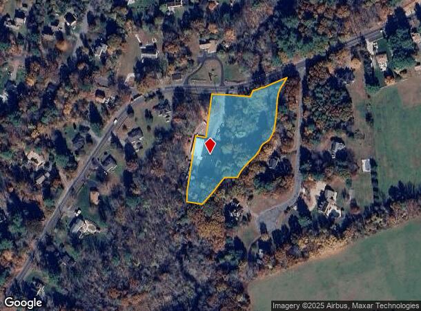
89 Hartford Ave E
MEND-000013-000140-000089
Plan 5604-118
Commercialbuilding
Worcester
AE
Massachusetts
25027C1032F
2.07 AC
2025
Outlying Worcester
2025
Boston
746100
Worcester, MA
15,114 SF
DEMOGRAPHICS near 89 Hartford Ave E
1 Mile
3 Mile
5 Mile
2024 Total Population
1,744
24,727
68,295
2029 Population
1,747
24,583
67,824
Pop Growth 2024-2029
+ 0.17%
(0.58%)
(0.69%)
Average Age
41
41
41
2024 Total Households
596
9,381
25,608
HH Growth 2024-2029
+ 0.17%
(0.59%)
(0.74%)
Median Household Inc
$157,382
$95,464
$108,866
Avg Household Size
2.90
2.60
2.60
2024 Avg HH Vehicles
2.00
2.00
2.00
Median Home Value
$606,837
$425,000
$420,149
Median Year Built
1986
1973
1975
Nearby Places
Map Layers
Map Styles
 Street
 Aerial
- Restaurants
- Banks
- Shops
- Fitness
- Groceries
PUBLIC TRANSPORTATION
COMMUTER RAIL
Forge Park/Route 495 (Franklin Line - Massachusetts Bay Transportation Authority Commuter Rail (Purple Line))
DRIVE
WALK
Distance
Forge Park/Route 495 (Franklin Line - Massachusetts Bay Transportation Authority Commuter Rail (Purple Line))
11 min
5.8 mi
Franklin (Franklin Line - Massachusetts Bay Transportation Authority Commuter Rail (Purple Line))
DRIVE
WALK
Distance
Franklin (Franklin Line - Massachusetts Bay Transportation Authority Commuter Rail (Purple Line))
14 min
7.4 mi
AIRPORT
Worcester Regional
DRIVE
WALK
Distance
Worcester Regional
47 min
27.8 mi
Rhode Island Tf Green International
DRIVE
WALK
Distance
Rhode Island Tf Green International
49 min
31.7 mi
General Edward Lawrence Logan International
DRIVE
WALK
Distance
General Edward Lawrence Logan International
63 min
45.6 mi
Freight Ports
Port of Davisville, RI
DRIVE
WALK
Distance
Port of Davisville, RI
61 min
43.5 mi
SALE & LEASE HISTORY
LISTING DATE
SALE/LEASE

Nov 20, 2018
For Lease
Nearby Properties
Address
Land Use
TOTAL SIZE
Lot Size
Zoning
Address
Land Use
TOTAL SIZE
Lot Size
Zoning
322,615 SF
17.33 AC
SUBN
Address
Land Use
TOTAL SIZE
Lot Size
Zoning
204,879 SF
12.44 AC
OR
Address
Land Use
TOTAL SIZE
Lot Size
Zoning
616,875 SF
141 AC
LI
Address
Land Use
TOTAL SIZE
Lot Size
Zoning
231,817 SF
35.01 AC
IND
Address
Land Use
TOTAL SIZE
Lot Size
Zoning
238,602 SF
109.37 AC
Address
Land Use
TOTAL SIZE
Lot Size
Zoning
238,975 SF
33.82 AC
IND
Address
Land Use
TOTAL SIZE
Lot Size
Zoning
75,140 SF
39.40 AC
Address
Land Use
TOTAL SIZE
Lot Size
Zoning
96,433 SF
5.40 AC
RB
Address
Land Use
TOTAL SIZE
Lot Size
Zoning
203,792 SF
27.93 AC
IND
Address
Land Use
TOTAL SIZE
Lot Size
Zoning
120,327 SF
28.75 AC
BUS2
Address
Land Use
TOTAL SIZE
Lot Size
Zoning
7.36 AC
RA
Address
Land Use
TOTAL SIZE
Lot Size
Zoning
106.49 AC
IB
Address
Land Use
TOTAL SIZE
Lot Size
Zoning
272,941 SF
34.05 AC
IB
Address
Land Use
TOTAL SIZE
Lot Size
Zoning
66,430 SF
10.19 AC
T
Address
Land Use
TOTAL SIZE
Lot Size
Zoning
111,100 SF
17.98 AC
IND
Address
Land Use
TOTAL SIZE
Lot Size
Zoning
7.80 AC
IB
Address
Land Use
TOTAL SIZE
Lot Size
Zoning
7.47 AC
CC
Address
Land Use
TOTAL SIZE
Lot Size
Zoning
128,693 SF
28.30 AC
Address
Land Use
TOTAL SIZE
Lot Size
Zoning
115,225 SF
10.79 AC
M
Address
Land Use
TOTAL SIZE
Lot Size
Zoning
49,920 SF
8.77 AC
IND
Address
Land Use
TOTAL SIZE
Lot Size
Zoning
53,380 SF
1.49 AC
OR
Address
Land Use
TOTAL SIZE
Lot Size
Zoning
87,000 SF
8.79 AC
RES
Address
Land Use
TOTAL SIZE
Lot Size
Zoning
60,156 SF
1.01 AC
HMF
Address
Land Use
TOTAL SIZE
Lot Size
Zoning
36,026 SF
4.03 AC
RES
Address
Land Use
TOTAL SIZE
Lot Size
Zoning
2,270 SF
71.25 AC
IND
Address
Land Use
TOTAL SIZE
Lot Size
Zoning
33,337 SF
1.01 AC
RA
Address
Land Use
TOTAL SIZE
Lot Size
Zoning
184.95 AC
T
Address
Land Use
TOTAL SIZE
Lot Size
Zoning
116 AC
IND
Address
Land Use
TOTAL SIZE
Lot Size
Zoning
52,700 SF
3.49 AC
IB
Address
Land Use
TOTAL SIZE
Lot Size
Zoning
3.51 AC
CC
The World's #1 Commercial Real Estate Marketplace
Connect with us
© 2026 CoStar Group
The information above has been obtained from sources believed reliable. While we do not doubt its accuracy we have not verified it and make no guarantee, warranty or representation about it. It is your responsibility to independently confirm its accuracy and completeness. Any projections, opinions, assumptions, or estimates used are for example only and do not represent the current or future performance of the property. The value of this transaction to you depends on tax and other factors which should be evaluated by your tax, financial, and legal advisors. You and your advisors should conduct a careful, independent investigation of the property to determine to your satisfaction the suitability of the property for your needs.